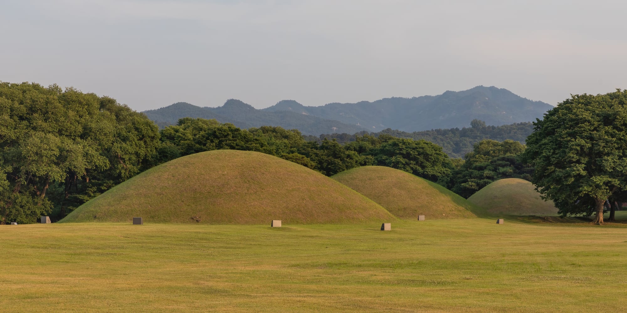
Three large grass-covered burial mounds rising from a mown lawn, with trees behind them and blue hills on the horizon

Busan, Gyeongju & the Southeast, South Korea

Gyeongju

Silla royal burial mounds in the historic centre of Gyeongju. (Basile Morin / Wikimedia Commons · CC BY-SA 4.0)

A low-built city in North Gyeongsang that was the capital of the Silla kingdom for almost a thousand years. Grassy royal burial mounds stand among the streets of the centre, temples and rock carvings fill the hills around it, and much of the town and its surroundings is inscribed on the UNESCO World Heritage list.

Neighbourhoods

  • The historic centre
    • First-time visitors
    • Historic district
    • Walking

    The flat heart of the old capital, where burial mounds, the Cheomseongdae observatory, the palace pond and the museum stand within a couple of kilometres of one another. Guesthouses, cafés and hanok stays fill the low streets between them, and building heights are strictly limited.

    Open in Maps
  • Hwangnam-dong
    • Best for food
    • Cafés and bars
    • Shopping

    The lanes immediately west and south of the largest tomb park, rebuilt in tiled-roof style and now the town's busiest strip of cafés, bakeries, souvenir shops and small restaurants. It is where Gyeongju's evening crowds gather.

    Open in Maps
  • Bomun Lake Resort
    • Hotels and resorts
    • Families
    • Quiet and residential

    A planned tourist district around a reservoir about seven kilometres east of the centre, developed as a tourist complex with the largest hotels in the area, a lakeside walking and cycling loop, convention halls and cherry trees that flower in April.

    Open in Maps
  • Bulguksa and the Tohamsan foothills
    • Temples
    • Nature
    • Quiet and residential

    The wooded slopes south-east of the town, where the Bulguksa temple complex sits below the road climbing to the Seokguram grotto. Small pensions, tea houses and restaurants serving mountain vegetables are scattered along the valley.

    Open in Maps
  • The station and market quarter
    • Local life
    • Markets
    • Close to public transport

    The older working centre north-east of the tombs, around the traditional market and the former railway station. It has little that is ancient but is where residents shop, and cheap motels and eating houses cluster nearby.

    Open in Maps

Things to do

The Silla capital

  • Daereungwonlandmark

    A walled park of more than twenty royal burial mounds in the middle of the town, grassed over and rising well above head height.

    Open in Maps
  • Cheonmachonglandmark

    The one excavated mound open inside, named after a painted flying horse found in it, displaying a gold crown and belt in the reconstructed burial chamber.

    Open in Maps
  • Cheomseongdaelandmark

    A bottle-shaped stone tower built in the 7th century and generally described as an astronomical observatory, standing alone in an open field near the tombs.

    Open in Maps
  • Donggung Palace and Wolji Pondlandmark

    The remains and reconstructed pavilions of the Silla crown prince's palace beside an artificial pond, floodlit and reflected in the water after dark.

    Open in Maps
  • Gyeongju National Museummuseum

    The main collection of Silla material, including gold crowns, the Emille Bell and finds from the palace pond and the royal tombs.

    Open in Maps
  • Bunhwangsalandmark

    A temple founded in 634 whose surviving stone pagoda, built of cut blocks imitating brick, is the oldest dated pagoda of the Silla kingdom.

    Open in Maps
  • Woljeonggyolandmark

    A reconstructed covered wooden bridge across the Namcheon stream on the site of a Silla crossing, lit at night.

    Open in Maps

Temples and mountains

  • Bulguksalandmark

    The great Silla temple of the 8th century, rebuilt many times, known for its stone terraces, twin pagodas and gilt-bronze Buddhas, and inscribed by UNESCO with Seokguram.

    Open in Maps
  • Seokguramlandmark

    A man-made granite grotto high on Tohamsan holding a seated Buddha surrounded by carved guardians and bodhisattvas, reached by a wooded path from the road.

    Open in Maps
  • Namsantrail

    The low mountain south of the town, scattered with Buddhist rock carvings, pagodas and temple sites on paths that climb from several valleys.

    Open in Maps
  • Golgulsalandmark

    A cliffside temple east of the town built into rock caves, known for its Buddhist martial art training and temple stays.

    Open in Maps

Around the city

  • Yangdong Folk Villageattraction

    A Joseon-era clan village of tiled-roof gentry houses and thatched servants' cottages on a wooded slope north of the town, inscribed by UNESCO with Hahoe.

    Open in Maps
  • Bomun Lakepark

    A reservoir ringed by a walking and cycling path, hotels and cherry trees, and the setting for outdoor events in spring and autumn.

    Open in Maps
  • Tomb of King Munmulandmark

    A rocky islet just off the east coast where the Silla king who unified the peninsula is said to have been buried at sea, facing a beach and the ruins of Gameunsa.

    Open in Maps

Short trips from the city

  • Pohangattraction

    The steel city on the coast to the north, with a working harbour, a long beach and fish markets, under an hour away.

    Open in Maps
  • Ulsanattraction

    The shipbuilding and car-making city south of Gyeongju, with a riverside bamboo garden and prehistoric rock carvings inland.

    Open in Maps

Seasonal events

  • Cherry blossom seasonearly April

    Blossom lines the road around Bomun Lake and the streets of the historic centre, drawing very large weekend crowds and a long-running road race.

  • Silla Cultural FestivalOctober

    The city's heritage festival, with processions, traditional music and rites recalling the Silla court, staged at sites around the town.

Eat and drink

Long-standing places and food districts in Gyeongju. Hours, ratings and directions come from your maps app, always current.

Gyeongju classics

  • Hwangnam breadcafe

    A small round pastry of thin dough packed with red-bean paste, baked in the town since the 1930s and sold by the boxful near the tomb park.

    Open in Maps
  • Ssambap restaurants near Daereungwonneighborhood

    A cluster of restaurants serving ssambap, rice and grilled or braised meat eaten wrapped in leaves with a spread of vegetable side dishes.

    Open in Maps
  • Seongdong Marketmarket

    The town's traditional market, near the old railway station, selling produce, fruit and seafood from the district alongside stalls of gimbap, sundae and tteokbokki.

    Open in Maps

Cafés and evening streets

  • Hwangnidan-gilneighborhood

    The remodelled lanes beside the tombs, thick with cafés, tea houses, dessert shops and small restaurants in hanok-style buildings.

    Open in Maps

Experience Gyeongju

History

Gyeongju's story begins around 57 BC with the founding of Saro, a small state on the Gyeongju plain that grew into Silla, one of Korea's Three Kingdoms. Its rulers were buried under earth and stone mounds inside the town itself, a practice that left the wooden-chamber tombs almost impossible to rob and so preserved the gold crowns, belts and glassware now in the museum. Buddhism was adopted in 527, reshaping the city with temples and pagodas.

Allied with Tang China, Silla defeated Baekje in 660 and Goguryeo in 668, then forced the Tang armies out, and Gyeongju became the capital of a unified peninsula for the first time. The city that followed, known as Seorabeol, was one of the larger cities in the world of its day, laid out on a grid, with Bulguksa and the Seokguram grotto built in the 8th century at the height of its wealth. Decline came through aristocratic feuding and rural revolt, and in 935 the last Silla king surrendered to the founder of Goryeo.

Afterwards Gyeongju became a provincial town, and its monuments decayed; Bulguksa burned during the Japanese invasions of the 1590s. Serious excavation began in the colonial period and expanded later in the twentieth century, when a national programme restored temples, dug the tomb parks and built the Bomun resort to receive visitors. The Gyeongju Historic Areas were inscribed by UNESCO in 2000, and building heights and roof styles in the centre remain tightly controlled so that the mounds stay visible above the town.

Culture & Customs

Gyeongju describes itself as a museum without walls, and its identity rests almost wholly on Silla. School trips have come here for generations, and the gold crowns, the stone observatory and the Buddha of Seokguram are among the most reproduced images in the country. Local festivals recall the Silla court through processions, ancestral rites and traditional music, and craft workshops keep up metalwork and pottery traditions traced to the period.

Buddhism remains a living practice rather than a heritage exhibit. Bulguksa and the smaller mountain temples hold daily services, temple stays are popular, and Golgulsa to the east teaches Sunmudo, a Buddhist martial art. Namsan's hundreds of carvings, pagodas and temple sites are treated as a sacred landscape, and many Korean visitors walk it as a pilgrimage as much as a hike.

The town is also Confucian in habit. The Choe clan house at Gyodong, whose family was known for centuries of restrained landholding and famine relief, is a standing example of local gentry values, and the Yangdong village north of the city keeps clan rites and head houses in use. Gyeongsang manners apply: speech is blunt and direct, hospitality is generous, and age and seniority govern seating, pouring and the order in which people speak.

Daily Life

About 250,000 people live in the wider Gyeongju city area, a figure that has been slipping for years, and the population is ageing as young people leave for Busan, Daegu and Seoul. Only part of that number lives in the historic centre; the rest are spread through suburbs, the industrial fringe and farming villages and fishing hamlets that reach to the coast some twenty-five kilometres east.

Tourism is the best-known industry but not the largest. Gyeongju sits between the industrial belts of Ulsan and Pohang, and car parts, machinery and metalworking factories on the edges of the city employ many residents, alongside the Wolseong nuclear power plant on the coast, a subject of long-running local debate. Agriculture continues on the plain, and the city is known for its pears, mushrooms and mountain vegetables.

Life in the centre is quiet and low-built by Korean standards: no tall blocks near the tombs, a strong seasonal rhythm of coach parties and school groups, and a rush of visitors in blossom season and on autumn weekends. Residents shop at the traditional markets and the newer commercial districts away from the monuments. Keeping a working city inside a World Heritage area is the persistent local issue, from building rules and excavation finds to traffic and parking.

Food

Gyeongju's most famous food is a sweet one. Hwangnam bread — small, thin-skinned buns filled with red-bean paste, sold hot in stacked boxes — has been baked in the town since the 1930s and leaves in the luggage of most visitors. Chalboribbang, a glutinous barley cake with a similar filling, is the other local pastry, sold around the markets.

The standard sit-down meal is ssambap: rice and a grilled or braised main dish served with a broad spread of leaves, vegetable banchan and pastes for wrapping, which restaurants near the tomb parks have made their speciality. Sanchae bibimbap, rice with mountain vegetables, is eaten near the hill temples, and temple stays serve the vegetarian monastic cooking that leaves out garlic and onion. Beef from the nearby uplands appears as bulgogi and in soups.

Gyeongju beopju, a clear rice wine long brewed by the Choe family at Gyodong, is the local drink and one of a small number of traditional Korean liquors given protected status. Sweet rice punch and roasted barley tea accompany meals, and the coast east of the city supplies raw fish, crab and dried seafood to the town's markets. Cafés in the remodelled lanes beside the tombs have made their own speciality of teas and desserts built around red bean, barley and pine nuts.

Planning tools

Budget

Gyeongju is inexpensive for a place with so much to see. Guesthouses and motels in the centre are cheap, hanok stays are moderately priced, and the Bomun resort hotels are the costly end. Admission charges to temples and tomb parks are small, several major sites are free to walk around, and rates rise mainly in cherry blossom season and during autumn weekends.

Daily Budget Midrange
USD 100–180 (hanok or resort hotel, ssambap dinners, site admissions, taxis between the outlying temples)
Daily Budget Shoestring
USD 35–65 (guesthouse or motel, market meals, city buses or a hired bicycle)

Staying overnight rather than visiting from Busan costs little and gives access to the floodlit sites after dark, when the day coaches have gone.

Best Time to Visit

Early April for the cherry blossom, which is heavy here and turns the roads white, and late October to early November for autumn colour on Tohamsan and Namsan and the clearest skies of the year. May and June are warm and quiet. July and August are hot, humid and wet, and winter is cold but dry and largely free of crowds.

Suggested Number of Days

Two days suits the compact historic centre and the hill temples. Longer stays take in the outlying villages, the coast and the mountain paths. Walking or cycling rather than driving adds time, as does blossom season, when traffic is heavy.

First Visit
2 days
With Surroundings
3–4 days

Transportation

City buses link the centre with the temples, Bomun Lake and the outlying villages, and run reasonably often on the main routes. The flat centre is well suited to cycling, and bicycle hire is widespread near the tomb parks. Taxis are inexpensive and are the simplest way to reach Seokguram or Yangdong.

The high-speed rail station is well outside town, so allow for a bus or taxi ride of fifteen to twenty minutes into the centre.

Airport & Station Connections

High-speed trains from Seoul reach Gyeongju in about two hours and from Busan in well under an hour, arriving at a station west of the town rather than in it. Intercity and express buses serve a terminal near the centre from Busan, Daegu and Seoul. The nearest airports are at Ulsan and Gimhae in Busan, both roughly an hour away by road.

Walkability

The historic centre is one of the most walkable in the country: flat, low-rise, with paths through the tomb parks and along the stream linking most of the major sites. Distances between them are short enough to cover on foot or by bicycle. The temples in the hills, the folk village and the coast are too far to walk and need a bus, taxi or car.

Safety

Gyeongju is a quiet and very safe city. The hazards are natural: heat and humidity in midsummer, heavy monsoon rain, the occasional typhoon in late summer, and steep rocky paths on Namsan and Tohamsan. The area has felt moderate earthquakes in recent years, including one centred near the city in 2016, though serious damage is rare.

Carry water and start hill walks early in summer, keep to marked paths among the rock carvings on Namsan, and treat tomb mounds as monuments rather than picnic hills. Check current official travel advice before travelling.

Climate

An inland basin climate with warm, wet summers and cold, dry winters, tempered a little by the sea a short way east. Spring and autumn are settled and mild, and most rain falls between late June and August.

Summer
hot and humid, often 30–33°C, with monsoon rain in July and typhoon remnants possible in August and September
Winter
cold and dry, generally around 0–8°C by day with frosty nights and little snow

Local Customs

Tipping is not practised. Shoes are removed at the door of hanok guesthouses, temple halls and floor-seated restaurants. Temples are working monasteries: visitors keep quiet in halls where services are under way, avoid pointing the soles of the feet at images, and ask before photographing monks. Many sites are burial places and are treated with corresponding respect.

Do not climb the tomb mounds or move stones at the rock-carving sites on Namsan, and follow the marked paths inside the walled parks.

Common Payment Methods

The currency is the South Korean won. Cards and phone payments are taken almost everywhere, including small cafés and taxis, and ATMs in convenience stores handle foreign cards. A little cash helps at market stalls, temple donation boxes and bicycle hire kiosks.