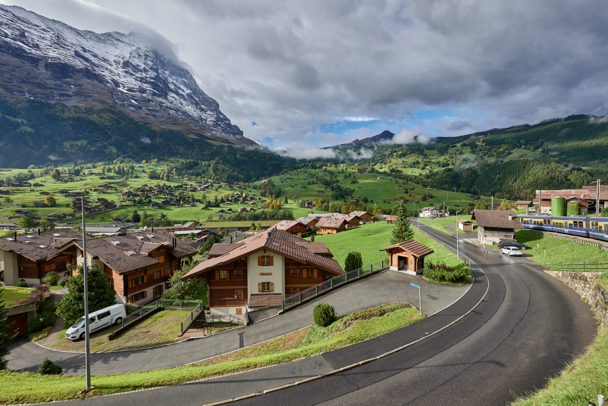
Wooden chalets on green slopes of the Grindelwald valley, with a curving road, a blue train and a dark, snow-dusted mountain on the left

Bern, Lucerne & Central Switzerland, Switzerland

Grindelwald

Grindelwald village, seen from the railway. (Leonhard Lenz / Wikimedia Commons · CC0)

A mountain village in the Bernese Oberland, spread across a green valley beneath the Wetterhorn and the north face of the Eiger. First recorded in 1146, it became one of the Alps' first great tourist resorts in the age of mountaineering, and today almost its whole economy rests on visitors, skiers, walkers and the railways and cable cars to the high peaks.

Neighbourhoods

  • Village centre
    • First-time visitors
    • Close to public transport
    • Shops and restaurants

    The main street, Dorfstrasse, runs past the railway station, the Reformed church and the local museum, lined with shops, restaurants and chalets. The Wetterhorn and the Mettenberg rise directly above.

    Open in Maps
  • Grund and the Terminal
    • Skiing
    • Close to the mountain railways

    The lower part of the village on the valley floor, where the Wengernalp railway starts its climb to Kleine Scheidegg. Nearby, Grindelwald Terminal is the station for the gondolas to the Männlichen and the Eiger Express, with a large car park used by day-trippers heading for the Jungfraujoch.

    Open in Maps

Things to do

Peaks and glaciers

  • Eiger north faceviewpoint

    The 3,967-metre Eiger overlooks the village; its north face, first climbed in 1938, has claimed so many climbers that it is nicknamed the Mordwand, the 'murderous wall'.

    Open in Maps
  • Lower Grindelwald Glacierattraction

    The glacier south-east of the village, which in 1900 still reached as far as the Rote Fluh and around 2000 into the gorge below the Eiger, but has retreated sharply, most of all since 2007.

    Open in Maps
  • Wetterhornviewpoint

    The 3,690-metre peak towering above the village, whose ascent in the 19th century marked the start of the golden age of alpinism.

    Open in Maps

Cable cars and railways

  • Firstviewpoint

    The cable-car station on the slopes of the Schwarzhorn above the village, a hiking area in summer and the launching point for gliders and paragliders.

    Open in Maps
  • Eiger Expressattraction

    A tricable gondola opened in December 2020, linking Grindelwald Terminal directly with the Eigergletscher station on the Jungfrau railway.

    Open in Maps
  • Männlichenviewpoint

    The 2,343-metre mountain reached by gondola from Grindelwald Terminal, at the heart of the main skiing area on the ridge towards Wengen.

    Open in Maps
  • Kleine Scheideggattraction

    The 2,061-metre pass between the Eiger and the Lauberhorn, reached by the Wengernalp railway from Grindelwald, where the Jungfrau railway begins.

    Open in Maps

Walks

  • Bachalpseepark

    A small lake at 2,265 metres in alpine meadows, about 3 km on foot from the First cable car station.

    Open in Maps
  • Faulhornviewpoint

    A 2,681-metre summit between Lake Brienz and Grindelwald, reached by trails beyond the Bachalpsee and on the classic walk between Schynige Platte and First.

    Open in Maps
  • Grosse Scheideggviewpoint

    The pass between the Schwarzhorn and the Wetterhorn, crossed in summer by buses from Grindelwald to Meiringen.

    Open in Maps

Short trips from the village

  • Jungfraujochattraction

    The saddle between the Jungfrau and the Mönch at 3,454 metres, the highest point in Europe reachable by train, approached from Grindelwald by the Eiger Express or via Kleine Scheidegg.

    Open in Maps

Eat and drink

Long-standing places and food districts in Grindelwald. Hours, ratings and directions come from your maps app, always current.

Food districts

  • Dorfstrasse restaurantsneighborhood

    Most of the village's restaurants and cafés line the main street between the station and the First cable car and the mountain lifts.

    Open in Maps
  • Restaurants at Kleine Scheideggneighborhood

    The tiny resort at the top of the pass has views of the Jungfrau and is a stop for walkers, skiers and railway passengers.

    Open in Maps

Experience Grindelwald

History

Grindelwald was first recorded in 1146 as Grindelwalt. A wooden church stood there by the mid-12th century, followed by a St Mary's church in 1180; the present church dates from 1793. In 1348–49 the villagers rose against Interlaken Monastery, and when Bern adopted the Reformation in 1528 it spread the new faith in the valley against the wishes of its people.

Tourism began in the late 18th century, when foreigners discovered the valley, and grew with the road in 1872 and the railway from Interlaken in 1890. Grindelwald was a cradle of mountaineering: the Wetterhorn, Eiger, Schreckhorn, Finsteraarhorn and Gross Fiescherhorn were all climbed in the 19th century, the ascent of the Wetterhorn marking the beginning of the golden age of alpinism. In 1888 it became the first resort in the Bernese Oberland to attract winter visitors too, with sleigh rides, curling, skating and then skiing; there were 10 hotels in 1889 and 33 by 1914.

The rack railway reached Kleine Scheidegg in 1893 and was extended to the Jungfraujoch in 1912, and lifts multiplied, among them the Wetterhorn Elevator, one of the first modern aerial tramways. In 1938 the Eiger north face, the "last problem" of the Alps, was finally climbed. New gondolas to the Männlichen, in 2019, and the Eiger Express, in 2020, now connect the valley directly to the ski slopes and the Jungfrau railway.

Culture & Customs

Grindelwald's identity is bound up with the mountains above it. The Eiger north face, nicknamed the Mordwand, has drawn climbers since the 1930s, and at least 64 climbers have died on it since 1935. The village remains the usual starting point for ascents of the Eiger and the Wetterhorn, and the highest peaks of the valley belong to the Jungfrau-Aletsch World Heritage Site.

Winter sport has produced its own inventions. The Velogemel, a single-track steerable sledge built like a wooden bicycle with runners instead of wheels, comes from Grindelwald, and from the 1930s until 1995 the village ran a "Funi", a cable-hauled sledge that pulled skiers up the practice slope. Hikers, gliders and paragliders take over in summer, and the village hosts the Eiger Ultra Trail mountain race.

The village was also studied as a laboratory of mass tourism: from 1979 to 1984 the University of Bern examined its effects there within UNESCO's Man and the Biosphere programme. Most residents belong to the Swiss Reformed Church, and the small Heimatmuseum beside the church tells the history of the valley.

Daily Life

Grindelwald had about 3,800 residents at the end of 2020. About a fifth are foreign nationals, German is the first language of most people, and Portuguese is the second most common; in 2000 almost half the residents had been born in the village. The population changed little between 2000 and 2010.

Almost the entire economy is based on tourism, from hotels and restaurants to the railways and cable cars that run up the slopes. Much of the municipality is high mountain land: almost a quarter is too rocky for vegetation and more than a fifth is covered by glaciers.

The year turns on two seasons, a winter of skiing from December to April and a summer of hiking, with quieter weeks in between when some lifts close. Day-trippers heading for the Jungfraujoch pass through the Terminal in large numbers. The retreat of the glaciers is visible from the village: the Lower Grindelwald Glacier, which still reached into the gorge below the Eiger around 2000, was only 6.2 kilometres long in 2015.

Food

Grindelwald's restaurants serve the food of the Swiss mountains. Fondue, usually several hard cheeses such as Gruyère and Vacherin melted with white wine and eaten hot with bread, and raclette, melted cheese with potatoes, are the convivial dishes associated with mountain culture and winter sports, more popular in cold weather than as everyday food.

Älplermagronen, the Alpine herdsmen's macaroni, is the frugal all-in-one dish of the alpine cottages: macaroni, potatoes, onions, small pieces of bacon and melted cheese, traditionally served with apple sauce instead of vegetables or salad. Rösti, the fried potato cake that began as a breakfast of Bernese farmers, is often eaten with cheese, onions and cold meat or eggs.

Meiringen, over the Grosse Scheidegg pass, claims to be the place where meringue was first created. Zopf, the braided bread with a golden crust, is traditionally eaten on Sunday mornings. Over the winter, the same cheese dishes are served to skiers in the restaurants of the village.

Planning tools

Budget

Grindelwald sits in the most expensive part of an expensive country. Mountain railway and cable-car tickets are the biggest cost, and hotels fill and rise in price in summer and at Christmas. Regional passes and the half-fare card soften the cost of the lifts.

Daily Budget Midrange
USD 340–620 (hotel, restaurant dinners, a cable car or mountain railway most days)
Daily Budget Shoestring
USD 140–220 (hostel or simple guesthouse, supermarket meals, walking from the village)

A ski pass for the area covers 27 lifts and public transport; in summer, check the summit weather before paying for the high railways.

Best Time to Visit

June to September for hiking, when the high trails and lifts are open; July and August are busiest. The ski season runs from about mid-December to mid-April, though the lower slopes at Grindelwald and First close earlier than those around Kleine Scheidegg. Late spring and autumn are quiet, with some lifts closed between seasons.

Suggested Number of Days

Two or three days give time for the village and one or two trips into the mountains. Most stays are longer because the weather can hide the peaks for days at a time, and skiers or walkers using Grindelwald as a base often stay a week.

First Visit
2–3 days
With Surroundings
4–6 days

Transportation

Grindelwald station, in the centre of the village, is served by the Bernese Oberland railway to Interlaken and by the Wengernalp railway, which climbs via Grund and Alpiglen to Kleine Scheidegg and continues to Wengen and Lauterbrunnen. Gondolas leave Grindelwald Terminal for the Männlichen and the Eigergletscher, cable cars climb to First and Pfingstegg, and summer buses cross the Grosse Scheidegg to Meiringen.

The Terminal car park fills with day-trippers; the train from Interlaken is usually simpler than driving.

Airport & Station Connections

Trains of the Bernese Oberland railway run from Interlaken Ost up the Lütschine valley to Grindelwald. Interlaken is reached by train from Bern, and from there from Zurich and Geneva airports. Drivers follow the same valley road from Interlaken.

Walkability

The village is spread along the hillside, with the main street running through the centre and chalets scattered across the slopes. The centre is walkable, but distances to Grund and the Terminal involve steep gradients, and local trains and buses link the parts of the village. Above it lies a wide network of marked hiking trails.

Safety

Switzerland is very safe, with low crime. Around Grindelwald the risks are those of high mountains: sudden storms, rockfall, steep paths, glaciers that should never be crossed without a guide, and avalanches in winter.

Stay on marked trails, carry warm layers and check mountain forecasts, and make sure travel insurance covers mountain rescue and helicopter evacuation. Check current official travel advice before travelling.

Climate

An alpine valley climate, with an annual mean temperature of about 5.9°C and about 1,250 mm of precipitation a year. The village is cooler than the lakeside towns below and much warmer than the summits above.

Summer
mild in the valley and cool on the heights; in nearby Interlaken, lower down, July averages about 18.6°C
Winter
cold and snowy; in nearby Interlaken, lower down, January averages about 0°C

Local Customs

Grindelwald is German-speaking and mostly Swiss Reformed, though its visitors come from all over the world. By law a service charge is included in the bill, and any tip is a personal choice. Sundays are quiet, and noisy activities are frowned on.

Farmland and alpine pastures are working land: keep to the paths through meadows and leave cattle undisturbed.

Common Payment Methods

The currency is the Swiss franc. Switzerland is more cash-oriented than many European countries, but credit and debit card payments are common, and all ATMs accept foreign cards. Some places, such as supermarkets, restaurants, ticket counters and the railways, accept euro notes (but not coins) and give change in francs.