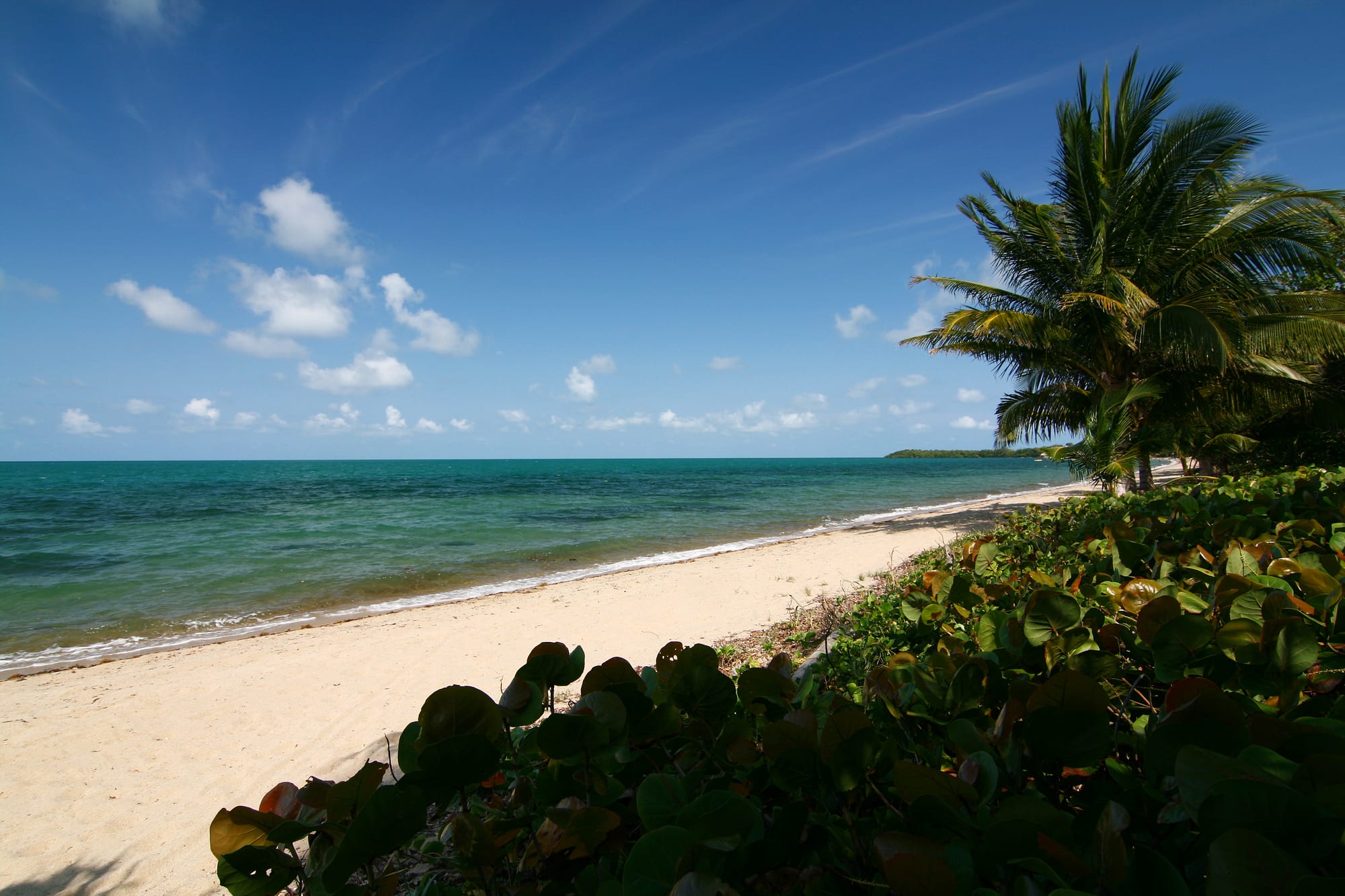
An empty pale sand beach curving along turquoise sea, with a coconut palm and low green sea grape bushes on the right under a blue sky

Belize

Cayo, Placencia & the South

Almond Beach at Hopkins, a Garifuna village on the coast of the Stann Creek District. (Walter Rodriguez / Wikimedia Commons · CC BY 2.0)

Western and southern Belize, from the Maya ruins, caves and pine uplands of Cayo around San Ignacio and the capital, Belmopan, down the Garifuna coast of Stann Creek to the rainforests and Maya villages of Toledo — the country's most mountainous, forested and culturally mixed region.

Explore Cayo, Placencia & the South

History

Cayo holds some of Belize's greatest Maya sites. Caracol, in the Chiquibul forest, became a major Classic-period power and in 562 AD defeated Tikal, which lies across today's border in Guatemala; at its height it was home to far more people than live in Belize City today. Xunantunich and Cahal Pech ruled the Belize River valley, and caves such as Actun Tunichil Muknal were used for ceremonies and sacrifices. In the south, Lubaantun and Nim Li Punit flourished in the foothills of the Maya Mountains.

In the colonial era the west was logging country, where mahogany cut along the rivers was floated down to the coast. The Garifuna, exiled from St Vincent, reached the Stann Creek coast in the early 19th century, and Garifuna Settlement Day on 19 November is celebrated above all in Dangriga. After the American Civil War, a group of Confederate settlers tried to farm in Toledo, and from the late 19th century Mopan and Q'eqchi' Maya families moved into Toledo from Guatemala.

After Hurricane Hattie in 1961, Belmopan was built as the new capital and became the seat of government in 1970. Refugees from the wars in Guatemala and El Salvador settled in Cayo in the 1980s, while Mennonites had founded Spanish Lookout in 1958. In 2015 the Caribbean Court of Justice ordered the government to create a registry of Maya customary lands, after Belize's Supreme Court had recognised the Maya villages' customary land titles. Guatemala's claim to part or all of Belize, including this western and southern border country, is before the International Court of Justice, and the border is managed along a line of adjacency pending the ruling.

Culture & Customs

The south is Belize's most mixed region. Cayo is largely Mestizo and Spanish-speaking, with close ties across the border to Guatemala's Petén, alongside Creole, Yucatec Maya and Mennonite communities. Spanish Lookout is one of the most modern Mennonite colonies, while Barton Creek keeps horse-drawn buggies and plain dress.

Stann Creek is the heartland of the Garifuna. Dangriga, their cultural centre, and Hopkins keep the Garifuna language, drumming and dances such as punta, and the dügü, an ancestral healing ceremony, is still practised. Punta rock, which electrified traditional rhythms from the 1970s, is associated with the Dangriga artist Pen Cayetano. On Settlement Day, parades, street music and traditional dancing fill Dangriga.

Toledo is home to Mopan and Q'eqchi' Maya villages, where many people speak their Maya language first and farm maize, beans and cacao. Village guesthouse and homestay programmes let visitors stay with families. Punta Gorda also has Garifuna, Creole and East Indian communities, the last descended from indentured labourers of the 19th century.

Daily Life

San Ignacio and its twin town of Santa Elena, on either side of the Macal River, form the busiest centre in the west, with a busy market and a lively tourism trade. Belmopan, the small, planned capital, is a town of ministries, embassies and the national university's main campus. Dangriga is the administrative centre of Stann Creek, and Punta Gorda, the southernmost town, looks across the Gulf of Honduras towards Guatemala and Honduras.

The economy varies by district. Cayo mixes tourism with farming, and Spanish Lookout's Mennonite farms are major producers of grain, poultry and dairy; small quantities of oil have been pumped nearby. Stann Creek grows bananas, shipped from the port of Big Creek, while Placencia and Hopkins live increasingly from tourism. Toledo depends on smallholder farming, including cacao sold to chocolate makers.

Life follows the heat and the rain. Many people work outdoors from early morning, markets are busiest at weekends, and the wet season can cut remote villages off for days.

Food

Cayo's markets reflect its Mestizo and Guatemalan ties, with garnaches, tamales, pupusas and fresh tortillas, and Mennonite stalls selling cheese, bread, honey and pies. San Ignacio's market is the place to find them, with tropical fruit from the river valleys.

On the Stann Creek coast Garifuna cooking dominates. Hudut is fish in a coconut broth served with mashed plantain, bundiga is a plantain lasusu, or gravy, and ereba, cassava bread made from grated and strained cassava, is eaten with fish or gravy. Dangriga and Hopkins also have Creole and seafood restaurants, with lobster and conch in season.

Toledo is Belize's cacao country. Maya families grow the beans and roast them for a traditional drink, and the district's cacao is sold to chocolate makers in Belize and abroad and celebrated each May at the Toledo Cacao Festival. Caldo, the best-known Maya dish, is everyday food in the villages. Across all three districts, rice and beans with stew chicken is the everyday midday meal.

Attractions & Natural Wonders

San Ignacio is the base for Cayo. The Actun Tunichil Muknal cave, reached by a jungle walk and river crossings, holds Maya pottery and skeletons in its main chamber. Xunantunich, above the Mopan River, has El Castillo with its carved frieze, and Cahal Pech sits on a hill above the town. Caracol, south through the Mountain Pine Ridge, is crowned by Caana, the tallest man-made structure in Belize. The Mountain Pine Ridge itself has Big Rock Falls, the Rio On pools and the Rio Frio cave, and Barton Creek cave is a large river cave.

On the coast, Hopkins is a Garifuna village strung along the beach, and Placencia stands at the end of a long sandy peninsula, with boat trips to Laughing Bird Caye National Park, snorkelling on the southern reef and whale sharks at Gladden Spit from April to July. Inland, the Cockscomb Basin Wildlife Sanctuary protects jaguars, tapirs and rainforest beneath Victoria Peak, with river tubing and waterfall trails, and the Mayflower Bocawina National Park has more waterfalls and forest.

In Toledo, Punta Gorda is the gateway to the Maya villages of San Antonio, San Pedro Columbia and Blue Creek, and to the ruins of Lubaantun and Nim Li Punit. Offshore, the Port Honduras Marine Reserve and the Sapodilla Cayes lie on the southern barrier reef.

Cities in Cayo, Placencia & the South

Planning basics

Budget

Cayo is one of the better-value parts of Belize, with guesthouses, market food and cheap buses around San Ignacio, although jungle lodges and guided trips to the ATM cave and Caracol add up. Placencia and Hopkins have a wide range, from simple cabins to expensive beach resorts. Toledo is the cheapest district, especially with a village homestay.

Daily Budget Midrange
USD 140–280 (jungle lodge or beach hotel, restaurants, guided cave or reef trips)
Daily Budget Shoestring
USD 50–85 (guesthouse or homestay, market and street food, buses)

Guided tours are compulsory for the ATM cave and advisable for Caracol; booking in San Ignacio is usually cheaper than from the coast.

Safety

The region is generally calm and far less affected by gang crime than Belize City. Robberies have occurred near the western border, and trips to Caracol have at times travelled with security escorts. In the Chiquibul forest, illegal logging, hunting and farming by people crossing the western border are a long-running concern. Cave trips involve wading and swimming, and flash floods can close caves and roads.

Visit caves and remote ruins only with licensed guides, travel the Caracol road in daylight, and heed the no-camera rule inside Actun Tunichil Muknal. Check current official travel advice before travelling.

Climate

Rainfall rises sharply from north to south: Cayo has a clear dry season, while Toledo is the wettest part of Belize and green all year. The Mountain Pine Ridge and Maya Mountains are cooler than the lowlands, pleasant by day and cool at night. The Stann Creek and Toledo coast is hot and humid, and hurricanes have struck Placencia and the south, notably Iris in 2001.

Summer
wet season: 81–91°F and humid, with heavy rain, especially in Toledo; rivers and caves can flood
Winter
dry season: 75–86°F in the lowlands, cooler in the Mountain Pine Ridge, with sea breezes on the coast

Transportation

The George Price Highway runs west from Belize City through Belmopan to San Ignacio and the Guatemalan border at Benque Viejo; the Hummingbird Highway crosses the mountains from Belmopan to Dangriga, and the Southern Highway continues to Punta Gorda. Buses cover all three, and small planes serve Dangriga, Placencia and Punta Gorda. Caracol is reached by a long unpaved road from San Ignacio. Boats link Punta Gorda with Puerto Barrios and Lívingston in Guatemala.

Use a 4x4 or a tour for the Mountain Pine Ridge and Caracol roads, and check river levels before cave trips in the wet season.

Best Time to Visit

The dry months from about February to May are best for caves, ruins and forest roads. Whale sharks gather at Gladden Spit off Placencia around the full moons from April to July. Garifuna Settlement Day on 19 November is the great festival in Dangriga, and Toledo's chocolate festival takes place in May. September and October carry the highest hurricane risk.