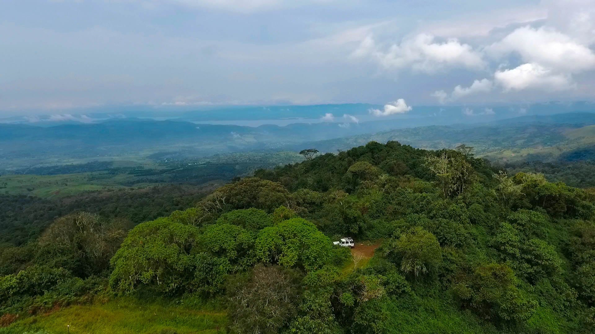
Aerial view of a forested green hilltop with a white vehicle on a clearing, and misty hills and a distant lake beyond

Democratic Republic of the Congo

Goma, Bukavu & the Kivus

Forested hills in Kahuzi-Biega National Park, in South Kivu in the eastern Democratic Republic of the Congo. (Forest Service, USDA / Wikimedia Commons · Public domain)

The eastern highlands of the DR Congo along the Albertine Rift — North and South Kivu, with Goma, Bukavu and Lake Kivu, the Virunga volcanoes and their mountain gorillas — together with the lowland forest province of Maniema around Kindu. It is among the most fertile parts of the country and the centre of a conflict that has continued since the 1990s.

Explore Goma, Bukavu & the Kivus

History

The Kivu highlands have long been densely farmed. Before colonial rule they were home to kingdoms and chiefdoms of the Shi around Bukavu, the Nande and Hunde in the north and many smaller groups, with Kinyarwanda-speaking communities living on both sides of what became the Rwandan border. In the 19th century Swahili-Arab traders pushed into Maniema from the east; David Livingstone reached Nyangwe on the Lualaba in 1871 and witnessed a massacre of market-goers by traders' gunmen there.

Under Belgian rule Europeans settled the cool highlands to grow coffee, tea and quinine, Bukavu was built as Costermansville, and Albert National Park, today's Virunga, was created in 1925. The colonial authorities also encouraged Rwandan settlement in Masisi, laying the ground for later disputes over land and citizenship. In 1961 thirteen Italian airmen serving the UN were killed at Kindu.

In 1994, after the genocide in Rwanda, more than a million Hutu refugees, among them soldiers and militiamen responsible for the killing, poured into camps around Goma and Bukavu, where cholera killed thousands. In 1996 a rebellion backed by Rwanda and Uganda broke up the camps and marched on Kinshasa, and in 1998 the Second Congo War began from Goma. Armed groups persisted after 2003. The M23, formed in 2012 by mutinous ex-rebels, briefly took Goma in November 2012, was defeated in 2013 and resurged from late 2021. UN Group of Experts reports have documented Rwandan troops and support for the M23, which Rwanda denies, pointing to the threat of the FDLR, a Rwandan Hutu armed group. In January and February 2025 an M23 offensive brought heavy fighting to Goma and then Bukavu. A US-brokered agreement between the DR Congo and Rwanda was signed in Washington in June 2025, and Qatar-mediated talks between the government and the M23 produced a declaration of principles in Doha in July, but fighting continued across the Kivus.

Culture & Customs

Swahili is the common language of the east, spoken in a Congolese form alongside French, Kinyarwanda, Mashi, Kinande and many others. The main communities include the Nande of Butembo and Beni, known as traders, the Hunde and Nyanga, the Hutu and Tutsi Banyarwanda, the Shi and Lega of South Kivu, the Bembe and Fuliru around Uvira, and the Banyamulenge of the South Kivu high plateaux. Questions of land, identity and belonging between these communities lie beneath much of the violence.

The Lega of South Kivu and Maniema are known for the Bwami society, whose ranked members used small ivory and wooden figures and masks in initiation. Goma has a young music and arts scene, and its Amani festival brought musicians from across the region to the city.

Most people are Christian, with strong Catholic and Protestant churches that also run schools and hospitals, and there are Muslim communities in Maniema, Kindu and the cities. Civil society groups, churches and women's organisations have played a large role in documenting abuses and supporting survivors of sexual violence.

Daily Life

Goma and Bukavu are the two largest cities, each with around a million people or more, their populations swollen by people displaced from the countryside. Butembo, Beni and Uvira are the other big towns, and Kindu is the capital of Maniema. Goma faces Gisenyi in Rwanda across a busy border, and cross-border trade shapes daily life.

The Kivus are rich farmland — beans, bananas, potatoes, coffee, tea and dairy cattle — and rich in minerals. Coltan, tin, tungsten and gold are dug by hand in thousands of artisanal sites, including the large coltan workings at Rubaya in Masisi, and UN investigators have repeatedly found that armed groups tax and control parts of this trade. Maniema has tin and gold mining and forest farming.

Everyday routines revolve around markets, motorbike taxis and minibuses, and long walks to fields when roads are unsafe. Displacement camps, checkpoints, power and water shortages, and the disruption of banks and schools during fighting define the present for millions of people.

Food

The highland diet is built on beans, potatoes, sweet potatoes, cooking bananas and ugali, a stiff dough of maize or cassava flour. Sombe, cassava leaves pounded and cooked, appears at most meals, and roasted maize and grilled goat brochettes are the street snacks.

Lake Kivu supplies sambaza, small sardine-like fish fried whole and eaten as a bar snack, and tilapia. The region grows respected arabica coffee on the slopes above the lake, and tea plantations lie in the hills.

Banana beer is brewed at home, and bottled beer is drunk in the cities. In Maniema the food turns to the lowland staples of rice, cassava, palm oil, river fish and forest produce.

Attractions & Natural Wonders

Goma lies on old lava flows at the foot of Nyiragongo, whose eruptions of 1977, 2002 and 2021 sent lava towards and into the city; when the park is open, an overnight climb to the crater rim looks down on the lava lake. Virunga National Park, founded in 1925 and a UNESCO World Heritage Site, protects the mountain gorillas of the Mikeno slopes, the Nyamulagira volcano, the savannas and hippos of Lake Edward and the glaciers of the Rwenzori. More than 175 of its rangers had been killed in the line of duty by 2018.

South of Goma, Lake Kivu stretches to Bukavu, whose peninsulas are lined with colonial villas, and the island of Idjwi in the middle of the lake belongs to South Kivu. Just west of Bukavu, Kahuzi-Biega National Park, named after two dormant volcanoes, protects the eastern lowland gorilla, also called Grauer's gorilla, in montane and lowland forest.

West of the highlands, Maniema is forest and river country: Kindu sits on the Lualaba, the upper Congo, and Nyangwe upstream recalls the history of Livingstone and the Swahili-Arab traders.

Cities in Goma, Bukavu & the Kivus

Planning basics

Budget

When Virunga has been open, visits have been sold as costly packages: gorilla permits and the Nyiragongo climb each cost several hundred US dollars, plus the park's lodges or tented camps. Goma and Bukavu have hotels priced for aid agencies and business visitors. Prices across the east rise sharply when fighting disrupts supply routes. Maniema sees almost no visitors.

Daily Budget Midrange
USD 200–500+ (park package or city hotel, driver, meals), before permits and flights
Daily Budget Shoestring
Not realistically applicable for visitors

Book only through Virunga National Park or a long-established specialist; independent travel in the Kivus is impractical and unsafe.

Safety

North and South Kivu are an active conflict zone. The M23 rebellion, the FDLR, the Allied Democratic Forces around Beni, many Mai-Mai and Wazalendo militias and the Congolese army all operate here, and front lines, road access and border crossings change quickly. Civilians face killings, kidnapping, sexual violence and forced displacement, and millions have fled their homes. Nyiragongo's eruptions and Lake Kivu's dissolved gases are natural hazards, and outbreaks of disease recur.

Globeway covers the DR Congo so it can be understood, not to encourage travel there now. Most governments advise against all travel to North and South Kivu and Maniema's border areas; Virunga National Park sets its own opening status. Check current official travel advice before travelling.

Climate

Altitude makes the Kivus temperate: Goma and Bukavu sit at around 1,500 metres and stay mild all year, with rain in two seasons, roughly March–May and September–December. The volcano summits and the Rwenzori are cold, with freezing nights on Nyiragongo's rim. Maniema is lowland forest, hot, humid and wet for most of the year.

Summer
mild in the highlands, 15–27°C, with regular rain; hot and humid in Maniema, 21–31°C
Winter
drier spells from June to August and around January–February in the highlands, cool nights

Transportation

Goma and Bukavu have airports, and historically most visitors entered over the land borders from Rwanda at Gisenyi and Cyangugu. Boats link Goma, Bukavu and Idjwi across Lake Kivu. Roads in the Kivus are mountainous, frequently cut by landslides, and exposed to armed groups and checkpoints; Kindu is reached by air or by long river and road journeys.

Do not travel by road in the Kivus without up-to-date security guidance from organisations working there; border crossings can close without notice.

Best Time to Visit

June to August and December to February are the drier windows, when forest trails to gorilla groups and the Nyiragongo path are easiest. The question in the Kivus, though, is not season but security: Virunga closes to visitors when conditions require, and at the time of writing the region is an active conflict zone.