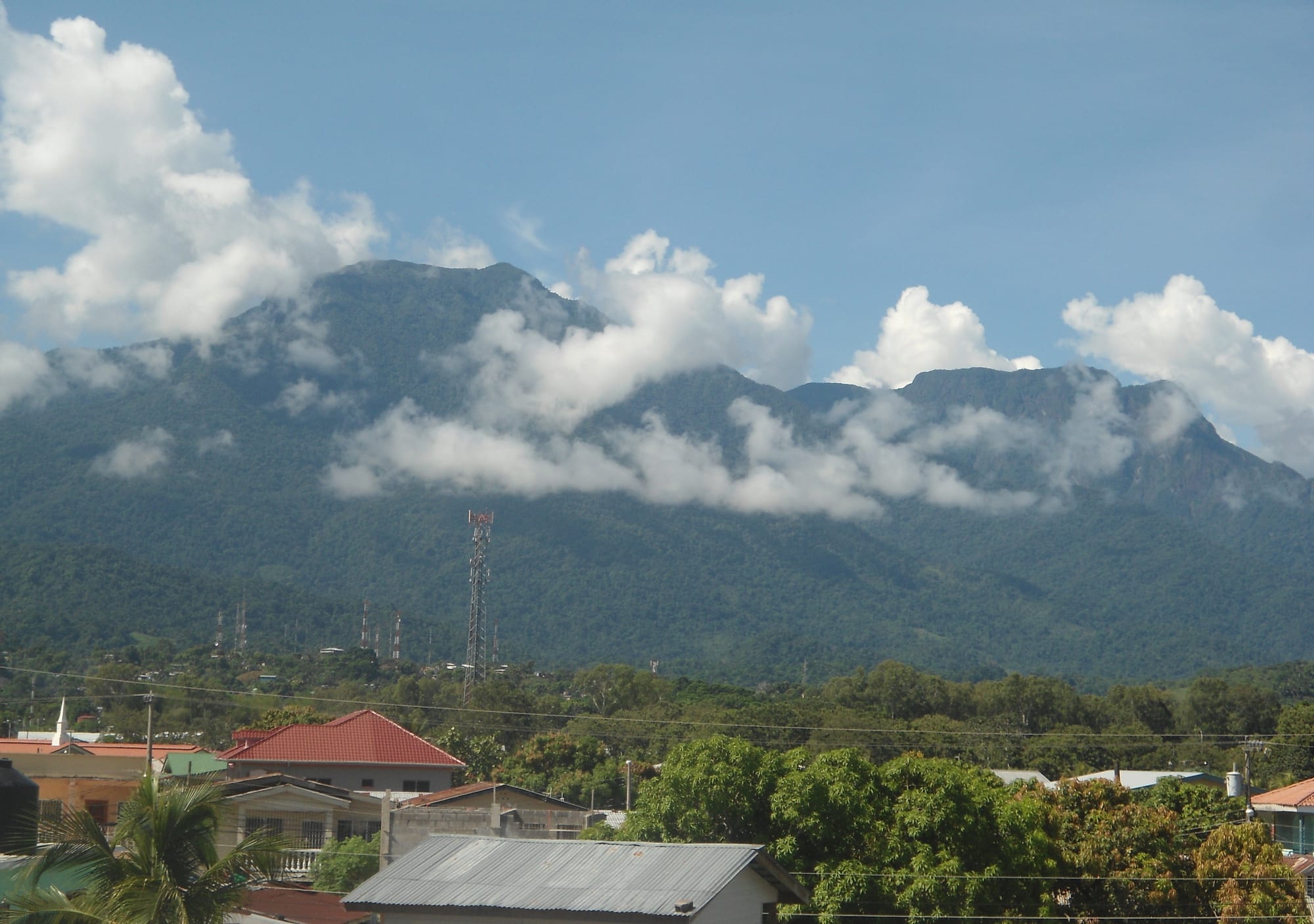
Forested mountains wreathed in low white cloud rising behind the red and tin roofs of a town

Honduras

San Pedro Sula & the North Coast

The Pico Bonito massif of the Cordillera Nombre de Dios, seen from La Ceiba. (SympatheticIsolation / Wikimedia Commons · CC BY-SA 3.0)

Honduras's hot, humid north, from the industrial city of San Pedro Sula and the port of Puerto Cortés along the Caribbean shore to Tela and La Ceiba, with Lake Yojoa to the south and the farming valleys of Yoro inland — the old banana coast, home to Garífuna villages and rainforest-covered mountains.

Explore San Pedro Sula & the North Coast

History

Before the Spanish, Maya-influenced and Lenca-related peoples farmed the Sula valley and the shores of Lake Yojoa, where the Los Naranjos site shows a ceremonial centre with earthworks dating back to around 800 BC. Pedro de Alvarado founded San Pedro Sula in 1536, but for most of the colonial era the coast was a thinly held frontier raided by pirates and privateers. To protect it, Spain built the fortress of San Fernando de Omoa in the second half of the eighteenth century.

The Garífuna reached the coast after the British deported them from St Vincent to Roatán in 1797; within a generation they had settled villages along the mainland shore, including those around Tela and La Ceiba.

The modern north was built on bananas. From the late nineteenth century the Vaccaro brothers' company, later Standard Fruit, made La Ceiba its base, and United Fruit's Tela Railroad Company made Tela its headquarters. They laid railways, drained swamps, expanded the ports, and dominated national politics. The general strike of 1954, which began on the banana plantations, won workers the right to organise and is a landmark of Honduran labour history. Later in the century San Pedro Sula grew into the country's industrial capital, filled with textile maquilas and migrants from the countryside. In the 2000s and 2010s it became the centre of gang violence between MS-13, Barrio 18 and drug-trafficking groups, and Hurricanes Mitch in 1998 and Eta and Iota in 2020 flooded the Sula valley.

Culture & Customs

The north coast is the most mixed part of Honduras. San Pedro Sula has a large community descended from Palestinian Christian immigrants who arrived in the early twentieth century and now figure prominently in business and politics, and the banana years drew workers from across Central America and the Caribbean.

The Garífuna villages along the coast keep their own language, which mixes Arawak and Carib roots with French and English loanwords, and their music and dance: punta, danced to drums and maracas, is the best known, and the language, dance and music are listed together as UNESCO intangible heritage. On 12 April the Garífuna commemorate their arrival in Honduras with festivals and re-enactments. Land is a long-running issue: communities such as Triunfo de la Cruz have disputed tourism projects on ancestral land, and the Garífuna organisation OFRANEH has taken land cases to the Inter-American Court of Human Rights.

La Ceiba's carnival in May, built around the feast of San Isidro, fills the city with parades and music, and Yoro town is known for its "lluvia de peces", a local tradition of small fish found on the ground after heavy early-summer storms. The Tolupan, a small Indigenous people, live in the mountains of Yoro.

Daily Life

San Pedro Sula has about 700,000 people and, with Choloma, Villanueva and La Lima, forms Honduras's largest urban area outside the capital. It is the country's business hub: textile and apparel maquilas, the Cervecería Hondureña brewery, food processing and trade through Puerto Cortés, the country's main port. El Progreso in Yoro is another large town, and La Ceiba, with roughly 200,000 people, is the service centre of the eastern coast.

The countryside grows bananas, African oil palm, pineapples and sugar cane, and Yoro's valleys raise cattle, maize and beans. Tourism centres on Tela, the Cangrejal valley and Lake Yojoa. Heat shapes the rhythm of the day: early starts, shade at midday, busy evenings and weekends at the beach or the river.

Extortion of shops, taxi drivers and bus companies has been a heavy burden in the cities, and emigration to the United States is common. Many families here depend on remittances.

Food

The north coast gave Honduras its favourite snack: the baleada, a thick flour tortilla folded over refried beans, crumbled cheese and mantequilla (a soured cream), which La Ceiba and San Pedro Sula both claim. Street stalls also sell pastelitos, fried chicken with tajadas (crisp green plantain chips) and pollo chuco.

Garífuna cooking is built on coconut, cassava, plantain and fish. Tapado is a seafood soup; hudutu, also called machuca, is pounded plantain mashed with coconut and eaten with fish; ereba, known in Spanish as casabe, is a large flat bread of dried cassava; and pan de coco, coconut bread, is baked all along the coast. Sopa de caracol, conch soup in coconut milk, is the coast's famous dish.

Fish from Lake Yojoa, fried whole and served with tajadas and pickled onions, is the classic lunch at the lakeside stalls. Salva Vida and Port Royal beers are brewed in San Pedro Sula.

Attractions & Natural Wonders

San Pedro Sula is mostly a gateway, though its cathedral, central park and the Museum of Anthropology and History give a good introduction to the region. To the west, Puerto Cortés leads to Omoa, where the Fortress of San Fernando looks over the bay.

Tela has a long curve of beach and the Lancetilla Botanical Garden, with fruit trees, bamboo and birdlife. Garífuna villages line the coast on either side — Triunfo de la Cruz and Ensenada to the east, Tornabé and Miami towards Punta Sal, a headland of forest and coves in Jeannette Kawas National Park, reached by boat. East of Tela, the Punta Izopo reserve and the Cuero y Salado refuge protect mangroves where manatees live.

La Ceiba sits beneath Pico Bonito, a national park of rainforest and cloud forest rising to about 2,400 metres. The Río Cangrejal on its eastern edge has whitewater rafting, swimming holes and lodges, and the Garífuna villages of Corozal and Sambo Creek lie just east of the city.

Inland, Lake Yojoa lies between mountains where Cortés meets Comayagua and Santa Bárbara. Its shores offer birdwatching, boat trips and lakeside fish restaurants; the Los Naranjos archaeological park has forest trails and early earthworks; and the Pulhapanzak waterfall drops about 40 metres just north of the lake.

Cities in San Pedro Sula & the North Coast

Planning basics

Budget

Prices are close to the national average. San Pedro Sula has business hotels and chain restaurants; La Ceiba and Tela have plenty of simple guesthouses, and the lodges around Lake Yojoa and in the Cangrejal valley range from hostels to comfortable eco-lodges. Rafting, guided hikes and boat trips are the main extra costs.

Daily Budget Midrange
USD 65–140 (lodge or beach hotel, restaurant meals, a rafting trip or guided hike)
Daily Budget Shoestring
USD 25–45 (hostel or guesthouse, comedor meals, local buses)

Treat San Pedro Sula as a transit point — most travellers go straight from the airport to Lake Yojoa, Tela or La Ceiba.

Safety

San Pedro Sula was for several years among the most violent cities in the world, and gang extortion and armed robbery remain serious in its poorer districts, in Choloma and in parts of La Ceiba and El Progreso. A state of exception against the gangs was declared there in December 2022. Tela, the Garífuna villages, Lake Yojoa and the Cangrejal valley are much calmer, though beach theft and robbery on isolated stretches occur.

Do not walk around San Pedro Sula at night or use its city buses; avoid deserted beaches and never travel by road after dark. Check current official travel advice before travelling.

Climate

Hot and humid all year, usually 28–33°C by day on the coast and in the Sula valley, which can pass 35°C before the rains. Rain is possible in any month; the wettest stretch runs from about September to January, when cold fronts bring heavy downpours to La Ceiba and Tela. Lake Yojoa sits higher and is a little cooler. Hurricanes and tropical storms are a risk from June to November; Eta and Iota flooded the Sula valley in 2020.

Summer
hot and humid, 28–35°C, with afternoon storms and the hurricane season from June
Winter
warm, 24–30°C, with long rainy spells on the coast from October to January

Transportation

San Pedro Sula's international airport is the main gateway to Honduras, and La Ceiba has a domestic airport with flights to the Bay Islands. Good coach services run along the coastal highway from San Pedro Sula to Tela and La Ceiba in about three to four hours, and ferries leave La Ceiba for Roatán and Utila. Lake Yojoa is about 90 minutes south of San Pedro Sula on the CA-5.

Use direct coaches between the coastal towns rather than local buses, and arrange transfers from San Pedro Sula airport in advance.

Best Time to Visit

February to May is the most reliable dry spell on the coast and the best time for beaches and the Cangrejal. La Ceiba's carnival in May is the biggest party on the coast. The heaviest rains, from October to January, can close trails and flood roads, and the hurricane risk peaks from August to October.