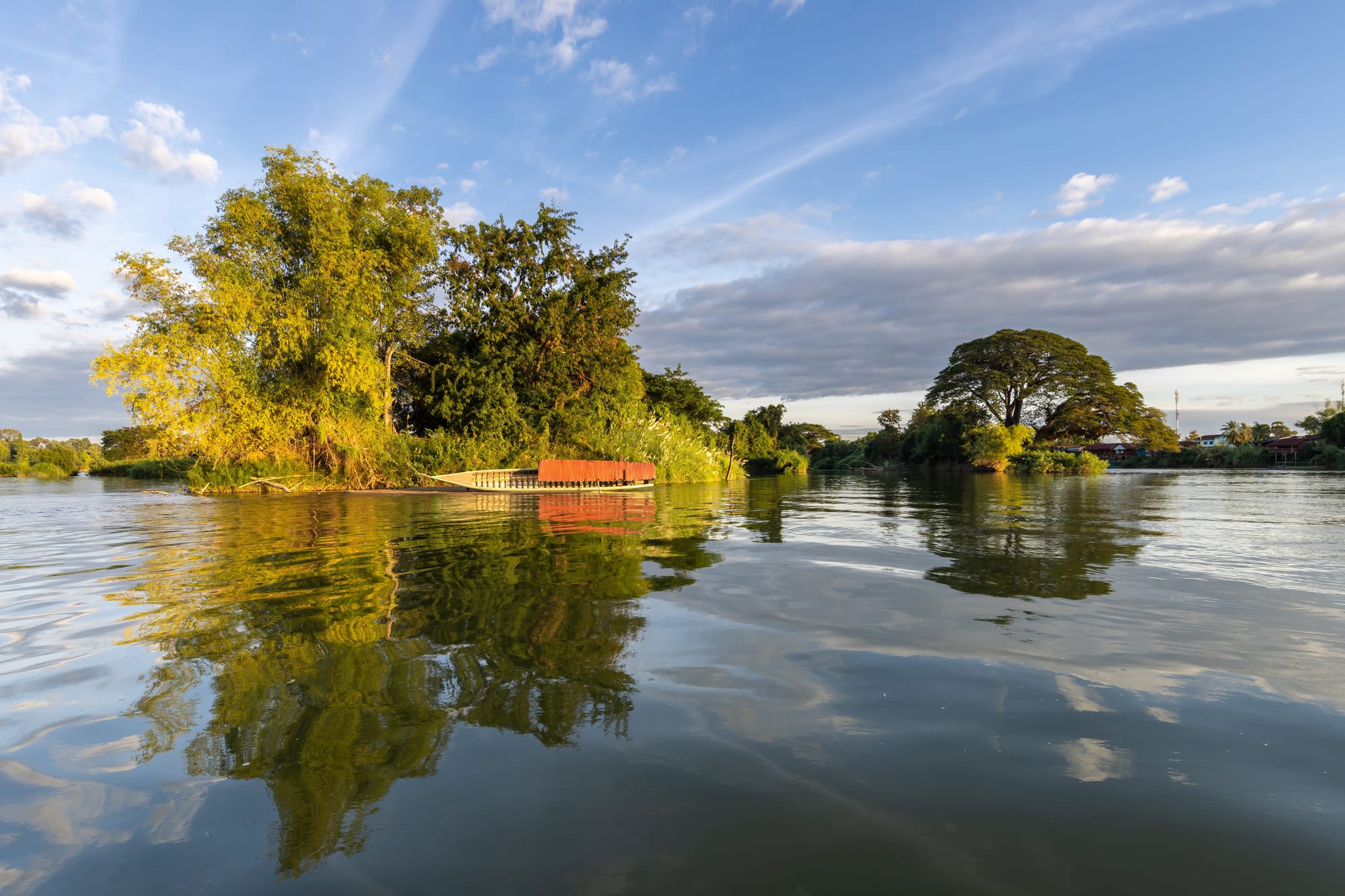
Wooded islands and a beached wooden boat reflected in the calm Mekong under a blue sky with evening light

Laos

Pakse & the South

River islands of the Mekong at golden hour in Si Phan Don, the 4,000 Islands of Champasak. (Basile Morin / Wikimedia Commons · CC BY-SA 4.0)

Southern Laos, the Mekong lowlands from Savannakhet to the Cambodian border and the uplands of the Bolaven plateau and the Annamite foothills — the country of the Khmer-era temple of Wat Phou, coffee farms and waterfalls, the river islands of Si Phan Don and the old Ho Chi Minh Trail.

Explore Pakse & the South

History

The south was part of the Khmer world long before it was Lao. At the foot of Phou Kao, a mountain whose summit resembles a linga, a city now called Shrestapura grew up by the 5th century, and the temple of Wat Phou, rebuilt mainly in the 11th and 12th centuries, was linked by road to Angkor. Lao settlers moved down the Mekong in the centuries after the founding of Lan Xang, and when that kingdom split in the early 18th century, Champasak became a separate Lao kingdom. It fell under Siamese control later that century.

In 1893 France took the east bank of the Mekong, and in 1904 the Champasak territory west of the river followed, although the royal house of Champasak survived. The French founded Pakse as a provincial seat in the early 20th century and planted coffee on the Bolaven plateau; from 1893 they also ran a short railway across the islands of Don Det and Don Khon to carry cargo around the Khone falls. Savannakhet grew as a trading post opposite Siam.

The uplands of Savannakhet, Salavan, Sekong and Attapeu carried the Ho Chi Minh Trail in the 1960s and 1970s and were among the most heavily bombed places in the country. Kaysone Phomvihane, the communist leader who ruled Laos from 1975 until 1992, was born in Savannakhet, and the city now bears his name officially. In 2018 the collapse of a dam at the Xe-Pian Xe-Namnoy project flooded villages in Attapeu, killing dozens of people and displacing thousands. Wat Phou and the Champasak landscape became a UNESCO World Heritage Site in 2001.

Culture & Customs

The Mekong lowlands are Lao and Buddhist, and their speech carries a southern accent close to that of north-east Thailand across the river. The uplands are a different world: the Bolaven plateau is named after the Laven people, and the Alak, Katu, Ta Oy and other Mon-Khmer-speaking groups of Salavan, Sekong and Attapeu keep their own languages and animist beliefs, some with animal sacrifices.

The great festival of the region is Boun Wat Phou, held at the full moon of the third lunar month, when many Lao pilgrims come to the sanctuary. Boat races on the Mekong mark the end of Buddhist Lent in Pakse and Savannakhet as elsewhere. Savannakhet also has a Catholic community, with a co-cathedral in the town.

Crafts include the weaving of the Katu and other upland groups.

Daily Life

Savannakhet is the largest province in Laos, and its capital, on the Mekong, is one of the country's largest towns; its Savan-Seno special economic zone and the bridge to Mukdahan have made it a trading hub on the road between Thailand and Vietnam. Pakse, the regional capital of Champasak, is the market town and transport centre of the south. Salavan, Sekong and Attapeu are small provincial towns.

Rice farming dominates the lowlands, and coffee dominates the Bolaven plateau, where farms grow Arabica and Robusta. Hydropower dams, rubber and cassava plantations, mining and logging have brought investment from Vietnam, Thailand and China, and disputes over land and resettlement. On the islands, fishing and tourism are the main livelihoods, and the Don Sahong dam near Khone has raised concerns over fish migration.

The day begins with the market and noodle soup, and on the islands it slows to the pace of the river: hammocks, bicycles and fishing traps.

Food

The south eats from the Mekong. Fish is grilled whole with salt, minced into laap pa with herbs and toasted rice, or steamed with dill and lemongrass in banana leaves as mok pa, and pa daek, the fermented fish paste of the Lao kitchen, is used in many dishes. On the islands, meals of small fried fish, sticky rice and tam mak hoong are eaten at waterside tables.

Vietnamese influence runs through Pakse and Savannakhet. Feu noodle soup, khao jii baguettes, and spring rolls are sold in the markets.

Coffee is the region's signature. Bolaven coffee, grown around Paksong, is served in the town's cafés, and farms offer visits. The plateau also grows tea, vegetables and fruit for the markets of Pakse, and lao-lao rice spirit is made in the villages.

Attractions & Natural Wonders

Pakse itself has riverside temples, and a large market. About 40 kilometres south, Champasak's ruined Khmer temple of Wat Phou climbs a stairway of stone from its baray reservoirs and processional causeway to a sanctuary under a cliff, with carved lintels and views over the river plain.

East of Pakse, the Bolaven plateau is a loop of coffee farms and waterfalls around Paksong: the falls of Tad Fane and Tad Yuang and, on the north-eastern side of the plateau, the village of Tad Lo with its waterfalls and ethnic villages nearby. Sekong and Attapeu, beyond the plateau, have rivers, forests and remnants of the Ho Chi Minh Trail.

In the far south, Si Phan Don, the 4,000 Islands, begins at Don Khong, the largest island, and ends at Don Det and Don Khon, once linked by the old French railway. Nearby, the Khone Phapheng falls, often described as the largest in Southeast Asia, pour through rock channels. Irrawaddy dolphins once lived in this stretch of the Mekong, but the species has been extinct in Laos since 2022.

Upriver, Savannakhet has a French-era quarter around its Catholic church, a small dinosaur museum and, elsewhere in the province, the stupa of That Ing Hang.

Cities in Pakse & the South

Planning basics

Budget

The south is among the cheapest parts of Laos. Bungalows on Don Det and Don Khon, guesthouses in Pakse and Savannakhet and homestays on the Bolaven plateau all cost little, and the loop of the plateau is usually done on a cheap rented motorbike. Costs rise only for riverside resorts, private boats and guided trips into Sekong and Attapeu.

Daily Budget Midrange
USD 40–90 (riverside hotel, restaurants, private driver or boat, coffee farm visits)
Daily Budget Shoestring
USD 15–30 (island bungalow or guesthouse, local food, shared songthaews and boats)

Cash machines are found in Pakse, Savannakhet and on Don Khong but are scarce on the smaller islands, so bring enough kip from Pakse.

Safety

The south is relaxed and crime is low, with occasional theft from bungalows on the islands. The real risks are the Mekong's currents and rapids around Si Phan Don, slippery rocks at waterfalls, road accidents on motorbikes, and unexploded ordnance in Savannakhet, Salavan, Sekong and Attapeu, which the Ho Chi Minh Trail crossed and the bombing followed.

Swim only in calm, known spots away from the rapids, keep to paths near the old trail, and lock valuables away. Check current official travel advice before travelling.

Climate

The Mekong lowlands are the hottest part of Laos, with fierce heat in March and April. The Bolaven plateau, at around 1,000 to 1,300 metres, is several degrees cooler and wetter during the monsoon, which is what makes its coffee and waterfalls. The Mekong runs low and clear in the dry season and high and brown in the rains.

Summer
very hot in the lowlands, 33–38°C before the rains; heavy monsoon rain from June to October, especially on the plateau
Winter
dry and warm, 20–32°C in the lowlands; cool nights on the Bolaven plateau

Transportation

Pakse has the south's main airport and a bridge over the Mekong, and is linked to Thailand by road to Ubon Ratchathani. Savannakhet has its own Friendship Bridge to Mukdahan. Route 13 runs south from Savannakhet to Pakse and on to the Cambodian border, with minibuses and ferries serving the islands. Motorbikes are the usual way round the Bolaven plateau.

Buy combined bus and boat tickets to the islands in Pakse, and allow two or three days for a Bolaven plateau loop.

Best Time to Visit

November to February is the best season, warm but dry, with the islands at their greenest just after the rains. The Wat Phou festival, held at the full moon of the third lunar month, in January or February, draws pilgrims to Champasak, and the waterfalls are at their fullest late in the wet season.