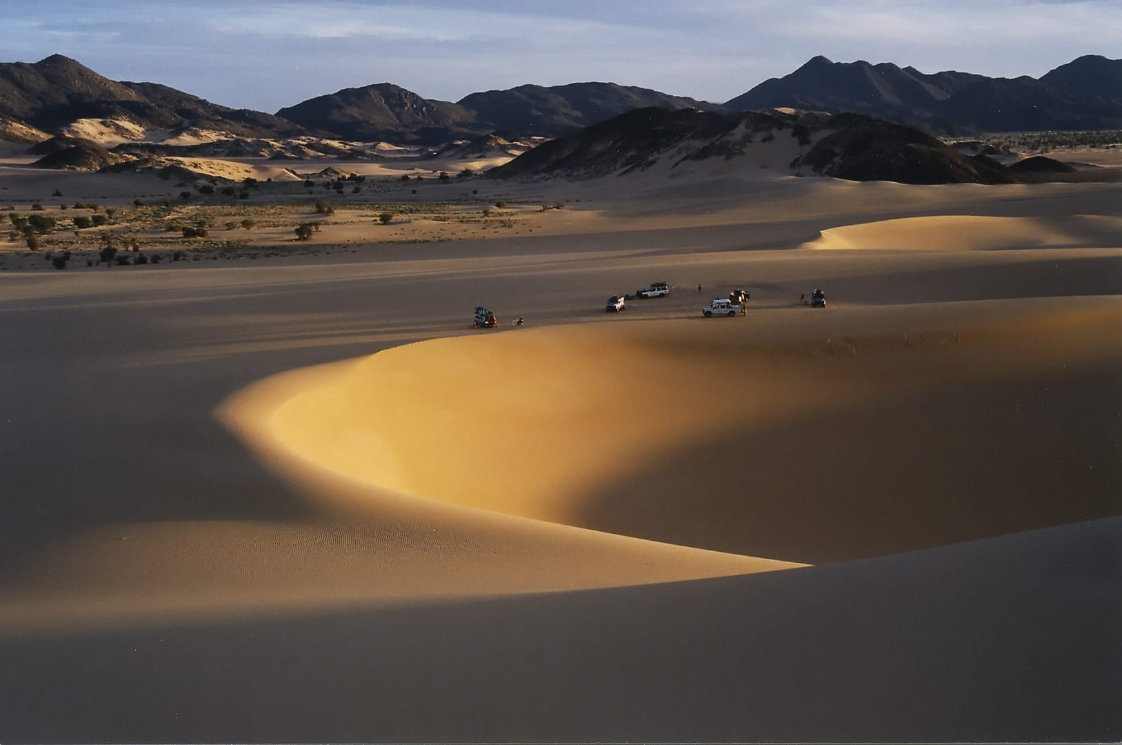
Curving golden sand dunes in evening light with dark rocky hills behind and a few vehicles parked on the sand

Niger

Agadez & the Sahara

Dunes inside the Arakao ring of hills on the eastern edge of the Aïr mountains. (Jacques Taberlet / Wikimedia Commons · CC BY 3.0)

The Saharan north and east of Niger — the caravan city of Agadez, the volcanic Aïr mountains, the sand sea of the Ténéré, the uranium towns of Arlit and the salt oases of Bilma, and in the far south-east the dry Lake Chad basin around Diffa — more than half the country's land, thinly peopled by Tuareg, Toubou, Kanuri and Fula.

Explore Agadez & the Sahara

History

The Sahara here was once green. Rock engravings in the Aïr, among them the life-size giraffes of Dabous, and the Neolithic cemetery at Gobero in the Ténéré record hunters, herders and fishing communities from thousands of years ago, and the desert has yielded dinosaur fossils at Gadoufaoua.

Tuareg groups moved into the Aïr from the north, and in the 15th century the Sultanate of Aïr made Agadez its capital, where caravans between the Hausa cities and North Africa met. The Songhai Empire took tribute from it in the 16th century, and the Grand Mosque was built in that period. Bilma and the Kaouar oases supplied salt and dates, carried south by great caravans. The Diffa region, by contrast, belonged to the Kanem-Bornu Empire centred on Lake Chad.

French troops occupied Agadez in the early 20th century, and in 1916–17 the Tuareg leader Kaocen besieged the town in a revolt that took months to put down. After independence, uranium mining began at Arlit in the early 1970s and made Niger a major producer. Tuareg rebellions in the 1990s and in 2007–09 were fought over neglect, land and a share of the mining wealth. From the 1990s Agadez became the main hub for migrants crossing the Sahara to Libya and Algeria, and since 2015 the Diffa region has been drawn into the Boko Haram insurgency around Lake Chad.

Culture & Customs

Tuareg identity dominates the north. The Kel Aïr and other groups are organised in confederations under the sultan of Agadez, whose office dates back to the 15th century. Men wear the tagelmust, a long veil and turban, and women hold a strong position in family life. The Agadez cross, a silver pendant, is the best-known of the region's jewellery designs, made by the smiths of Agadez. Sweet tea is served in small glasses, and camel races and dances mark weddings and festivals.

The Toubou live in the Kaouar and Djado oases of the north-east, and in the south-east the Kanuri, heirs of Bornu, farm around Diffa and N'Guigmi, while the Buduma live on the islands of Lake Chad with their large-horned Kuri cattle. Fula and Wodaabe herders move through the pastures, and at In-Gall, around September, the Cure Salée brings herders together to graze their animals on salty grassland, with the Wodaabe Gerewol, feasts and markets.

Tuareg guitar music, the assouf, has a strong base in Agadez, the home region of Bombino, and the imzad fiddle, played by women, is recognised as UNESCO intangible heritage.

Daily Life

Agadez, with over 100,000 people, is the region's main city; Arlit and its twin town Akokan grew around the uranium mines, and Diffa, N'Guigmi, Bilma and Iférouane are small. Much of the population is nomadic or semi-nomadic, following grazing for camels, goats and cattle.

The economy rests on mining, trade and herding. Uranium from Arlit has been Niger's main export for decades; in June 2025 the military government announced the nationalisation of Somaïr, the Orano-run company that mines at Arlit, a move Orano contests. Oil from the Agadem fields in the Diffa region feeds the refinery at Zinder and a pipeline to Benin. Gold rushes in the Djado area since 2014 have drawn thousands of miners. The Aïr oases grow vegetables, citrus and dates in irrigated gardens, and Agadez craftsmen make jewellery, leather and saddles.

Migration is a major part of life in Agadez: drivers, guesthouse owners and traders have lived by moving migrants north, a trade that the authorities cracked down on in the 2010s. Around Diffa, years of insurgency have displaced hundreds of thousands of people, and fishing and pepper farming along the Komadougou Yobé river have suffered.

Food

Desert food is simple and portable. Taguella, the Tuareg flatbread of wheat baked under the embers in hot sand, is broken into a sauce of goat or mutton. Eghajira, a sweet, thick drink of grain and fruit, is served to guests, and dried cheese, dates and dried meat are carried on journeys.

Milk from camels and goats is the everyday drink in the camps, and rice and pasta with sauce are the town meal in Agadez. The Aïr oases supply vegetables and fruit — tomatoes, onions, oranges, grapefruit and dates from the gardens of Timia — and salt from Bilma is sold across the region.

Around Diffa, Kanuri cooking uses millet porridge with sauces of okra and baobab, fish from Lake Chad and the Komadougou, dried and smoked, and the red peppers for which the Diffa area is known, dried in the sun and sold across Niger and Nigeria. Everywhere, sweet green tea closes the meal.

Attractions & Natural Wonders

Agadez and its mud minaret dominate the town: the Grand Mosque's 27-metre tower of banco, bristling with wooden beams, rises over a historic centre of earthen houses and lanes listed as a UNESCO World Heritage Site, with the sultan's palace, the camel market and the silversmiths' workshops.

North of the city, the Aïr mountains rise in dark granite and volcanic massifs to Mont Idoukal-n-Taghès, Niger's highest point, at about 2,000 metres. Valley oases such as Timia, with its palm gardens and rock pools, and Iférouane shelter Tuareg villages, and rock engravings, including the Dabous giraffes, are scattered across the range. The Aïr and Ténéré Natural Reserves form a UNESCO World Heritage Site, currently listed as in danger.

East of the Aïr, the Ténéré desert is a sea of sand and gravel plains; the Tree of Ténéré, once the only tree for hundreds of kilometres, was knocked down by a lorry in 1973. Beyond it lie the salt oases of Fachi and Bilma, the cliffs of the Kaouar and the ruined fortified villages of the Djado plateau. In the far south-east, the Lake Chad basin around Diffa has reed-lined channels, islands and a lake that has shrunk dramatically since the 1960s.

Cities in Agadez & the Sahara

Planning basics

Budget

Agadez once had a small desert-tourism industry of guesthouses, Tuareg guides and 4x4 expeditions into the Aïr and Ténéré; it has been largely dormant since the late 2000s. Any travel now means a hired vehicle, driver, guide and security arrangements, and fuel and goods in the desert cost more than in the south. Diffa has only basic lodgings.

Daily Budget Midrange
USD 170–350 where travel is permitted (hired 4x4, driver, guide and escort)
Daily Budget Shoestring
Not realistically applicable given the security situation

Arrange any desert travel only through an established Agadez operator, and carry enough cash for the whole trip.

Safety

Most governments advise against all travel to northern Niger and the Diffa region. The desert north has seen Tuareg rebellions, smuggling of drugs, arms and migrants, banditry at gold-mining sites and the kidnapping of foreigners, including uranium workers from Arlit in 2010. Around Diffa and Lake Chad, Boko Haram and the Islamic State West Africa Province have attacked towns and army bases since 2015.

Most governments advise against all travel to Niger, or against all but essential travel to Niamey only. Do not travel to the Diffa region or into the desert without official approval and escort. Check current official travel advice before travelling.

Climate

True Saharan climate across most of the region. Agadez gets a little rain in July and August; the Ténéré and the oases of Bilma and Djado get almost none. Summer days pass 40°C, while winter nights in the Aïr can fall close to freezing. Diffa, in the south-east, is Sahelian, with a short rainy season and cattle pasture.

Summer
extremely hot, 40–45°C, with rare storms in the Aïr and around Diffa in July and August
Winter
warm, dry days around 25–30°C and cold nights, sometimes near 0°C in the mountains and open desert

Transportation

A paved road runs from Tahoua to Agadez and north to Arlit, and Agadez has an airport. Beyond that, travel is by 4x4 on desert tracks, often in convoy with a military escort, and the routes north to Libya and Algeria carry migrants, smugglers and armed groups. Diffa is reached by the long road east from Zinder.

Never travel into the desert without an experienced guide and escort, and follow official restrictions on movement.

Best Time to Visit

November to February is the only comfortable season for the desert, when the old Aïr and Ténéré expeditions ran. The Cure Salée herders' gathering at In-Gall is held around September. Security, not the weather, now determines whether travel is possible.