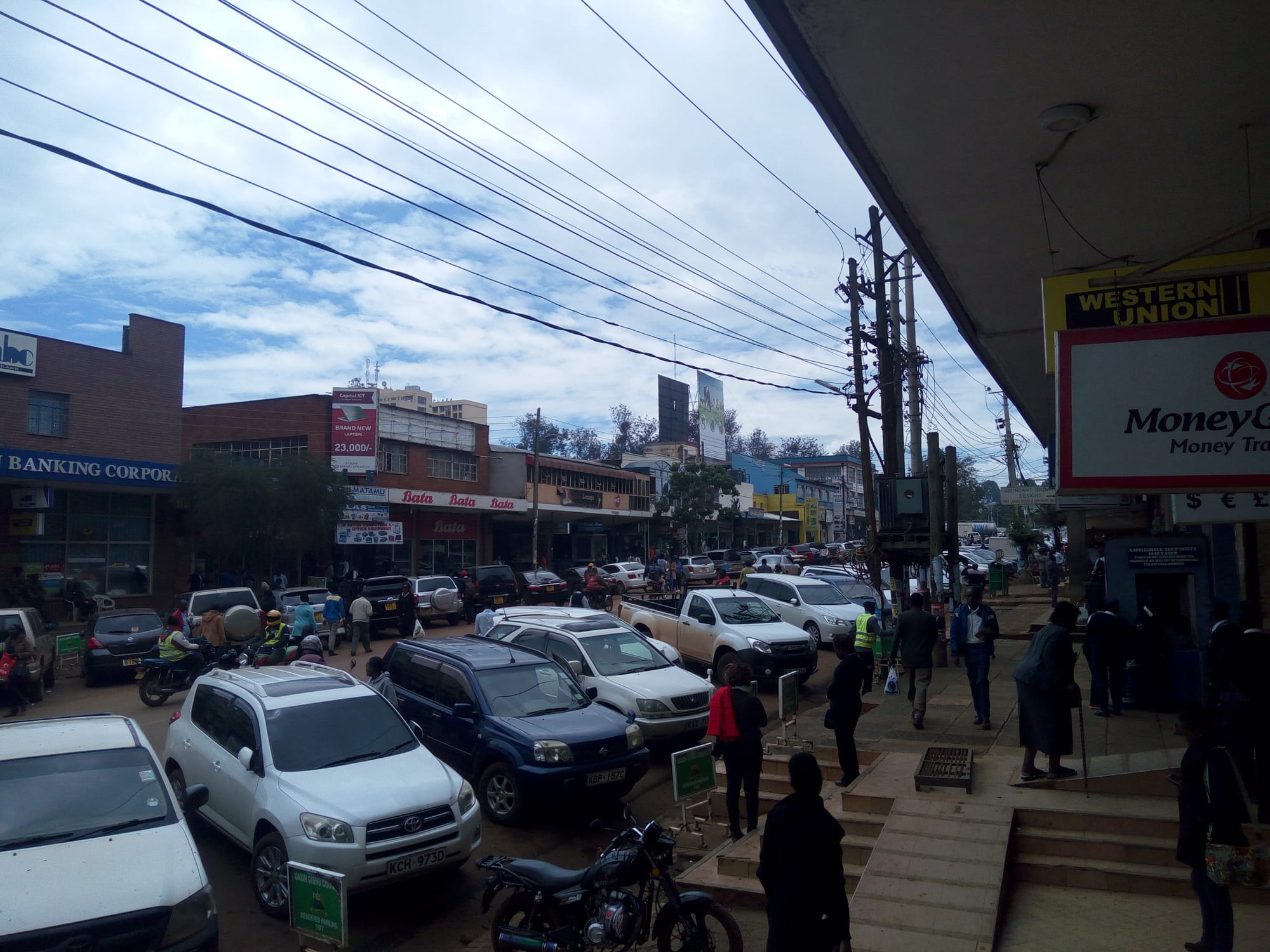
A busy town-centre street in Eldoret lined with low shopfronts, parked cars and pedestrians under a cloudy sky

The Maasai Mara & the Rift Valley, Kenya

Eldoret

A street in central Eldoret, with the shopfronts and parked traffic of the town centre. (Shadychiri / Wikimedia Commons · CC BY-SA 4.0)

A highland city on the Uasin Gishu plateau in western Kenya, at about 2,100 metres, laid out on farmland opened to settlers early in the twentieth century. Maize, wheat and dairy built it, two universities and a busy trade in transit goods to Uganda keep it growing, and the hills around it are the training ground of Kenya's distance runners.

Neighbourhoods

  • Town centre
    • First-time visitors
    • Shopping and markets
    • Close to transport

    The grid of streets around Uganda Road and Oginga Odinga Street, where the banks, hotels, matatu stages and the municipal market sit within a few blocks of each other. It is compact, loud and busy from early morning, and almost everything in the city is reached from here.

    Open in Maps
  • Elgon View
    • Quiet and residential
    • Leafy streets

    An older residential quarter south-east of the centre, with large plots, hedged gardens and some of the city's guesthouses and restaurants. It is a short drive from the shops and much quieter than the streets around the market.

    Open in Maps
  • Kapsoya and the eastern estates
    • Local life
    • Value accommodation

    Middle-income housing spreading east of the town on the Kaptagat side, a mix of bungalows, flats and small shopping parades. Matatus run in from here all day, and many people who work in the centre live in this belt.

    Open in Maps
  • Langas
    • Local life
    • Markets

    A large, densely built neighbourhood on the south-western edge of the city, a place of small trade, workshops and street food rather than sights.

    Open in Maps
  • Annex and the university side
    • Students
    • Quiet and residential

    The north-eastern approach towards the University of Eldoret campus at Chepkoilel, with student housing, hostels, cheap eating places and open farmland beginning just beyond the last buildings.

    Open in Maps

Things to do

In the city

  • Kipchoge Keino Stadiumlandmark

    The city's main sports ground, named after the athlete Kipchoge Keino and holding about 10,000 people, used for athletics meetings and by local football clubs.

    Open in Maps
  • University of Eldoretattraction

    A public university on the Chepkoilel campus north-east of the centre, with strengths in agriculture and natural resources.

    Open in Maps
  • Moi Universityattraction

    A public university established in 1984 by act of parliament, with its main campus on the plateau south-east of the city at Kesses.

    Open in Maps
  • Eldoret International Airporttransit hub

    The airport south of the city, opened in 1995, serving domestic and international flights and a substantial cargo trade in agricultural exports.

    Open in Maps

The running country

  • Itenattraction

    A small town on the edge of the Kerio escarpment at about 2,400 metres, known as a training base where Kenyan and foreign distance runners live and run on the red dirt roads.

    Open in Maps
  • Kerio Valleyviewpoint

    A deep rift valley dropping away east of Iten, with long views from the escarpment road down to the hot, dry valley floor and the hills beyond.

    Open in Maps

Short trips from the city

  • Cherangani Hillstrail

    A forested escarpment range of ridges and rocky gorges north of the plateau, one of Kenya's five main forest and water catchment areas.

    Open in Maps
  • Nandi Hillsattraction

    Tea estates and steep green country south-west of the plateau, the home district of several of Kenya's best-known runners.

    Open in Maps
  • Kitaleattraction

    A farming town north of Eldoret, home to the National Museum of Western Kenya, with the road onward to Mount Elgon and Saiwa Swamp.

    Open in Maps
  • Saiwa Swamp National Parkpark

    Kenya's smallest national park at about 3 square kilometres, created as a habitat for the sitatunga, a rare aquatic antelope.

    Open in Maps
  • Kakamega Forestpark

    The rainforest remnant south-west of the plateau, known for forest monkeys and several hundred recorded bird species.

    Open in Maps

Seasonal events

  • Christmas and the long holidaysDecember

    Families return to the plateau from Nairobi and beyond, church services fill and the markets and matatu stages are at their busiest.

Eat and drink

Long-standing places and food districts in Eldoret. Hours, ratings and directions come from your maps app, always current.

Eldoret classics

  • Nyama choma grillsrestaurant

    Roast goat and beef ordered by weight and cut up on a wooden board with kachumbari salad and ugali, eaten at butchery-bars around the town and along the Iten and Kaptagat roads.

    Open in Maps
  • Mursik and milk barsmarket

    The Kalenjin fermented milk, soured in a smoked gourd, is sold in the markets and dairy shops of a city that sits in the middle of Kenya's dairy country.

    Open in Maps

Markets and food streets

  • Eldoret municipal marketmarket

    The town-centre market for maize, potatoes, greens, bananas and beans from the plateau, with cooked-food stalls around its edges.

    Open in Maps
  • Uganda Road and the town centreneighborhood

    Cafés serving chai, mandazi and chapati from early morning, canteens with githeri and stews at lunchtime, and a row of Indian and fast-food places along the main street.

    Open in Maps

Experience Eldoret

History

The plateau the city stands on was Nandi and Keiyo grazing country when the Uganda Railway opened the highlands to British administration at the turn of the twentieth century. A settlement grew at a crossing of the Sosiani River, and in its first years it was known simply as Farm 64, a number that recorded its distance of about 103 kilometres from the railhead at Londiani. The name Eldoret comes from the Maasai word eldore, "stony river", a reference to the bed of the Sosiani. From August 1908 Afrikaner families, originally from South Africa, moved up onto the Uasin Gishu plateau to take up farms, and British settlers took others; wheat, maize and dairy cattle replaced open grassland.

The extension of the Uganda Railway from Londiani reached the town in 1924, giving the plateau's grain a way to market and fixing Eldoret as the trading centre of the North Rift. Mills, a creamery and later a textile plant followed, and the road west towards the Ugandan border made it a transit town for goods moving inland.

After independence the farms were subdivided and bought by Kenyan families, and the city expanded quickly with them. Moi University was founded in 1984 on the plateau south-east of the town, the Chepkoilel campus north of the centre became the University of Eldoret, and the population multiplied several times over. Land disputes between long-settled and newer farming communities also made the district a centre of the violence that followed the disputed election of 2007, including the burning of a church at Kiambaa near the city. Eldoret was granted city status in 2024, the fifth in Kenya.

Culture & Customs

Eldoret's international reputation rests on running. The hills and dirt roads around the city and the escarpment town of Iten, a short drive to the north-east, are the training ground of a remarkable line of Kenyan Olympic and marathon champions, most of them Kalenjin, and athletes from around the world come to train at altitude alongside them. Groups running in loose formation at dawn are an everyday sight, the city's stadium is named after the Olympic champion Kipchoge Keino, and a returning winner is met with celebration and with mursik, the smoked sour milk poured for guests of honour. For many years the city was also the home of the Discovery cross-country championships, and the Eldoret Discovery Half Marathon was run for the 28th time in 2019.

The wider culture is Kalenjin — Nandi and Keiyo above all — with age-sets, cattle, initiation ceremonies and respect for elders still shaping family life, overlaid by a strongly Christian public culture of church choirs, harambee fundraising and long Sunday services. Decades of migration have also made the city mixed: Kikuyu, Luhya, Luo, Kisii and Somali families trade in the same streets, and Swahili is the common language of the market.

Student life from two universities and several colleges gives the town cheap eating places, bookshops and music, and football and athletics dominate conversation. Weddings and funerals bring extended families back to the plateau from Nairobi and abroad, and both are large, communal and carefully organised affairs.

Daily Life

About 475,000 people lived in the urban area at the 2019 census, and the city has grown fast since, spreading east towards Kapsoya and Kaptagat and south-west into Langas. It is a farming city first: maize, wheat, dairy and horticulture from the plateau are traded, milled and processed here, and the cereals board, mills, creameries and a textile plant are among the larger employers, alongside the universities, the referral hospital and a wholesale trade supplying much of the North Rift.

The rhythm of the day starts early. Matatus and boda-bodas fill the roads into town before dawn, runners are already on the dirt roads outside it, the market takes deliveries from the farms in the early morning, and the centre empties again in the evening as people return to the estates. Rents are lower than in Nairobi and the city has drawn businesses and residents for that reason.

The pressures are those of a fast-growing Kenyan city: housing and roads lagging behind the population, water supply and drainage under strain, youth unemployment, and the cost of fertiliser and fuel for farmers. Land ownership on the plateau remains a sensitive subject, and election years are watched closely.

Food

Eldoret eats the food of the Kenyan highlands. Ugali, the stiff maize meal known in Kalenjin as kimnyet, is the base of most meals, eaten with sukuma wiki (braised collard greens), managu or other traditional greens, beans, and a stew of beef, goat or chicken. Githeri, maize and beans boiled together, is the everyday canteen lunch, and chapati and rice appear on Sundays and at celebrations.

Nyama choma — goat or beef roasted over charcoal, ordered by the kilo and cut up on a board with kachumbari, a salad of raw tomato and onion — is the social meal, eaten at butchery-bars in town and along the roads towards Iten and Kaptagat. Mutura, a grilled sausage made with meat and spices, is sold from street grills in the evening.

Dairy is everywhere in a city surrounded by dairy farms: fresh milk, mala (fermented milk) and above all mursik, the Kalenjin sour milk fermented in a gourd lined with soot from particular trees, which gives it a smoky taste and a ceremonial role at homecomings. Breakfast is chai, strong tea boiled with milk and sugar, with mandazi or chapati; roasted maize is sold at the roadside; and local lagers and traditional brews are drunk in the town's bars.

Planning tools

Budget

Eldoret is inexpensive by Kenyan standards. Guesthouses, canteen meals and matatus cost little, and the main expenses are a hire car or taxi for the Kerio Valley and Iten and a night in one of the better hotels in the centre or in Elgon View. Prices rise around graduations, the agricultural show and December.

Daily Budget Midrange
USD 90–180 (good hotel, restaurant meals, a car with a driver for a day in the running country)
Daily Budget Shoestring
USD 30–55 (guesthouse, local food, matatus and boda-bodas)

Agree a price for a taxi to Iten and the escarpment viewpoints before setting out, and carry some cash for markets and matatus.

Best Time to Visit

December to February is the driest and warmest stretch, and June to September is cooler with showers but still good for the escarpment roads. The long rains from March to May bring heavy afternoon storms and mud on the dirt roads used by runners and on farm tracks.

Suggested Number of Days

The city itself is quickly seen and most visitors give it a day or two. Three or four suit anyone adding the highland country around it, and longer again if the trip continues north or west by road.

First Visit
1–2 days
With Surroundings
3–4 days

Transportation

Matatu minibuses and boda-boda motorbike taxis are the everyday transport, with stages in the town centre serving the estates and the surrounding towns. Long-distance coaches and shared vehicles run to Nairobi, Kisumu, Kitale and the Ugandan border. Taxis and ride-hailing apps operate in the city, and a hire car or a driver is the practical way to reach the escarpment.

Travel between towns in daylight; the Nairobi and Uganda highways carry heavy lorry traffic through the plateau.

Airport & Station Connections

Eldoret International Airport lies about 17 kilometres by road south of the city, with scheduled domestic and international flights and a cargo trade in farm produce. Most people arrive by road: the highway from Nairobi runs through Nakuru and takes most of a day by coach, Kisumu is a few hours to the south-west, and the same road continues west to the Malaba crossing into Uganda.

Walkability

The centre is flat, compact and easily walked, with the market, banks, hotels and matatu stages within a few blocks, though pavements are crowded and traffic is heavy around the stages. The residential estates spread well beyond the centre, and at about 2,100 metres the air is thin enough that newcomers notice a steep street.

Safety

Eldoret is a calm working city for most visitors, with the usual risks of pickpocketing and bag-snatching in crowded markets, around matatu stages and after dark. Road traffic is the more serious danger, on the highways and on the escarpment roads. The plateau has a history of land disputes and of violence around disputed elections, including the 2007–08 post-election violence in which a church at Kiambaa near the city was burned, and political gatherings are best avoided.

Travel in the north with a reputable operator who knows local conditions, keep a respectful distance from wildlife, and avoid gatherings at election time. Keep valuables out of sight around the stages and markets, use a taxi or a ride-hailing app after dark, and take malaria precautions if the trip continues to the lake or the Kerio Valley. Check current official travel advice before travelling.

Climate

A cool highland climate shaped by altitude rather than season. Days are mild and nights cold all year, rain falls in most months, and the long rains from March to May and the wet middle of the year bring heavy afternoon storms. Mornings are often clear and bright.

Summer
December to February is the driest and warmest period, with days around 25–27°C and cold nights
Winter
June to September is cooler and showery, with days around 22–24°C and nights near 10°C

Local Customs

This is Kalenjin country, and Nandi and Keiyo are widely spoken alongside Swahili and English, though Kikuyu, Luhya and Luo families have farmed and traded on the plateau for generations. Greetings are unhurried and elders are addressed first. Christianity is strong and Sunday services are long and well attended. Running is a matter of local pride, and athletes on the roads at dawn are part of ordinary life.

Ask before photographing people, especially athletes training and traders at work; dress modestly in the market and at church; tipping is not expected, though rounding up a taxi fare or restaurant bill is welcome.

Common Payment Methods

The currency is the Kenyan shilling. Mobile money is used for almost everything locally, from matatu fares to market stalls, and cards are accepted in hotels, supermarkets and larger restaurants. ATMs are easy to find in the town centre, and small cash is useful everywhere else.