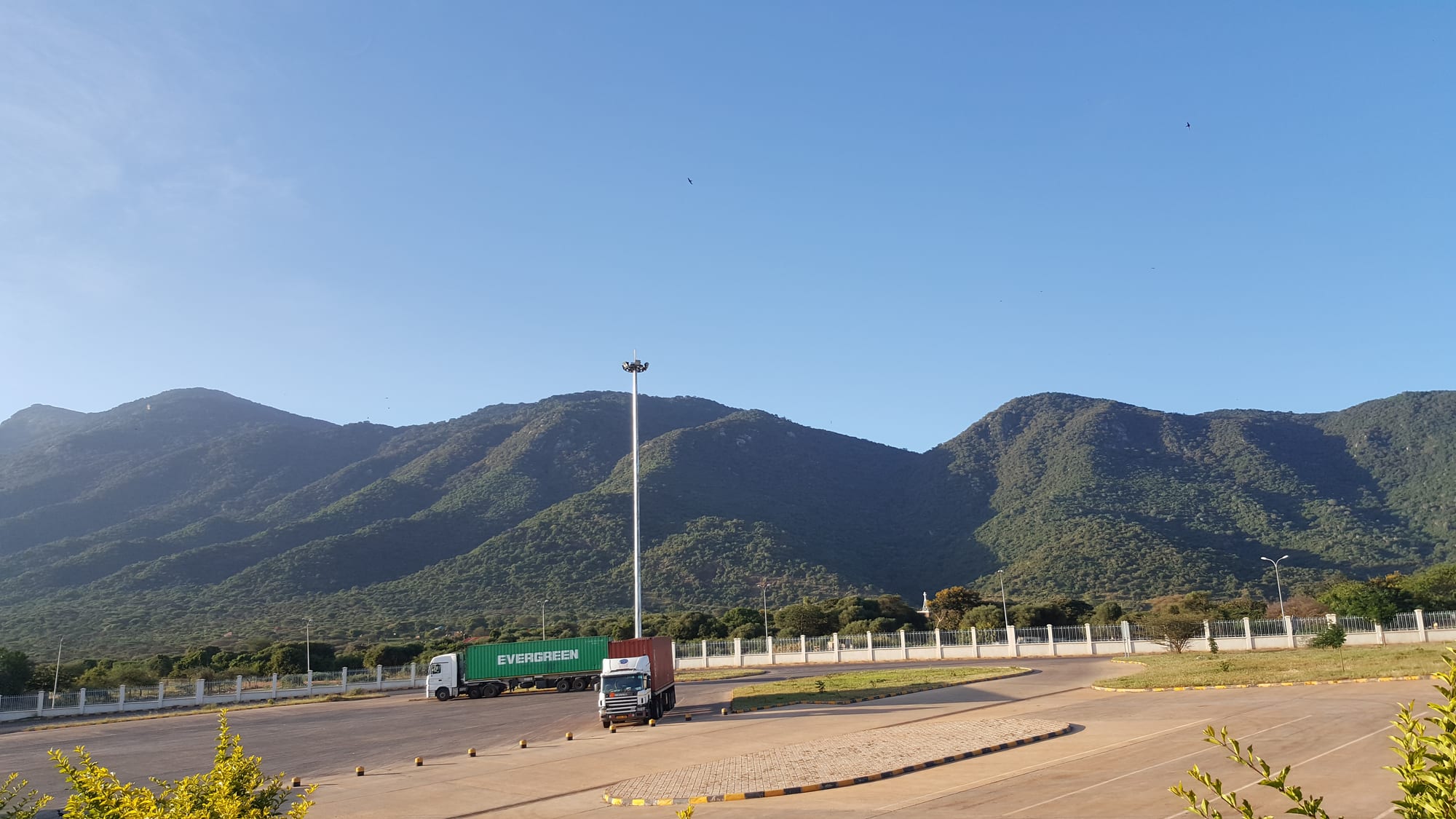
Two container lorries parked in a wide tarmac yard below a long green ridge of hills under a clear blue sky

The Maasai Mara & the Rift Valley, Kenya

Namanga

Lorries at the Namanga border post, below the wooded slopes of Ol Doinyo Orok. (KeyoT / Wikimedia Commons · CC BY-SA 4.0)

A small Maasai trading town on the main road between Nairobi and Arusha, divided by the Kenya–Tanzania border and overlooked by the wooded ridge of Ol Doinyo Orok. Lorries, buses and safari vehicles queue at its crossing all day, and traffic between Nairobi and Amboseli National Park passes through it.

Neighbourhoods

  • The border crossing
    • First-time visitors
    • Close to transport

    The customs and immigration compound and the lorry yards around it are the centre of gravity of the whole town, busy from early morning with freight, buses and shuttles between Nairobi and Arusha, and ringed by money changers, kiosks and curio stalls.

    Open in Maps
  • The Kenyan town
    • Local life
    • Markets
    • Value

    North of the barrier, a strip of shops, guesthouses, bars, petrol stations and a livestock and produce market serving Maasai families from the surrounding rangeland of Kajiado County. Dusty, low-rise and walkable end to end.

    Open in Maps
  • The Tanzanian side
    • Onward travel

    South of the line the town continues as a smaller settlement in Longido District, with its own shops, transport stand and road running on towards Arusha across the plains.

    Open in Maps

Things to do

Around the town

  • Ol Doinyo Orokviewpoint

    The forested massif immediately north-west of the town, also called the Namanga Hills, rising to about 2,548 metres and catching cloud above the dry plains.

    Open in Maps

Short trips from the town

  • Amboseli National Parkpark

    Swamps and dusty plains below Kilimanjaro, entered from Namanga at the Meshanani gate and known for large elephant herds and for the clarity of the mountain's profile in the early morning.

    Open in Maps
  • Mount Kilimanjaroviewpoint

    Africa's highest mountain at 5,895 metres, a dormant volcano with a snow-capped summit that stands above the plains south of the border.

    Open in Maps
  • Longidoattraction

    A small town at the foot of Mount Longido, the seat of Longido District, on the road across the plains to Arusha.

    Open in Maps
  • Chyulu Hills National Parkpark

    A volcanic range of cones and lava flows rising to about 2,188 metres, its most recent eruptions recorded in 1856, with a national park that forms part of the Tsavo conservation area.

    Open in Maps

Eat and drink

Long-standing places and food districts in Namanga. Hours, ratings and directions come from your maps app, always current.

Namanga classics

  • Nyama choma and roadside grillsrestaurant

    Goat roasted over charcoal and sold by weight, cut up on a board with kachumbari and ugali — the usual meal in a town where livestock is the local trade.

    Open in Maps
  • Transit cafés at the bordercafe

    Small kitchens feeding drivers, traders and bus passengers with chai, chapati, beans, rice and stew through the day and late into the evening.

    Open in Maps

Markets

  • Namanga market and curio stallsmarket

    Produce trucked in from the highlands, livestock from the surrounding rangeland, and beadwork, carvings and blankets sold to passing traffic near the crossing.

    Open in Maps

Experience Namanga

History

Namanga owes its existence to a line on a map. The boundary between British East Africa and German East Africa was fixed by Anglo-German agreement, confirmed by the Heligoland–Zanzibar Treaty of 1890, cutting across Maasai grazing country that had been used as a single range, and a customs post grew where the track between Nairobi and Arusha crossed it. The settlement that formed around the post kept the Maasai name of the hills above it, Ol Doinyo Orok.

For much of the twentieth century it was a quiet frontier station. The road south carried colonial officials, hunters and later the first safari traffic, and a small hotel on the Kenyan side became a familiar overnight halt on the drive between the two territories. Trade continued in both directions regardless of the border, as Maasai families with relatives and cattle on both sides moved back and forth.

Two developments shaped the modern town. The first was Amboseli, gazetted as a national park in 1974, which turned the Namanga road into a tourist route and gave the town its hotels, curio stalls and guides. The second was the growth of East African regional trade: the road between Nairobi and Arusha became one of the main freight corridors of the region, and the opening of East African Community borders drew still more trade through the crossing, alongside the tourist traffic the town had lived on. The town has grown along the road ever since, its fortunes tied to how freely traffic moves.

Culture & Customs

Namanga is a Maasai town with a border through it. The communities on either side belong to the same pastoral world, speak Maa, and keep ties of family, marriage and cattle that ignore the frontier, even though the two sides now answer to different governments, currencies and school systems. Swahili is the shared working language, and traders, drivers and officials from elsewhere in Kenya and Tanzania add their own mixture to the main street.

Cattle remain the measure of standing and the basis of daily life in the surrounding rangeland. Livestock markets draw herders from a wide area, age-sets still structure Maasai male life, and beadwork made by women is both custom and income, sold at stalls by the crossing. Dress is visibly Maasai — red and checked cloth, beaded collars, sandals cut from tyres — worn alongside the jeans and jackets of the transport trade.

The culture of the town itself is one of movement and negotiation: queues, paperwork, currency exchange, haggling and long waits. People are used to visitors and used to being photographed, which has made photography a transaction to be agreed rather than assumed. Christianity is widespread alongside older Maasai practice, and dry-season grazing agreements, water points and the effects of drought are the subjects that matter most in local conversation.

Daily Life

The town has an urban population of roughly 10,000, with about 5,500 more in the rural area around it, in a district whose wider population is thinly spread across the rangeland. The Kenyan side is the larger, a strip of shops, lodgings and yards along the highway in Kajiado County; the Tanzanian side is smaller and quieter.

The economy has three strands. Cross-border trade and transport come first: the customs post, clearing agents, lorry parks, fuel stations and the cafés and lodgings that serve drivers and traders. Second is livestock — Maasai herding on the plains, with markets where cattle, goats and sheep change hands. Third is tourism, mostly in transit, from the safari vehicles and shuttle buses that pass through towards Amboseli or Arusha, supporting curio stalls, guides and hotels.

Days follow the traffic. Trading starts early and the crossing is at its busiest in the morning, with queues of freight building through the day and a lull after the posts close. Water is the persistent problem: the plains are dry, boreholes and piped supply are limited, and drought years hit herds hard and push families towards the town. Dust, heavy lorries on a narrow road and the informal work that grows up around a frontier shape the rest of ordinary life here.

Food

Meat is the centre of eating in Maasai country, and Namanga's grills reflect it. Goat, and to a lesser extent beef, is roasted over charcoal as nyama choma, ordered by weight, chopped on a board and eaten with the hands along with kachumbari, a salad of raw tomato, onion and chilli. Ugali, stiff maize meal, is the standard accompaniment, with sukuma wiki, braised collard greens, or a bean stew.

Traditional pastoral food sits behind this: milk, soured milk and, on ceremonial occasions, blood taken from live cattle, with meat reserved for celebrations. Everyday town meals are the food of the road — chapati, beans, rice and stew, githeri of boiled maize and beans, and mandazi, lightly sweet fried dough, taken with strong milky chai, which is drunk throughout the day on both sides of the line.

Because the plains grow little, vegetables and fruit are trucked in from the highlands around Kajiado and Nairobi, or up from the slopes of Kilimanjaro on the Tanzanian side, and sold in the market. Roadside stalls sell roast maize, boiled eggs, mutura sausage and sodas to passengers waiting for transport, and the cafés around the crossing serve much the same menu in Kenyan and Tanzanian versions a few hundred metres apart.

Planning tools

Budget

Namanga is cheap. Guesthouse rooms, café meals and shared transport cost little, and most people spend money here only on a night's stay, food, fuel and the formalities of crossing. Costs rise sharply on the other side of the journey: Amboseli charges non-resident park fees in US dollars per person per day, and safari vehicles are hired by the day.

Daily Budget Midrange
USD 120–270 (a comfortable lodge in the district, restaurant meals, a hired vehicle) — park days cost much more
Daily Budget Shoestring
USD 25–50 (basic guesthouse, local food, shared matatus and shuttles)

Visa and entry fees at the crossing are charged in US dollars or by card; money changers at the border quote worse rates than banks in Nairobi or Arusha.

Best Time to Visit

June to October and January to February are dry, and the mountain views for which the district is known are clearest in the early morning at those times. The long rains of March to May green the plains and make the tracks towards Amboseli slower. Border traffic is heaviest at the start and end of the week and around public holidays in either country.

Suggested Number of Days

The town itself asks for no more than a stop or an overnight stay between Nairobi and Arusha. Two or three days makes sense only for someone using it as a base for the western side of Amboseli or for walking in the hills above the town.

First Visit
Half a day to a night
With Surroundings
2–3 days

Transportation

Buses and shuttle minibuses running between Nairobi and Arusha stop here, and matatus connect north to Kajiado and Nairobi. On the Tanzanian side, transport continues to Longido and Arusha. Boda-boda motorcycles carry people across the town and through the crossing area, and 4x4s are needed for the tracks towards the park.

Cross-border shuttles handle the formalities as a group, which is usually quicker than walking through with a separate ticket on each side.

Airport & Station Connections

Namanga lies about 183 km south of Nairobi on the main road to Arusha, normally three hours or so by bus or car, and roughly 110 km north-west of Arusha. Both countries' controls are handled together at the joint One-Stop Border Post in the middle of the town, and travellers need their passports, any required visa or entry authorisation and a yellow fever certificate if arriving from a risk country. There is no airport.

Walkability

Everything in the town is within a few minutes' walk of the crossing — shops, guesthouses, the market and the transport stands are strung along the one main road. Pavements are informal, the dust and lorry traffic are constant, and the walk between the two countries' posts is short enough that many people do it on foot with their luggage.

Safety

Namanga is a transit town and its risks are those of a busy crossing: pickpocketing and bag theft in the queues and around the bus stands, overcharging by money changers and touts offering to speed up formalities, and heavy lorry traffic on a narrow road. The surrounding rangeland is quiet, though wildlife moves through it, and the roads are unlit at night.

Avoid the northeastern counties and the immediate Somali border, take care in Nairobi's central and eastern districts and after dark, use hotel or app-based transport, and take malaria precautions outside the highlands. Keep documents and luggage in hand at the crossing, change money at a bank rather than with street dealers, and do not photograph the border post, officials or police. Check current official travel advice before travelling.

Climate

The town sits on dry plains below the hills, so it is warmer than the Kenyan highlands and often dusty, with rain concentrated in the long rains of March to May and a shorter spell around November and December.

Summer
January to March is hot and bright, with days often around 30°C
Winter
June to August is cooler and windier, with days near 26°C and comfortable nights

Local Customs

This is Maasai country on both sides of the line, and red shúkà cloth, beadwork and cattle are everyday life rather than display. Swahili is spoken throughout, Maa at home, and English is understood in the tourism and transport trades. Greetings come before business, and bargaining at the curio stalls is normal and good-humoured.

Ask before photographing people or homesteads and expect a fee for posed pictures; never photograph the border installations, immigration staff or police, and dress modestly in town.

Common Payment Methods

The Kenyan shilling is used on the northern side and the Tanzanian shilling on the southern, with US dollars accepted for official fees and widely quoted at the crossing. Mobile money works within each country but not across the line. There are banks and ATMs in the town, but cash is the norm for small traders and transport.