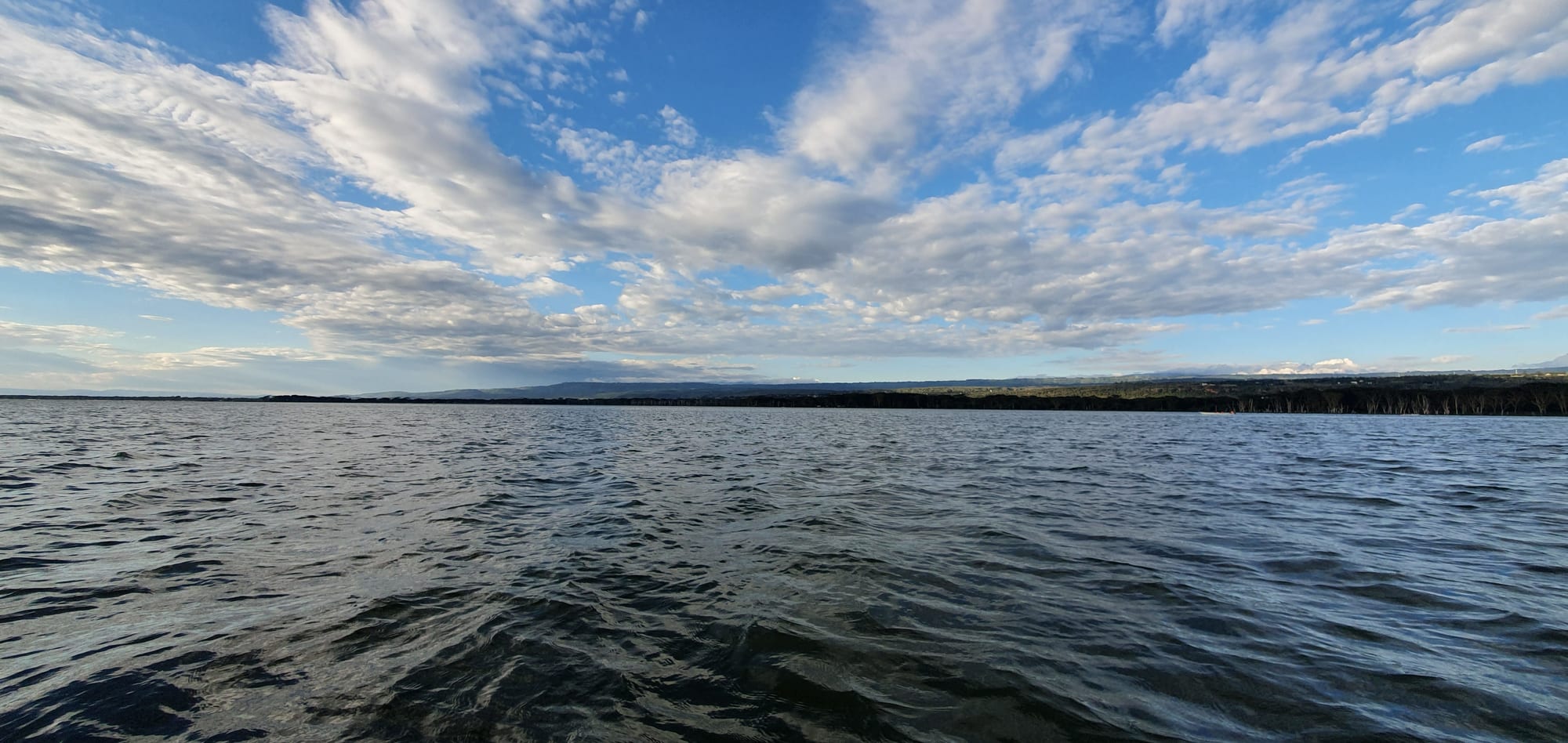
Open water of a broad lake under a wide sky of scattered cloud, with a low wooded shoreline and distant hills

The Maasai Mara & the Rift Valley, Kenya

Naivasha

Late light on Lake Naivasha, the freshwater lake that the town is built beside. (Kenenock / Wikimedia Commons · CC BY-SA 4.0)

A Rift Valley town beside a shallow freshwater lake of hippos, papyrus and fish eagles, about 90 km north-west of Nairobi. Colonial settlers, then cut-flower farms, built it; today greenhouses line the shore, the volcanoes of Longonot and the Hell's Gate cliffs stand within sight, and weekend traffic from the capital fills its lakeside lodges.

Neighbourhoods

  • Town centre
    • First-time visitors
    • Close to transport
    • Markets

    The old grid of streets beside the Nairobi–Nakuru road, with the market, banks, bus and matatu stages and most of the town's shops. It is compact, busy and cheap, and a couple of kilometres from the water.

    Open in Maps
  • Moi South Lake Road
    • Lake views
    • Wildlife
    • Quiet

    The road running west along the southern shore, lined with flower farms, camps and lodges set in fever-tree woodland where hippos graze at night. Most lakeside stays, boat landings and the turnings for Hell's Gate and Elsamere are along it.

    Open in Maps
  • Karagita and the farm estates
    • Local life

    Dense worker settlements that grew with the greenhouses south of town, home to much of the flower industry's labour force. Busy, informal and central to how Naivasha actually works, with markets, bars and small kitchens.

    Open in Maps
  • The northern shore and Kongoni
    • Birdwatching
    • Quiet and residential

    Farmland, ranches and scattered camps on the far side of the lake, reached by the north lake road. Quieter than the south shore, with papyrus edges, birdlife and long views to the escarpment.

    Open in Maps

Things to do

The lake

  • Lake Naivashaattraction

    A shallow freshwater lake at about 1,880 metres, fringed with papyrus and fever trees, with hippos, pelicans and African fish eagles; boat trips run from landings along the shore, and Crescent Island on its eastern side is grazed by plains game and walked rather than driven.

    Open in Maps

Volcanoes and gorges

  • Hell's Gate National Parkpark

    A small park of red cliffs, rock towers and a narrow gorge, one of only two Kenyan national parks where walking and cycling are allowed, among zebra, buffalo and antelope.

    Open in Maps
  • Mount Longonottrail

    A young stratovolcano south-east of the lake with its own national park and a steep path to a crater rim circuit high above the valley floor.

    Open in Maps
  • Eburruviewpoint

    A village in the hills north-west of the lake, below the Ol Doinyo Eburru volcano, reached by rough roads through farmland and forest and looking out over the Rift.

    Open in Maps

Short trips from the town

  • Mount Suswaviewpoint

    A shield volcano with a double crater and a system of lava caves in its flanks, reached by rough track from the valley floor.

    Open in Maps
  • Lake Elmenteitaattraction

    A shallow soda lake known for its flamingos, pelicans and the conservancies around it, protected as a World Heritage Site together with Lake Nakuru and Lake Bogoria as the Kenya Lake System in the Great Rift Valley.

    Open in Maps

Seasonal events

  • Safari RallyVaries by year

    Kenya's round of the World Rally Championship, which returned to the calendar in June 2021 with an event based around Naivasha; the date has since moved about the calendar, and stages run on the tracks and farm roads near the lake.

Eat and drink

Long-standing places and food districts in Naivasha. Hours, ratings and directions come from your maps app, always current.

Naivasha classics

  • Lakeside fried tilapiarestaurant

    Whole tilapia deep-fried and served with ugali and kachumbari at simple places along the lake road and at the landing sites — the dish most associated with the town.

    Open in Maps
  • Nyama choma barsrestaurant

    Goat and beef roasted over charcoal, chopped on a board and shared, with the usual accompaniments of ugali and raw tomato and onion salad.

    Open in Maps

Markets and street food

  • Naivasha town marketmarket

    Vegetables, potatoes and fruit from the surrounding farms, plus cheap kitchens and stalls selling chapati, mandazi and roast maize.

    Open in Maps
  • Karagita eating placesneighborhood

    Small canteens and grills serving the flower-farm workforce — githeri, beans, chapati and stew at the lowest prices in the district.

    Open in Maps

Experience Naivasha

History

The lake gave the town its name: the Maasai word ɛnaɨpɔ́sha, "that which heaves", describes water big enough to raise waves in a wind, and British settlers wrote it down as Naivasha. The land around the shore was Maasai grazing country until the treaties of 1904 and 1911 moved Maasai communities south, opening the central Rift to European settlement just as the Uganda Railway crossed the valley.

A station and a small settler town followed. Ranching and mixed farming spread across the flats and up the slopes, and Naivasha became a byword for colonial society between the wars, when the farms and country houses of the Wanjohi Valley north of the lake gave the Happy Valley set its name and a reputation for scandal that outlived them, and the shore at Naivasha was one of their haunts. Flying boats on the Britain–South Africa route landed on the lake between 1937 and 1950, and the town remained a farming centre through independence.

Its modern shape dates from the 1980s, when commercial horticulture arrived. Greenhouses spread along the southern shore, and Naivasha became the heart of an export cut-flower industry that ships roses to Europe through Nairobi's airport, drawing tens of thousands of workers into new settlements around the town. Tourism grew alongside, on the back of the lake, Hell's Gate and Longonot. The town was among the places hit by reprisal killings during the post-election violence of 2007–08, and since about 2010 rising lake levels have flooded shoreline farms, homes and lodges, changing the geography of the shore again.

Culture & Customs

Naivasha is a mixed, migrant town rather than a place of one community. Maasai families hold land to the south and west, Kikuyu farming families settled the slopes and the town, and the flower farms have drawn workers from Nyanza, western Kenya and the wider Rift, so Swahili is the language that binds the streets together and English is common in offices and tourism. That mixture is the town's defining social fact, and also its fault line: the 2007–08 violence fell along those lines and is remembered.

Life is organised around work and church. Farm shifts start early, and Sunday fills the churches that anchor the estates and the town centre. Weekend leisure belongs partly to Nairobi: Naivasha is the capital's nearest lake, and Friday evenings bring buses of visitors out for the shore, the camps and the bars, which gives the town a resort rhythm at odds with its working week.

Conservation is a live public subject here, argued over rather than admired from outside — water abstraction, fertiliser run-off, fishing rules on the lake and the grazing corridors that hippos and buffalo still use. The Safari Rally's return to the area has added an annual sporting occasion, drawing crowds onto the farm tracks around the lake. Manners are those of the Rift generally: greet first, speak gently, respect elders, and ask before taking photographs.

Daily Life

The 2019 census counted 355,383 people in the town and its surrounding settlements, a figure that has climbed fast with the greenhouses. The centre is a grid of shops, banks and matatu stages beside the highway; most people live in estates such as Karagita and the newer settlements spreading south and west, and a small number in farms and lodges along the shore.

Horticulture is the economy. The flower farms dominate work in the district, with geothermal power from the Olkaria field nearby, tourism on the lake and its parks, fishing, dairy and smallholder farming making up much of the rest. The inland container depot beside the railway terminus was built to make Naivasha a cargo hub as well.

Days begin before dawn with farm buses collecting shift workers and end early outside the tourist strip. The pressures are familiar ones: housing and water supply for a fast-growing workforce, the condition of the lake, and the flooding that has followed the rise in water levels since about 2010, which has submerged lakeside land and forced homes and businesses back from the shore. Hippos moving between the water and grazing land at night are a routine hazard rather than a novelty.

Food

Fish is what Naivasha is known for. Tilapia from the lake is deep-fried whole and eaten with ugali and kachumbari at roadside places along the lake road and at the landings. Nyama choma — goat or beef roasted over charcoal and cut up on a board — is the other social meal, ordered by weight in the town's bars.

Everyday eating follows the Rift Valley pattern: ugali with sukuma wiki, braised collard greens, or a stew of beef or beans; githeri, boiled maize and beans; chapati; and mandazi, lightly sweetened fried dough, with strong milky chai. The estates around Karagita add cheap canteens serving the same food in quantity, and mutura, a grilled sausage, is sold at stalls in the evenings.

The market is supplied by the farms that surround the town — potatoes, cabbages, kale, tomatoes and maize — with fruit trucked in from lower and wetter country. On the south shore, lodge kitchens serve international menus alongside Kenyan dishes, and the lakeside bars keep Tusker and other lagers cold. Honey from the escarpment and fresh passion-fruit and mango juices are common additions.

Planning tools

Budget

Naivasha covers a wide range. The town has cheap guesthouses and café meals, while the lakeside camps, lodges and private ranches along the south shore charge far more, and prices rise on Kenyan holiday weekends when Nairobi comes out. Park entry to Hell's Gate and Mount Longonot, boat hire on the lake and bicycle rental are the main extras.

Daily Budget Midrange
USD 120–270 (a lakeside lodge or a good hotel in town, restaurant meals, park entry and a boat trip)
Daily Budget Shoestring
USD 30–60 (guesthouse or campsite, local food, matatus and boda-bodas)

Boat trips and park fees are usually per person and payable at the gate or landing, and weekday rates for lakeside stays are noticeably lower than weekends.

Best Time to Visit

June to October and January to February are dry and the easiest for walking and cycling at Hell's Gate or climbing Longonot. The long rains of March to May bring green country, fewer visitors and muddy tracks, and dust on the lake road is heaviest at the end of a dry spell. Mornings are the best time for birds and for clear views of the volcanoes.

Suggested Number of Days

One or two days covers the lake and one of the parks; three or four allow a slower stay on the shore and time for the crater lakes and the north side. Visitors combining Naivasha with Nakuru or the Mara usually pass through in a single night.

First Visit
1–2 days
With Surroundings
3–4 days

Transportation

Matatus run constantly between the town centre and Nairobi, Nakuru and Mai Mahiu, and shared matatus work along Moi South Lake Road as far as Kongoni. Boda-boda motorcycles and tuk-tuks handle short hops, and taxis or hired cars are usual for the lodges. Bicycles can be hired for Hell's Gate, and boats are hired at the lakeside landings.

Distances along the lake are longer than they look on a map, and the south lake road is unlit and used by wildlife at night, so travel it in daylight where possible.

Airport & Station Connections

Naivasha is about 90 km north-west of Nairobi on the main highway towards Nakuru, typically around two hours by road, with frequent buses and matatus from the capital. The standard gauge railway from Nairobi reaches a terminus near the town, and an inland container depot has been built beside it. Most visitors arrive by road as part of a Rift Valley route.

Walkability

The town centre is small, flat and easily walked, with the market and the matatu stages within a few blocks. The lake itself is not walkable from the centre — the shore is a few kilometres out and the lakeside road runs for tens of kilometres past farms and gated camps — so getting between the town and the water needs transport.

Safety

Naivasha is a well-travelled tourist town and generally straightforward, with ordinary risks of theft around the market, the bus stages and at night. The real hazards are natural and practical: hippos come out of the lake to graze after dark and are dangerous to walk near, the shoreline is shared with buffalo in places, and the busy Nairobi–Nakuru highway carries heavy lorry traffic. The town saw killings during the post-election violence of 2007–08.

Avoid the northeastern counties and the immediate Somali border, take care in Nairobi's central and eastern districts and after dark, use hotel or app-based transport, and take malaria precautions outside the highlands. Do not walk between the lake and lodges after dark, keep well back from hippos and buffalo, and follow guides' instructions on the water. Check current official travel advice before travelling.

Climate

At about 1,900 metres the climate is warm by day and cool at night, drier than the highlands to the west. Rain falls mainly in the long rains of March to May and in a shorter spell around November, and afternoons can be windy on the lake.

Summer
January to March is the warmest and driest period, with days often 27–30°C
Winter
June to August is cooler and greyer, with days near 24°C and nights around 10°C

Local Customs

The district mixes Maasai and Kikuyu communities with workers from across Kenya drawn by the flower farms, so Swahili is the common language and English is widely understood. Greetings before business are expected, dress in town is modest, and churches are full on Sundays. The flower industry is a sensitive subject locally, discussed in terms of jobs as much as water.

Ask before photographing people, farm workers or homesteads, avoid photographing police and government buildings, and treat the lake shore as private land in many places — access is usually through a camp or a landing site.

Common Payment Methods

The currency is the Kenyan shilling. Mobile money is used for nearly everything, including boat and bicycle hire, and ATMs are plentiful in the town centre. Cards are accepted at lodges and larger hotels, but cash is needed for markets, matatus and small landings on the lake.