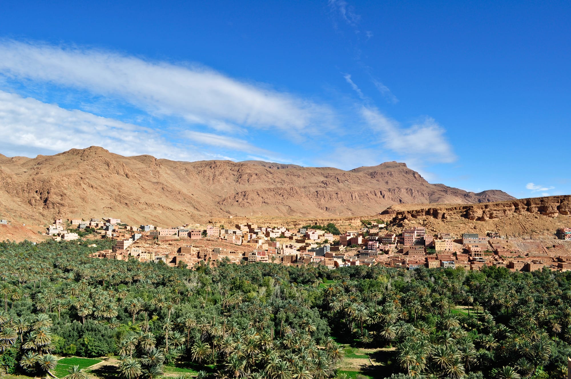
A dense green palm grove filling a valley floor, with earth-coloured houses on the slope behind and dry red mountains above

Agadir, the Drâa Valley & the South, Morocco

Tinghir

The town of Tinghir above its palm grove, with the bare limestone hills of the eastern High Atlas behind. (Elena Tatiana Chis / Wikimedia Commons · CC BY-SA 4.0)

An oasis town on the northern edge of the Moroccan pre-Sahara, strung along a long palm grove watered by the Todgha river below bare limestone mountains. Old earthen ksour and a hilltop kasbah stand above the gardens, the modern town spreads along the road between Ouarzazate and Errachidia, and the Todgha gorge cuts into the cliffs just upstream.

Neighbourhoods

  • The town centre
    • First-time visitors
    • Transport connections
    • Everyday shopping

    The modern town along Avenue Mohammed V and Avenue Hassan II, where the buses stop and the banks, cafés, grill houses and most hotels are. It is functional rather than old, and it is where the weekly market and the daily business of a provincial capital happen.

    Open in Maps
  • The palm grove and its ksour
    • Walks
    • Historic district
    • Quiet and residential

    Below the town the Todgha oasis runs for about 30 km, and up to about 4 km wide, in a green ribbon of date palms, olives, alfalfa and small walled gardens, watered by channels. Villages of earth-built houses and old ksour, among them Afanour and Aït El Haj Ali, sit along its edges, linked by paths that are easy to walk.

    Open in Maps
  • The kasbah hill
    • Views
    • Historic district

    The ridge above the gardens carries a crumbling earthen kasbah, left from the era of the local lords who ruled the south under the French protectorate. The walls are decayed and partly unsafe, but the lanes below them give the best view over the palms and the mountains.

    Open in Maps
  • The gorge road
    • Scenery
    • Walks
    • Quiet stays

    North of town a road follows the Todgha upstream past the village of Tizgui into the gorge, with guesthouses, gardens and rock walls rising on both sides. Beyond the narrows the valley opens again towards the high village of Tamtattouchte.

    Open in Maps

Things to do

The oasis and the gorge

  • Todgha Gorgelandmark

    A series of limestone canyons cut by the Todgha river upstream of the town, with walls up to about 400 m high that close in the final stretch to a corridor as little as 10 m wide, popular with rock climbers.

    Open in Maps

Short trips from the town

  • Dades Gorgeslandmark

    A second set of gorges to the west, up the valley beyond Boumalne Dades, known for folded red rock, a road of tight hairpin bends and the kasbahs along the valley floor.

    Open in Maps
  • Boumalne Dadesattraction

    The market town at the mouth of the Dades valley, about 50 km west along the road of the kasbahs, and the usual base for the gorge above it.

    Open in Maps
  • Jbel Saghrotrail

    A dry range of dark bare rock south of the valley, with prehistoric engravings, isolated villages and trekking country grazed by Aït Atta nomads, who fought the French until their surrender at the Battle of Bougafer in 1933.

    Open in Maps
  • Tinejdadattraction

    An oasis town about 50 km east on the road towards Errachidia, with old ksour along the valley.

    Open in Maps
  • Imiterattraction

    A village about 25 km west, site of the biggest silver mine in Africa, and of sit-ins begun in 2012 by villagers demanding a share of the wealth taken from the region.

    Open in Maps

Eat and drink

Long-standing places and food districts in Tinghir. Hours, ratings and directions come from your maps app, always current.

Tinghir classics

  • Dates from the Todgha palm grovesmarket

    The oasis grows several varieties of date, sold loose by weight in the town's shops and market stalls, sweetest after the autumn harvest.

    Open in Maps
  • Tagine and berkoukesrestaurant

    The grills and small restaurants along the main avenues cook vegetable, chicken and lamb tagines over charcoal, and in winter berkoukes, a large-grained couscous served as a broth.

    Open in Maps

Markets and food streets

  • Tinghir weekly soukmarket

    The town's market day brings farmers from the oasis and the mountains with dates, olives, vegetables, spices, mint and livestock.

    Open in Maps
  • Avenue Mohammed V cafésneighborhood

    The main street is lined with cafés serving mint tea, coffee and pastries, busiest in the early evening when the heat drops.

    Open in Maps

Experience Tinghir

History

Tinghir grew where water reaches the surface. The Todgha river, fed by snowmelt in the eastern High Atlas, emerges from its gorge and is split into channels that have irrigated this stretch of valley for centuries, and the settlement is really a chain of earth-built villages and ksour strung along the gardens rather than a single old town. Its people are Amazigh, mainly of the Aït Todgha, in a valley long contested and traded across by the Aït Atta of the mountains to the south.

The oasis lay on the routes linking the Tafilalet, the caravan terminus in the east, with the Drâa and Marrakesh, and its fortified granaries and walled villages reflect a history in which stored grain and dates had to be defended. In the early twentieth century the valley fell under the authority of the Glaoui family, the "lords of the Atlas" who ruled much of southern Morocco in cooperation with the French protectorate; and a ruined kasbah stands on the ridge above the palm grove. The Aït Atta of the mountains fought the French until their surrender at the Battle of Bougafer in 1933, and the region was among the last to be brought under protectorate control.

Tinghir, like other oasis towns of the south, had a Jewish community living among the ksour; almost all of Morocco's Jews emigrated, most of them to Israel, in the decades after 1948. Since independence the town has grown out of the gardens and along the main road, drawing people from the surrounding villages, and in 2009 it became the seat of its own province.

Culture & Customs

Tinghir belongs to the Amazigh south, and Tamazight is the language of the street and the market; Moroccan Arabic is the language of administration and business, and French is used in schools and offices. Amazigh identity is worn openly here, in the alphabet on shopfronts and official signs and in the music played at weddings, where ahidous-style line dancing with frame drums and sung verse can continue most of the night.

The rhythm of the oasis is collective. Water rights in the palm grove are shared out by long-standing custom, with turns at the channels divided among families, and the upkeep of ditches, paths and walls is organised village by village. Traditional houses of packed earth, some several storeys high, are still built and repaired with the same materials, although concrete and breeze block have taken over in the new town.

Craftwork is modest compared with the imperial cities, but silver and carpets from the valley and the Saghro have a local reputation, and the Aït Atta weave heavy woollen rugs in dark colours. Life is conservative and family-centred: Friday couscous after prayers, long evenings of tea and conversation in the cafés for men, and household gatherings for women and families. Visitors are common enough not to be remarkable, and rare enough that hospitality is still offered rather than sold.

Daily Life

The town itself had just over 42,000 people at the 2014 census, with many more in the villages strung along the oasis and in the mountain settlements of the province. Agriculture underpins everything: dates above all, with olives, almonds, alfalfa for livestock and vegetables grown in small irrigated plots under the palms. Tourism is the second pillar, built on the gorge, the kasbah road and the desert circuits that pass through, and it supports guesthouses, cafés, drivers and guides.

Money also arrives from elsewhere. Tinghir has sent migrants to France, Belgium and the Netherlands for generations, and remittances pay for houses, weddings and shops; the town fills in summer when families return. Mining provides work in the province, notably the silver operation at Imiter to the west, which has also been the focus of a long local dispute over the wealth it takes from the region.

Drought is the defining issue. Years of poor rain and snow have lowered the water table, dried channels and killed palms across the oases of the south, and deep wells and pumps have spread. Days follow the sun: business early, a long pause in the afternoon heat, and the streets busy again after sunset, when the cafés fill and the market stalls light up.

Food

Tinghir eats the food of the oases. Dates are the staple harvest, eaten fresh in autumn, dried through the year and offered to guests with milk or tea; several varieties are grown in the valley and sold by weight in town. Bread is baked at home or in neighbourhood ovens, and the local flatbread is eaten with olive oil or with amlou where argan oil reaches the market from the Souss.

Tagines are cooked over charcoal with the vegetables of the gardens — carrots, turnips, potatoes, tomatoes — and with lamb, goat or chicken, often flavoured with cumin, saffron and preserved lemon. Couscous is the Friday dish, rolled from barley as well as semolina in mountain households. Berkoukes, a soup of large couscous grains in a vegetable broth, and harira, thickened with lentils and chickpeas, are winter food, and in Ramadan harira with dates and honeyed pastries breaks the fast.

Drinks are simple: mint tea poured from height, sweetened heavily and often flavoured with wormwood in winter or with sage, and fresh orange juice in season. Olive oil pressed in the valley, almonds from the terraces and honey from the mountain hives are the local products worth buying, and alcohol is not part of everyday life here.

Planning tools

Budget

Tinghir is inexpensive. Guesthouses in the oasis and simple hotels in town cost little, meals in the grill houses less, and the main expenses are transport — a hire car or a driver for the gorges and the kasbah road — and guided walking or climbing in the Todgha.

Daily Budget Midrange
USD 70–150 (comfortable kasbah hotel or gorge guesthouse, restaurant meals, a car or driver)
Daily Budget Shoestring
USD 25–45 (guesthouse room, café meals, coaches and shared grand taxis)

Rooms in the gorge itself cost more than rooms in town; walking in the palm grove and along the river costs nothing.

Best Time to Visit

October to April is the comfortable season, with warm days, cold nights and clear light in the gorge. Spring brings green in the gardens and blossom in the valleys to the west. July and August are very hot, and the town empties into the shade in the middle of the day.

Suggested Number of Days

The oasis and the gorge fill a day or two. Allow three or four to add the Dades valley, the kasbah road west or a walk in the mountains, and longer again for anyone continuing to the dunes further east.

First Visit
1–2 days
With Surroundings
3–4 days

Transportation

The town is small enough to cross on foot, and shared taxis and minibuses run from the centre out along the oasis and up the gorge road. Everything further afield — the Dades valley, the rose towns, Jbel Saghro — is reached by grand taxi, by hire car or with a driver, since services are infrequent.

Agree the price of a grand taxi or a driver before setting off, and check whether a fare is for a seat or for the whole car.

Airport & Station Connections

Tinghir has no airport or railway. It sits on the N10 between Ouarzazate, about 170 km west, and Errachidia, about 170 km east, both of which have small airports; Marrakesh is roughly 360 km away over the Tizi n'Tichka pass, a long day by road. CTM and Supratours coaches and private buses stop in town on the routes between Marrakesh, Ouarzazate and the Tafilalet, and most visitors arrive by hire car or on a desert circuit.

Walkability

The centre is walkable and flat, and the tracks through the palm grove are the best walking in the town, though the gardens are a maze and paths end at irrigation channels. The climb to the kasbah ridge is steep and rough underfoot, and the narrows of the gorge are too far upstream to walk to comfortably.

Safety

Tinghir is quiet and sees far less touting than the imperial cities, though unofficial guides do approach visitors at the gorge. The real risks are environmental: strong sun and dehydration, cold nights, rockfall on the gorge walls and flash floods, which can fill the riverbed and the road through the gorge after a storm anywhere in the mountains upstream.

Carry water, keep out of the riverbed and the gorge road in wet weather, and treat the decayed earthen kasbah walls as unsafe. Use official guides booked through a riad or a licensed agency, keep bags across the body in medinas, and avoid the cannabis-growing Ketama area of the Rif. Check current official travel advice before travelling.

Climate

A dry pre-Saharan climate at about 1,430 metres, with big differences between day and night, very little rain and strong sunshine nearly all year. Occasional violent storms cause flooding out of proportion to the rainfall.

Summer
hot and dry, typically 35–40°C by day, cooler at night than the desert further south
Winter
sunny days of about 15–18°C with nights near or below freezing

Local Customs

This is a Tamazight-speaking Amazigh town, conservative in dress and habit, where Arabic and some French are also spoken. Modest clothing covering the shoulders and knees is expected, greetings are unhurried, and an invitation to mint tea is a courtesy rather than a sale. Photographing people, especially women, needs permission, and the gardens of the oasis are private property.

Tip small amounts for service, ask before entering a garden or a ksar, and expect reduced daytime hours and quieter streets during Ramadan.

Common Payment Methods

The currency is the Moroccan dirham. There are banks and cash machines on the main avenues, but cash rules in the market, in the oasis villages and in small guesthouses, and card acceptance is limited to larger hotels. Draw money in town before heading up the gorge or into the mountains.