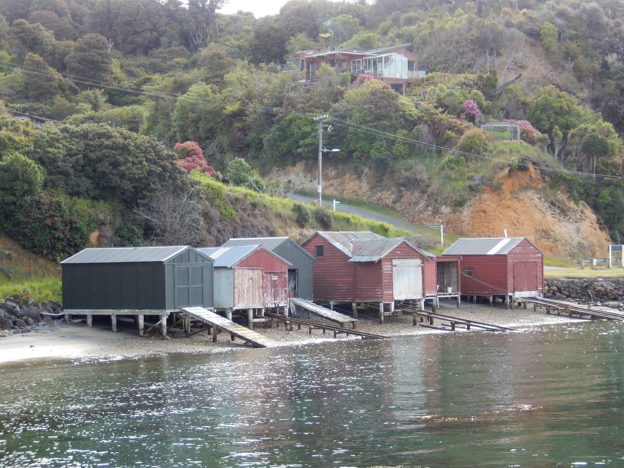
A row of weathered red and grey wooden boat sheds on piles at the edge of a calm bay, with bush-covered hillside and houses behind

Queenstown, Otago & Southland, New Zealand

Stewart Island

Boat sheds along the shore of Halfmoon Bay at Oban, Stewart Island. (AlasdairW / Wikimedia Commons · CC BY-SA 3.0)

New Zealand's third-largest island, lying across Foveaux Strait from the southern tip of the South Island and known in Māori as Rakiura. Around 480 people live on it, almost all in the village of Oban on Halfmoon Bay, while the great majority of the island is Rakiura National Park — forest, granite hills, empty beaches and kiwi that live down on the dunes and beaches.

Neighbourhoods

  • Oban and Halfmoon Bay
    • First-time visitors
    • Close to the ferry
    • Places to eat

    The island's only village and the arrival point for the ferry, gathered around the wharf on Halfmoon Bay. A hotel, a general store, a museum, a Department of Conservation visitor centre, a handful of cafés and most of the island's accommodation stand within a few minutes' walk of each other.

    Open in Maps
  • Horseshoe Bay and Butterfield Beach
    • Quiet and residential
    • Beaches

    A sheltered curve of sand about two kilometres north of Oban, reached on the island's short stretch of sealed road. Holiday houses sit among the bush behind it, and the bay is a calm place to swim by southern standards.

    Open in Maps
  • Paterson Inlet and Ulva Island
    • Wildlife
    • Boat trips
    • Kayaking

    The long drowned valley that almost cuts the island in two, with bush to the waterline, wooded islands and the bird sanctuary of Ulva Island near its mouth. Water taxis and kayaks are the way to reach it.

    Open in Maps
  • Mason Bay and the west coast
    • Wildlife
    • Serious walking
    • Solitude

    A long dune-backed beach on the exposed western side, one of the best places in the country to see wild kiwi. It is reached on foot across the island, by water taxi and track, or by light aircraft landing on the sand at low tide.

    Open in Maps
  • Rakiura National Park backcountry
    • Tramping
    • Huts and camping

    The forested interior and northern peninsula, laced with muddy tracks and simple huts and empty of roads or settlements. The North West Circuit runs for days around the coast; most of the island's area lies inside the park.

    Open in Maps

Things to do

Wildlife and islands

  • Ulva Islandattraction

    A predator-free sanctuary of 267 hectares in Paterson Inlet, open to visitors by water taxi, where saddlebacks, kākā, rifleman and Stewart Island robins live in tall podocarp forest crossed by easy tracks.

    Open in Maps
  • Mason Baybeach

    A remote west-coast beach several kilometres long, backed by high dunes, with a hut nearby and a well-known population of Stewart Island brown kiwi, or tokoeka.

    Open in Maps
  • Paterson Inletattraction

    A large sheltered inlet used for kayaking, fishing and boat trips, with wooded islands, old whaling and sawmilling sites and a whaler's base on Ulva's neighbouring shores.

    Open in Maps

Walks and the national park

  • Rakiura National Parkpark

    Opened in March 2002 and covering about 85 per cent of the island, a park of rimu and kāmahi forest, granite ranges, peat bogs and a long unvisited coastline.

    Open in Maps
  • Rakiura Tracktrail

    One of New Zealand's Great Walks, a circuit of 32 kilometres from Oban over a forested ridge and along the coast, usually walked in three days, with huts at Port William and North Arm.

    Open in Maps

The village and the strait

  • Obanneighborhood

    The island's village, with a wharf, a museum of island history, a pub facing the water and short tracks leading straight into the bush.

    Open in Maps
  • Foveaux Straitattraction

    The shallow, often rough strait between the island and Bluff, crossed by the ferry and fished for blue cod, crayfish and the Bluff oyster.

    Open in Maps

Short trips from the island

  • Bluffattraction

    The port town on the mainland where the ferry docks, with the Stirling Point signpost, a hill lookout and the oyster fleet.

    Open in Maps

Eat and drink

Long-standing places and food districts in Stewart Island. Hours, ratings and directions come from your maps app, always current.

Island specialities

  • Blue cod and crayfishrestaurant

    Fish landed in the strait is the staple of island menus, usually blue cod, battered or pan-fried, with crayfish and paua appearing when the boats have them.

    Open in Maps
  • The Oban waterfront pub and cafésrestaurant

    The hotel bar and dining room on the Halfmoon Bay waterfront is the island's social centre; a few cafés and takeaways nearby complete the choice.

    Open in Maps
  • Oban general storemarket

    The village supermarket, where trampers buy supplies before heading into the park; everything arrives by ferry or plane, so prices are higher and stock can run out.

    Open in Maps

Experience Stewart Island

History

Rakiura, usually translated as glowing skies, has been known to Māori for centuries as a seasonal food-gathering place, reached by canoe across Foveaux Strait for fish, shellfish and above all tītī, the young sooty shearwaters harvested from small islands off its coast. Kāi Tahu tradition ties the island to the anchor stone of the canoe from which Māui fished up the North Island, and the name Te Punga o Te Waka a Māui is still used for it. Sealers arrived early in the 19th century and worked the offshore rocks hard; whalers, boatbuilders and timber cutters followed, and mixed European and Kāi Tahu families settled around Paterson Inlet and Halfmoon Bay. The English name commemorates William Stewart, first officer on the Pegasus, which visited in 1809; he charted the southern harbour that still carries the ship's name and showed that Rakiura was an island.

Most of the island later passed to the Crown, while Rakiura Māori kept reserves and the tītī islands, where the muttonbird harvest still takes place. Later ventures came and went: timber, flax and trading schemes, sawmills in the inlets and whaling bases in Paterson Inlet. Each left rusting machinery and overgrown clearings in the bush.

By the middle of the 20th century fishing and crayfishing had become the mainstay, and the population settled into a few hundred people concentrated at Oban. In March 2002 Rakiura National Park was opened over about 85 per cent of the island, confirming a change already under way from extraction to conservation and tourism, and the island was recognised as a dark sky sanctuary in 2019.

Culture & Customs

The island's culture is that of a very small, remote community that has learned to be self-reliant. Fewer than five hundred residents share one village, one school, one store, one pub and a volunteer fire brigade, and nearly everyone has more than one job — fishing in season, guiding, driving a water taxi, running a guesthouse. Boats matter more than cars, weather forecasts are read closely, and the ferry timetable structures the week.

Rakiura Māori remain a distinct part of the community, and the annual muttonbird season still takes families out to the tītī islands, a right held and managed by descent rather than by permit. The whakapapa of the old sealing and whaling families, many of them of mixed Kāi Tahu and European descent, is woven through the island's names and headstones.

Conservation has become a shared identity as much as an industry. Residents trap predators, watch for rats coming off boats and take pride in birdlife that mainland New Zealand has largely lost; kiwi wandering across a lawn or a kākā raiding a deck are ordinary events. Visitors are welcomed without ceremony and expected to fit in: mud on boots, an early night before an early boat, and a willingness to talk to strangers at the bar. The bar of the waterfront hotel is the closest thing to a formal social institution.

Daily Life

About 480 people live on the island, almost all at Oban, making it one of the smallest permanently settled districts in New Zealand; the number swells in summer with holiday-house owners, seasonal staff and trampers. The economy rests on fishing — blue cod, crayfish and paua — together with tourism, conservation work for the Department of Conservation, and the services the village needs.

Everything else arrives by sea or air: groceries on the ferry, fuel by barge, mail and freight by plane. Power has come from local diesel generators rather than the national grid since 1988, which makes electricity about three times the mainland price and heating a constant consideration in a wet, windy climate. Housing is scarce, and finding a rental for seasonal workers is a perennial problem.

The school teaches a few dozen children, who leave for the mainland for secondary education, and health care is provided by a small local centre with patients flown out when needed. Daily life follows the weather and the tide: work on the water when the strait allows, jobs ashore when it does not. Current concerns include the cost and reliability of the ferry link, the pressure of visitor numbers on a tiny infrastructure, and long-running plans for a predator-free island.

Food

Seafood is the island's food. Blue cod, caught in the strait and the inlets, is the standard fish in the pub and the takeaway, fried in batter or pan-fried with lemon, and is often the reason people order fish twice in three days. Crayfish, the southern rock lobster, and paua, the black-footed abalone whose shell is prized for its colour, come and go with the seasons and the quota. Bluff oysters, dredged from Foveaux Strait between the island and the mainland, are eaten in autumn and winter, usually raw or lightly crumbed.

The most distinctive local food is the tītī, or muttonbird, the salted young sooty shearwater harvested each autumn from the islands off the coast. It is strong, oily and salty, boiled or roasted after long soaking, and is far more a family and community food than a restaurant dish, traded and gifted within Rakiura Māori networks and sometimes sold on the mainland.

Otherwise the cooking is plain southern New Zealand: lamb and mutton, venison from deer shot in the bush, whitebait fritters in spring, and the cheese roll, that southern invention of grated cheese and onion rolled in bread and toasted, which turns up in island cafés as it does everywhere below the Waitaki. Because supplies come across the strait, menus change with the boat and self-catering visitors often bring their own provisions from Invercargill.

Planning tools

Budget

Getting to the island and moving around it are the main costs: the ferry or flight across Foveaux Strait, then water taxis for Ulva Island or Mason Bay and guided kiwi or bird-watching trips. Beds are limited in summer, which keeps prices firm, and food costs more than on the mainland because it is all shipped in. Walking the tracks and huts is the cheap way to spend time here.

Daily Budget Midrange
USD 190–340 (guesthouse or motel room, restaurant meals, a water taxi and a wildlife trip)
Daily Budget Shoestring
USD 80–130 (hostel bunk or a national park hut, self-catered food, walking)

Supplies cost less on the mainland, so trampers cooking for several days often carry food from Invercargill or Bluff.

Best Time to Visit

December to March gives the longest days, the warmest sea and the most reliable boat and flight schedules, and is when the tracks and huts are busiest. Shoulder months from October to November and in April are quieter, with fewer sandflies than midsummer. Winter is cold, wet and windy, with short days, though crossings still run and the dark skies are at their best.

Suggested Number of Days

Two to three days allow the village, a boat trip and a short walk. Four to six suit a multi-day walk with nights in backcountry huts, and the longest circuits need a week or more. Weather can delay boats and flights, so a spare day is wise.

First Visit
2–3 days
With Surroundings
4–6 days

Transportation

There is little road on the island, nearly all of it within a few kilometres of Oban, and no public transport. Most visitors walk; a small number of rental cars, scooters and bicycles are available, and a minibus runs sightseeing tours. Everything beyond the village is reached by water taxi from the Oban wharf, by charter boat, by light aircraft landing on Mason Bay's sand, or on foot along the tracks.

Water taxis, charter boats and flights are run by small operators and depend on the weather, and services thin out outside summer.

Airport & Station Connections

A passenger ferry crosses Foveaux Strait from Bluff, a route of about 39 kilometres, in roughly an hour; the strait is shallow and often rough, and the crossing is known for it. Small aircraft fly from Invercargill Airport to the sealed airstrip at Ryan's Creek above Oban in about twenty minutes, with a shuttle into the village. Bluff is a short drive or shuttle ride from Invercargill, and cars are usually left on the mainland.

Walkability

Oban is small enough to cross on foot in ten minutes, and tracks to Ackers Point, Observation Rock and the start of the Rakiura Track begin in the village. The road is narrow, hilly and lightly used. Beyond the settlement the walking is proper tramping: mud, tree roots, tidal crossings and boardwalk, and boots and waterproofs are needed even for short sections.

Safety

Crime is close to non-existent and the community is small and watchful. The risks are environmental: sudden weather changes, cold water, rough seas in the strait, and very muddy tracks where twisted ankles are the commonest injury. Medical facilities are limited to a small local service, with serious cases flown to Invercargill, and mobile coverage fades quickly outside Oban.

Leave trip intentions with someone before heading into the park, carry a locator beacon and warm waterproof clothing on any walk, and expect sandflies in summer. Check current official travel advice before travelling.

Climate

Cool, wet and windy, with rain possible on any day and rapid changes driven by the Southern Ocean. Frost and snow are rare at sea level and hot days are rarer still. In the southern hemisphere summer falls in December to February and winter in June to August. The island is recognised as an international dark sky sanctuary, and the aurora australis is sometimes visible on clear winter nights.

Summer
mild and changeable — daytime highs usually 15–18°C, with wind and showers between fine spells
Winter
cold and wet — highs around 9–11°C, strong westerlies and short daylight hours

Local Customs

Life is informal and neighbourly; people greet strangers on the road and the pub doubles as the village meeting place. Tipping is not expected. Rakiura Māori hold customary rights to harvest tītī, or muttonbirds, on islands in the strait, which are not open to visitors, and those rights are respected rather than debated. Biosecurity is taken seriously because the island's birds depend on it.

Check boots, bags and tent for seeds, soil and rodents before crossing to Ulva Island, keep to tracks near nesting birds, and ask before photographing people in the village.

Common Payment Methods

The currency is the New Zealand dollar. Cards and contactless payment are taken at the store, the hotel and tour operators, but banking facilities on the island are minimal, connections can drop out and some small operators prefer cash, so it is sensible to arrive with a reserve of notes drawn in Invercargill or Bluff.