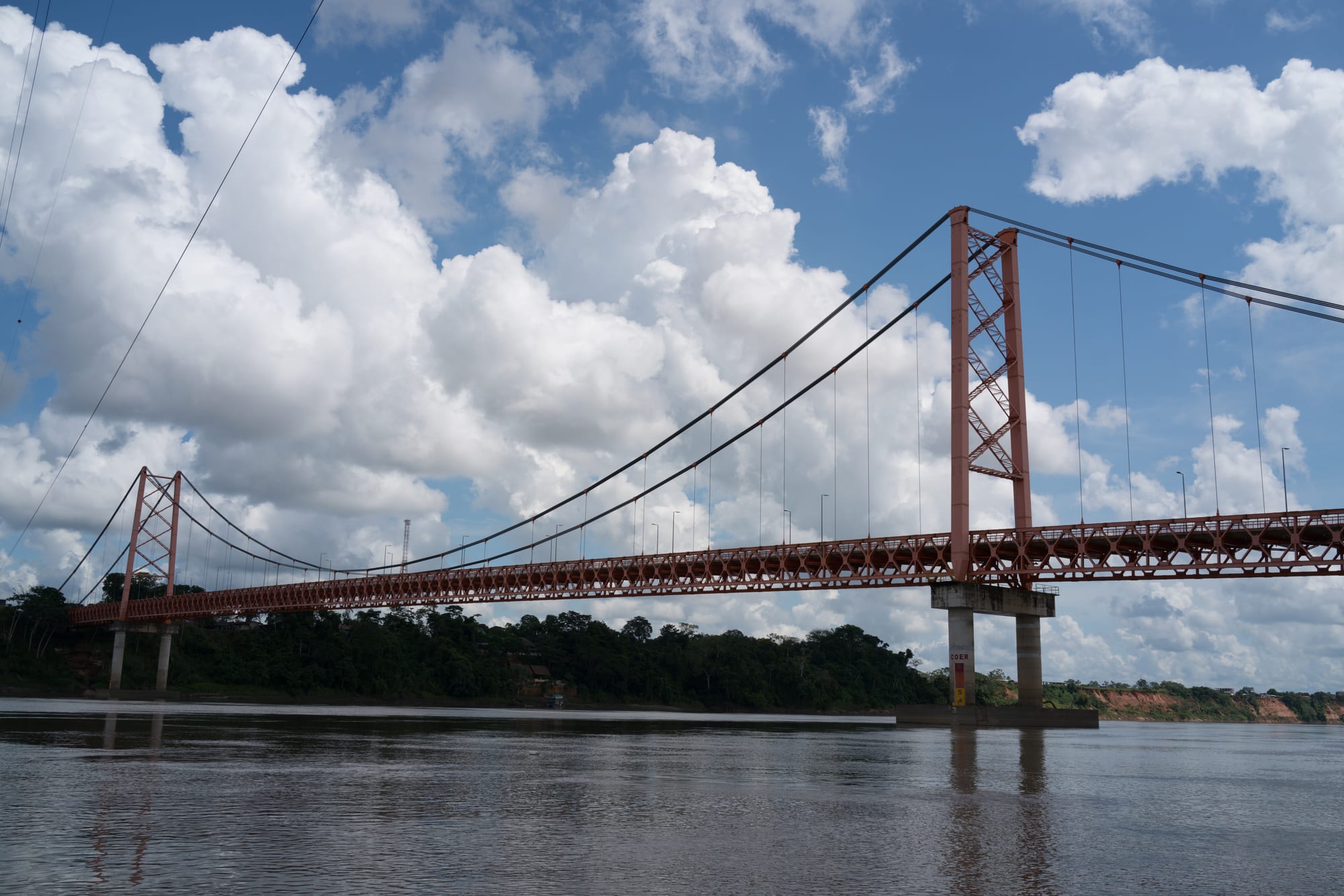
A long red steel suspension bridge spanning a wide brown river, with rainforest on the far bank under white clouds

Cusco, Machu Picchu & the Sacred Valley, Peru

Puerto Maldonado

The Billinghurst Bridge carrying the Interoceanic Highway over the Madre de Dios River at Puerto Maldonado. (Kuruman from Tokyo, Japan / Wikimedia Commons · CC BY 2.0)

The capital of Madre de Dios, at the meeting of the Tambopata and Madre de Dios rivers in the Peruvian Amazon, 55 km from the Bolivian border. Founded in 1902 during the rubber boom, it grew on logging, Brazil nuts and gold, and is now a busy frontier city on the Interoceanic Highway and the gateway to the Tambopata rainforest.

Neighbourhoods

  • The Plaza de Armas and centre
    • First-time visitors
    • Best for food
    • Nightlife

    The grid around the main square, with its banks, cafés and restaurants. It sits on slightly higher ground that does not normally flood in the wet season, and most town hotels, agencies and bars are within a few blocks.

    Open in Maps
  • Puerto Tambopata and the riverfront
    • Boats to the forest
    • Shopping for supplies

    The river port on the Tambopata, where boats leave for the reserve and the lodges upriver. Shops along Avenida León Velarde down to the bank sell almost anything a trip into the forest needs.

    Open in Maps
  • The market quarter
    • Local life
    • Cheap eats

    The busy blocks around the city market, with produce stalls, cheap restaurants and the everyday trade of a frontier town.

    Open in Maps

Things to do

In the city

  • Plaza de Armaslandmark

    The main square, a place to sit with an ice cream and the centre of the city's evening life.

    Open in Maps
  • The Obeliskviewpoint

    A tall monument decorated with sculptures by a local artist that tell a story of the jungle, with a viewpoint at the top over the city and the Tambopata and Madre de Dios rivers.

    Open in Maps
  • Confluence of the Tambopata and Madre de Diosviewpoint

    The meeting of the two rivers at the edge of the city, the reason Puerto Maldonado was founded where it was.

    Open in Maps
  • President Guillermo Billinghurst Bridgelandmark

    A 722-metre steel suspension bridge over the Madre de Dios, completed in 2011 as part of the Interoceanic Highway and the second-longest bridge in Peru.

    Open in Maps
  • City marketmarket

    The central market, where river fish, forest fruit, Brazil nuts and everyday goods are traded.

    Open in Maps

On the rivers

  • Monkey Islandattraction

    An island in the river, reached by boat, home to hundreds of monkeys of several species, which will try to steal whatever they can.

    Open in Maps

Into the forest

  • Lake Sandovalattraction

    An oxbow lake about 16 km from the city, reached by boat and a forest trail, known for giant river otters, black caimans, macaws and parrots.

    Open in Maps
  • Tambopata National Reservepark

    A rainforest reserve created in 2000 upriver from the city, with oxbow lakes and clay licks where hundreds of birds, macaws among them, feed on clay.

    Open in Maps

Eat and drink

Long-standing places and food districts in Puerto Maldonado. Hours, ratings and directions come from your maps app, always current.

Puerto Maldonado classics

  • Restaurants around the Plaza de Armasneighborhood

    Cafés, bakeries and restaurants around the main square, among them ice-cream shops making flavours from Amazonian fruit and Brazil nuts.

    Open in Maps
  • Cevicherías near the marketneighborhood

    Simple, cheap restaurants around the market serving ceviche and river-fish dishes.

    Open in Maps
  • Puerto Maldonado marketmarket

    The city's food market, with stalls selling juane, river fish, tropical fruit and Brazil nuts.

    Open in Maps

Experience Puerto Maldonado

History

The forests of Madre de Dios were home to Indigenous Amazonian peoples long before outsiders arrived. Because the region was harder to reach by the major rivers, it was among the last parts of the Amazon basin to be explored during the rubber boom of the late 19th century. Rubber barons, among them Carlos Fermín Fitzcarrald of Iquitos, along with Brazilian and Bolivian interests, brought in workers whose diseases caused epidemics among the Indigenous peoples of the Manu River from 1889 to 1892; another epidemic followed in 1896.

Fitzcarrald found a short overland route — the Isthmus of Fitzcarrald — that let rubber be carried down the Madre de Dios to the Madeira, the Amazon and the Atlantic, and he picked out the site of today's city as a strategic point. He died in 1897 when his ship sank in the river at the point where the city was later founded. In 1902 an expedition led by Juan Villalta founded Puerto Maldonado on 10 July as a station at the confluence of the Tambopata and Madre de Dios, naming it after Faustino Maldonado, who had explored the river in 1861.

The department of Madre de Dios was created in 1912 with Puerto Maldonado as its capital. Rubber collapsed once plantations in South-East Asia undercut South American production, and the town turned to mahogany logging, Brazil nuts and gold. The Tambopata National Reserve was established in 2000, and the Interoceanic Highway to Brazil, with the Billinghurst Bridge over the Madre de Dios, was completed in 2011.

Culture & Customs

Puerto Maldonado is a frontier town, shaped by waves of newcomers from the Andes and the rest of Peru drawn by rubber, timber, gold and land, alongside the Indigenous peoples of the Amazon who live along the rivers; among the peoples of the wider area are the Machiguenga. The result is a mixed, informal and fast-changing culture.

The rivers are central to life and identity. The confluence of the Tambopata and the Madre de Dios is the reason the city exists, and the city's Obelisk carries sculptures by a local artist that tell a story of the jungle.

Conservation and ecotourism have become part of the city's identity as well. The nearby Tambopata National Reserve, Bahuaja-Sonene National Park and Manu National Park protect some of the most pristine primary rainforests in the world, and the clay licks where macaws gather have made the area known to naturalists and visitors. Guides, boatmen and researchers are a visible part of town life.

Daily Life

Puerto Maldonado had about 79,000 people at the 2017 census. It is the capital of Madre de Dios, and its centre sits on slightly raised ground that does not normally flood in the wet season, though roads can become impassable.

The economy rests on logging, artisanal small-scale gold mining, Brazil nut collecting, boat building and ecotourism. The area has been almost logged out, and only one sawmill remains. Gold dominates: at least 30,000 miners work in the region around the city, much of the gold is mined illegally with mercury, which has cleared forest and polluted rivers, and the mining zone around La Pampa is best avoided by visitors. Some groups fear that the Interoceanic Highway encourages illegal logging, hunting and settlement in areas once hard to reach.

The rhythm of the day follows the heat: early starts, a slow middle of the day and a busy evening around the Plaza de Armas, when moto-taxis fill the streets. The airport, with flights from Lima and Cusco, and the boats up the Tambopata link the town to the lodges and to the rest of the country.

Food

The cooking of Madre de Dios is Amazonian. Juane, rice with meat, egg and spices wrapped in bijao leaves and boiled, is one of the main dishes of the Peruvian jungle, and river fish are eaten grilled, fried or in soups. Brazil nuts, collected in the forests around the city, are a major local product, sold in the market and used in ice cream.

The market is the best place to see what the forest and rivers provide: fish, tropical fruit, nuts and plantains, as well as the ingredients that migrants brought from the Andes. Cheap restaurants near the market serve ceviche and river-fish dishes, and ice-cream shops around the Plaza de Armas make flavours from Amazonian fruit and Brazil nuts.

Around the main square, cafés, bakeries and restaurants serve both Amazonian and national dishes, and at least one bar mixes cocktails with local flavours, with a view over the confluence of the two rivers. In the forest lodges, meals are part of the package and draw on the same river fish, fruit and Brazil nuts.

Planning tools

Budget

The city itself is cheap: moto-taxis cost little, and menús and market food are inexpensive. The real cost is the rainforest: lodges in Tambopata are sold as all-inclusive packages with boat transfers and guides, and entering the national reserve needs a permit.

Daily Budget Midrange
USD 80–160 (town hotel, restaurants, day trips by boat; lodge packages extra)
Daily Budget Shoestring
USD 30–50 (guesthouse, menús and market food, moto-taxis)

Lodge packages usually include airport pick-up, boats, meals and guides; compare what is included before booking.

Best Time to Visit

The drier months, from about May to September, are easiest: rivers are lower, trails are drier and roads stay open. The wet season, from October to April, brings heavy rain, and road travel can become impossible. Cold snaps called friajes, when polar winds blow in from the south, can bring several days of surprisingly cool weather.

Suggested Number of Days

The town itself needs a day or two at most. Most visitors stay longer in the forest, and three or four nights at a lodge upriver is common; the further upriver, the more days the trip needs.

First Visit
1–2 days
With Surroundings
4–5 days

Transportation

Moto-taxis and taxis are everywhere and take passengers anywhere in town, including to the airport and the river port. Boats leave from the port on the Tambopata for the lakes, the reserve and the lodges, which normally arrange transfers for their guests.

Taxis are harder to find after midnight, so arrange a ride back before a late evening out.

Airport & Station Connections

Padre Aldamiz International Airport has flights from Lima and from Cusco. Buses run from Cusco along the Interoceanic Highway, completed in 2011, which continues across the Billinghurst Bridge towards Brazil. Arrival by river is possible but rare for visitors.

Walkability

The centre around the Plaza de Armas, the market and the river port is compact and easy to walk, though the heat and humidity make long walks tiring. Moto-taxis cover anything further, and the airport is a short ride from the centre.

Safety

The standard tourist circuit — Lima's Miraflores and Barranco, Cusco, the Sacred Valley, Arequipa, Puno — is generally safe with urban precautions, but crime has risen. The illegal gold-mining zone around La Pampa in Madre de Dios is best avoided. Health precautions matter here: travellers may be asked for proof of yellow fever vaccination.

The standard tourist circuit — Lima's Miraflores and Barranco, Cusco, the Sacred Valley, Arequipa, Puno — is generally safe with urban precautions, but crime has risen. Keep away from the La Pampa mining zone, use licensed guides and operators in the forest, carry proof of yellow fever vaccination and secure belongings from the monkeys on Monkey Island. Check current official travel advice before travelling.

Climate

A hot, humid tropical climate, with an average temperature of 26°C and more than 2,000 mm of rain a year. August and September are the hottest months, the wet season runs from October to April, and the rivers are lowest between June and August.

Summer
the wet season, from October to April, hot and humid with heavy rain, around the yearly average of 26°C
Winter
the drier season, from May to September, around the yearly average of 26°C, with August and September the hottest months and the rivers lowest from June to August

Local Customs

Puerto Maldonado is a frontier town of migrants from the Andes and other parts of Peru, with Indigenous Amazonian communities along the rivers. Visitors to Indigenous communities should go with a guide and ask before taking photographs. Dress is casual and light, but long sleeves help against insects in the forest.

Do not buy products made from wild animals or feathers, and follow guides' instructions around wildlife and clay licks.

Common Payment Methods

The currency is the sol (PEN). There are banks with ATMs around the Plaza de Armas, and cards are taken by hotels, lodges and some restaurants, but moto-taxis, market stalls and small eateries need cash in soles.