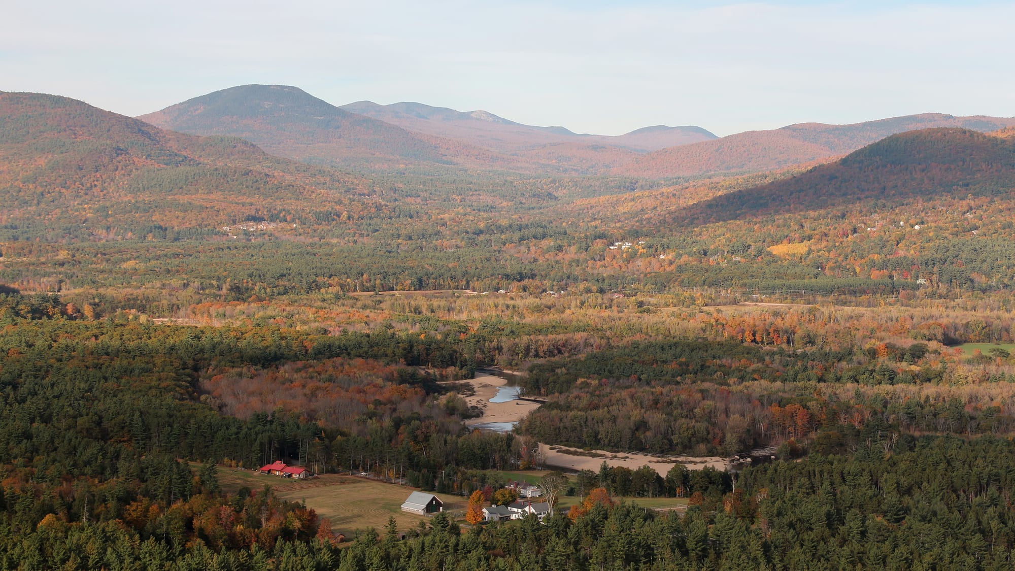
A wide valley of autumn forest in orange and green, with a river and sandbars below rounded mountains under a pale sky

New England, United States

North Conway

The Saco River valley and the surrounding mountains seen from Cathedral Ledge above North Conway in autumn. (Robert Linsdell from St. Andrews, Canada / Wikimedia Commons · CC BY 2.0)

A village in the Saco River valley of New Hampshire's White Mountains, with Mount Washington, the highest peak in the north-east, to the north-west. Landscape painters made it famous in the 19th century, the railway brought tourists, and ski trains followed in the 1930s; today it is the busy centre of the Mount Washington Valley, known for hiking, climbing, a heritage railway and outlet shopping.

Neighbourhoods

  • North Conway Village
    • First-time visitors
    • Historic district
    • Restaurants

    The old village centre on Main Street (Route 16), with shops, restaurants, the Victorian railway station of the Conway Scenic Railroad and the slopes of Cranmore Mountain rising just to the east.

    Open in Maps
  • Route 16 outlet strip
    • Shopping
    • Restaurants

    South of the village, the main road is lined with outlet shopping centres, among them Settlers Green, together with restaurants and places to stay. Traffic here can be slow on holiday weekends.

    Open in Maps
  • West Side Road and Echo Lake
    • Hiking and climbing
    • Quiet
    • Views

    Across the Saco River from the village, a quieter road runs beneath Cathedral Ledge and White Horse Ledge, past Echo Lake and the waterfalls of Diana's Baths, with farms and woods along the valley floor.

    Open in Maps
  • Conway village
    • Local life
    • Gateway to the Kancamagus

    The largest village of the town of Conway, a few miles south, at the eastern end of the Kancamagus Highway and the southern end of the scenic railway's line.

    Open in Maps

Things to do

The village and the valley

  • Conway Scenic Railroadattraction

    A heritage railway based at the historic station in the village centre, running excursions south to Conway and north through Crawford Notch on the former Maine Central mountain line.

    Open in Maps
  • Echo Lake State Park and Cathedral Ledgepark

    A small lake with a one-mile trail around it beneath two rock ledges; Cathedral Ledge, popular with climbers, has a road to its summit and views over the Saco valley.

    Open in Maps
  • Diana's Bathstrail

    A series of small waterfalls in the corner of neighbouring Bartlett, near the village, one of the most popular walks in the area.

    Open in Maps
  • Cranmore Mountain Resortattraction

    The village's own ski area, opened in 1937–38, where the Austrian ski teacher Hannes Schneider ran a ski school from 1939; in summer it operates as a mountain adventure park.

    Open in Maps

Short trips from the town

  • Mount Washingtonviewpoint

    The highest peak in the north-eastern United States at 6,288 feet, notorious for erratic weather; its observatory recorded a gust of 231 mph in 1934, long the world record.

    Open in Maps
  • Mount Washington Auto Roadattraction

    A 7.6-mile private toll road opened in 1861, climbing more than 4,600 feet from Route 16 near Pinkham Notch to near the summit.

    Open in Maps
  • Mount Washington Cog Railwayattraction

    The world's first mountain-climbing cog railway, about 3 miles long, climbing the western slope at an average grade of over 25 per cent to just short of the summit.

    Open in Maps
  • Kancamagus Highwayviewpoint

    The 32-mile road from Conway to Lincoln through the White Mountain National Forest, most of it a National Scenic Byway, known for its autumn colour.

    Open in Maps
  • Pinkham Notchviewpoint

    The mountain pass on Route 16 below the eastern face of Mount Washington, carved by the ice sheet and a base for hikes onto the mountain.

    Open in Maps
  • White Mountain National Forestpark

    The federally managed forest that covers much of the White Mountains around the valley, with trails, campgrounds and scenic roads.

    Open in Maps

Seasonal events

  • Fall Festival and Scarecrow Contestautumn

    An autumn festival with a scarecrow contest at the Settlers Green outlet village.

  • Polar Express trainsDecember

    Holiday trains on the Conway Scenic Railroad that carry families from the village centre to the 'North Pole'.

Eat and drink

Long-standing places and food districts in North Conway. Hours, ratings and directions come from your maps app, always current.

Valley classics

  • Moat Mountain Smoke House & Brewing Co.restaurant

    A brewpub and smokehouse on the White Mountain Highway, suited to children and adults alike.

    Open in Maps
  • Horsefeathersrestaurant

    A sit-down restaurant on the White Mountain Highway, the main road through the village.

    Open in Maps

Food districts

  • North Conway Villageneighborhood

    Cafés, restaurants and bars along Main Street, close to the railway station.

    Open in Maps
  • Route 16 south of the villageneighborhood

    Family restaurants and casual places among the outlet centres on the main road south.

    Open in Maps

Experience North Conway

History

The valley was Abenaki country: early English settlers called the area Pequawket, after an Abenaki village that stretched down the Saco River to a stockaded centre at what is now Fryeburg, Maine. In 1765 the colonial governor Benning Wentworth chartered the town of Conway, named after the British politician and soldier Henry Seymour Conway, and North Conway grew as one of its villages on the river meadows beneath the mountains.

In the 19th century the valley became a magnet for landscape painters. Benjamin Champney, who settled in North Conway in 1853, popularised the Conway valley, and John Frederick Kensett's Mount Washington from the Valley of Conway, distributed as a print to more than 13,000 subscribers, became one of the most effective advertisements for the White Mountains. The paintings, known collectively as White Mountain art, drew tourists, especially after the railway reached North Conway in 1872, and inns and taverns multiplied.

Winter added a second season. From 1932 "snow trains" carried skiers to what became known as the birthplace of American skiing, and the local businessman Harvey Gibson opened Cranmore for the 1937–38 season, adding the Skimobile, a lift of small cars on a wooden track, a year later. In 1939 the Austrian ski teacher Hannes Schneider, briefly imprisoned in Austria for his anti-Nazi views, came to run the ski school, and his family owned Cranmore until 1984. In 1974 Dwight Smith, a Boston and Maine Railroad employee, founded the Conway Scenic Railroad with two local businessmen, and outlet stores later made the village a shopping destination.

Culture & Customs

The valley's identity is outdoor recreation. Cathedral Ledge and White Horse Ledge make it one of the main rock-climbing areas in the north-eastern United States, and the trails of the White Mountain National Forest draw hikers in every season. Winter brings skiers to Cranmore and the nearby resorts of Attitash, Black Mountain and Wildcat, and the village is where they gather in the evenings.

The painters' legacy is part of local pride. White Mountain art was produced by more than four hundred artists in the 19th century to promote the region, and the view that Champney and Kensett made famous — Mount Washington above the meadows of the Saco — still rises over the valley.

North Conway is also a shopping town, and the outlet centres on Route 16 make holiday weekends as busy as the ski slopes. Behind the commerce, the valley keeps the rhythm of a mountain community, where the weather on Mount Washington, the state of the trails and the arrival of the first snow are everyday conversation.

Daily Life

North Conway, counted by the census as a separate place that includes part of neighbouring Kearsarge, had 2,116 residents at the 2020 census. The wider town of Conway, the most populous community in Carroll County, had 9,822 at the same census and an estimated 10,308 in 2025.

Tourism is the town's biggest economic engine, with lodging and rental properties serving visitors to the eastern White Mountains and the Mount Washington Valley; the technology sector is the second-largest source of jobs. Much work is seasonal, following the foliage, ski and summer peaks.

Life runs along Route 16 and the Saco River. Residents shop and work in the village and along the outlet strip, drive the back roads to avoid holiday traffic, and spend free time on the trails, rivers and slopes that bring the visitors. The Saco forms the western edge of the village, and the low ridge on the east side of Route 16 frames the valley.

Food

The food is that of northern New England: hearty breakfasts with maple syrup, chowder and seafood brought inland from the coast, and apple cider and cider doughnuts in autumn. After a day of hiking or skiing, the valley's restaurants lean towards generous, informal meals — burgers, barbecue, pizza and pub food — and many places are geared to families.

Brewpubs are part of the valley's evenings, and a smokehouse and brewery on the White Mountain Highway caters to children as well as adults, in a valley where much of the eating out is built around families and visitors coming back from the trails and the slopes.

Most restaurants sit along Main Street in the village and on Route 16 to the south, among the outlet centres, with a few more along the roads towards the ski areas. In summer and autumn, farm stands along the valley roads sell local produce, maple syrup and baked goods.

Planning tools

Budget

North Conway is one of the more affordable bases in the mountains of New England, with a wide range of motels, inns and rentals, but prices rise sharply on foliage weekends in late September and October, in the winter holidays, and on summer weekends. The Auto Road, the Cog Railway and the scenic railway each charge for tickets, and a car is needed for most trips.

Daily Budget Midrange
USD 240–450 (mid-range room, restaurant dinners with tax and tip, rental car, a scenic train, Auto Road or Cog Railway ticket)
Daily Budget Shoestring
USD 110–180 (motel or campground, diners and takeaway, hiking trails and state parks)

Book foliage weekends well ahead; the hiking trails, Diana's Baths and the Kancamagus Highway cost little or nothing beyond parking fees.

Best Time to Visit

Late September and October bring the autumn colour that fills the Kancamagus Highway with leaf peepers. Summer is best for hiking and for the Auto Road and Cog Railway, when the summit is most often accessible. Winter is ski season at Cranmore and the nearby resorts. Late spring is muddy and quiet.

Suggested Number of Days

Two or three days suit a first visit to the village and the valley. Four or five allow for longer hikes and the wider White Mountains. Mountain weather changes quickly, so a spare day helps.

First Visit
2–3 days
With Surroundings
4–5 days

Transportation

A car is needed to explore the valley and the mountains. Route 16 runs through the village and north to Pinkham Notch and the Auto Road, and the Kancamagus Highway runs west from Conway. Taxis serve the local area. The scenic railway is an excursion rather than transport.

Traffic on Route 16 through the outlet strip can be slow on holiday and foliage weekends, so allow extra time.

Airport & Station Connections

Most visitors drive; Boston is about two hours away by road. Airports with regular flights and car hire are Portland International Jetport in Maine and Manchester–Boston Regional Airport in southern New Hampshire, with Boston's Logan Airport the main gateway for the region.

Walkability

The village centre around Main Street and the station is easy to walk, but the outlet strip, the ledges, the trailheads and the mountains are spread along busy roads and need a car.

Safety

For most visitors the US is safe, with the main risks being petty theft and car break-ins in tourist areas of some cities, road accidents over long distances, extreme weather, and the hazards of the outdoors. Mount Washington's weather is notoriously erratic, with hurricane-force gusts on the summit on about 110 days a year, and conditions on the high trails can turn dangerous quickly. Winter driving, moose on roads at dusk and ticks are the other practical risks.

Check the summit forecast before hiking or driving up Mount Washington, carry warm layers even in summer, and drive slowly at night. Check current official travel advice before travelling.

Climate

The valley has four distinct seasons, with warm summers and cold, snowy winters. Mount Washington, above it, has an alpine climate with extreme winds and very heavy precipitation, much of it falling as snow.

Summer
warm in the valley; on the summit of Mount Washington the record high is only 72°F, and readings of 60°F or more come on about 13 days a year
Winter
cold and snowy in the valley; on the summit of Mount Washington, temperatures rise above 32°F on only about 15 days from December to March, and snowfall there averages around 280 inches a season

Local Customs

Tipping of roughly 18–22 per cent is expected in restaurants, as elsewhere in the United States. Dress is casual and outdoor-minded. Hikers are expected to stay on trails, carry out their litter and be prepared for the mountains' weather.

Respect closures on mountain roads and trails. Identification is asked for when buying alcohol (the legal age is 21).

Common Payment Methods

The currency is the US dollar. Cards and contactless payment are accepted almost everywhere, including the outlets and attractions. A little cash is useful for parking, tips and farm stands.