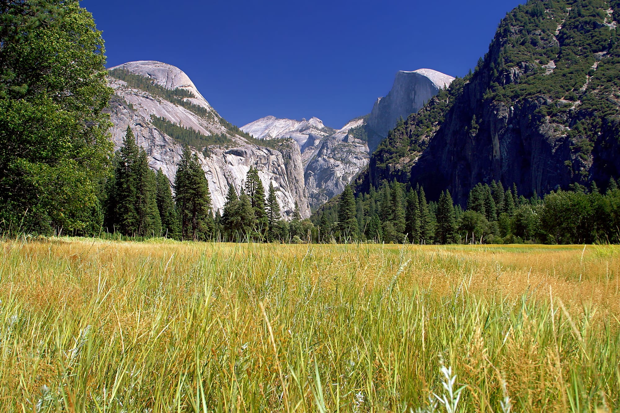
A golden grass meadow on the floor of Yosemite Valley, with pine forest, granite cliffs and the sheer face of Half Dome behind

California, United States

Yosemite Valley

A meadow on the floor of Yosemite Valley, with Half Dome rising at the eastern end of the valley. (Jon Sullivan / Wikimedia Commons · Public domain)

The small settlement on the floor of Yosemite Valley, the glacial canyon at the heart of Yosemite National Park in California's Sierra Nevada. Home of the Ahwahneechee before 1851 and protected since 1864, it holds the park's headquarters and main visitor centre below El Capitan, Half Dome and Yosemite Falls, and fills with visitors every summer.

Neighbourhoods

  • Yosemite Village
    • First-time visitors
    • Visitor services
    • Close to the shuttle

    The main developed area on the north side of the valley floor, with the park headquarters and main visitor centre, a post office, a medical clinic, a store, restaurants and gift shops.

    Open in Maps
  • The eastern valley
    • Hiking
    • Camping
    • Views of Half Dome

    The upper end of the valley below Half Dome and Glacier Point, with campgrounds, tent cabins and the trailheads for the Mist Trail and Mirror Lake.

    Open in Maps
  • The western valley
    • Viewpoints
    • Climbing
    • Quieter meadows

    The lower valley around El Capitan, Cathedral Rocks and Bridalveil Fall, where most visitors enter through the Tunnel View and the Merced River flows out of the valley.

    Open in Maps

Things to do

Granite walls and domes

  • El Capitanlandmark

    A granite monolith on the north side of the valley, about 3,000 feet from base to summit along its tallest face, and one of the world's most famous big-wall climbing sites.

    Open in Maps
  • Half Domelandmark

    The rock at the eastern end of the valley with one sheer face and three smooth, rounded sides, rising to over 8,800 feet above sea level.

    Open in Maps
  • Tunnel Viewviewpoint

    The viewpoint at the western entrance that gives many visitors their first sight of the valley, with El Capitan, Bridalveil Fall and Half Dome in one view.

    Open in Maps

Waterfalls and valley walks

  • Yosemite Fallslandmark

    The highest waterfall in the park, dropping 2,425 feet from the top of the upper fall to the base of the lower one, at its fullest in late spring.

    Open in Maps
  • Bridalveil Falllandmark

    A waterfall of about 620 feet beside Cathedral Rocks near the western end of the valley.

    Open in Maps
  • Mist Trail and Vernal Falltrail

    A steep trail up the Merced River's canyon past Vernal Fall, about 317 feet high, towards Nevada Fall.

    Open in Maps
  • Mirror Laketrail

    A small lake on Tenaya Creek below Half Dome, reached on a short walk from the eastern end of the valley.

    Open in Maps

Above the valley

  • Glacier Pointviewpoint

    A viewpoint on the south rim, about 3,200 feet above Curry Village on the valley floor, looking across to Half Dome, reached by road or by the steep Four Mile Trail.

    Open in Maps
  • Tuolumne Meadowspark

    High subalpine meadows on the Tioga Road, open by road only when the pass is free of snow, usually from late spring or early summer to autumn.

    Open in Maps
  • Mariposa Grovepark

    The grove of giant sequoias near the park's southern entrance, protected together with the valley in the Yosemite Grant of 1864.

    Open in Maps

Eat and drink

Long-standing places and food districts in Yosemite Valley. Hours, ratings and directions come from your maps app, always current.

Eating in the valley

  • Yosemite Villageneighborhood

    The village's restaurants, cafés and store are the main places to eat and buy supplies on the valley floor.

    Open in Maps
  • Picnic areas along the Merced Riverneighborhood

    Picnic areas beside the river, such as those near Swinging Bridge and Sentinel Beach, are a common choice for meals outdoors.

    Open in Maps

Experience Yosemite Valley

History

The valley was home to the Ahwahneechee, a Southern Sierra Miwok people, who called it Ahwahnee. The name Yosemite comes from a Miwok word meaning 'those who kill', which neighbouring peoples used for the valley's inhabitants. The California Gold Rush brought miners into conflict with the Native peoples of the Sierra, and in March 1851 the state's Mariposa Battalion entered the valley in pursuit of the Ahwahneechee; Chief Tenaya and his people were captured and marched to a reservation, and the survivors were later absorbed by the Mono Lake Paiute.

Visitors followed within a few years. On 30 June 1864 President Abraham Lincoln signed the Yosemite Grant, giving the valley and the Mariposa Grove to California for public use — the first time the US government had set land aside for preservation and public use. John Muir's writing and campaigning led to the creation of Yosemite National Park around the valley on 1 October 1890, and after he camped with Theodore Roosevelt near Glacier Point in 1903 the valley was returned to federal control. The Curry Company began providing camps in 1899, and for decades visitors watched the Firefall, burning embers pushed off Glacier Point at night, until the National Park Service ended such attractions.

Southern Sierra Miwok families lived in the valley until they were evicted in the 1960s. Yosemite became a World Heritage Site in 1984, and in 1996 a rock slide of 60,000–80,000 tons crashed from Glacier Point into the valley. Park visits reached a record five million in 2016, and an entry reservation system was introduced in 2020. In 2025 laid-off park workers hung a giant upside-down American flag on El Capitan as a protest against federal job cuts.

Culture & Customs

Yosemite Valley has shaped how Americans think about wild land. The Yosemite Grant of 1864 set a precedent for Yellowstone, the first national park, in 1872, and John Muir, who argued that glaciers had carved the valley and campaigned for its protection, remains its best-known figure. The Yosemite Museum in the village tells the story of the valley's Native people, whose descendants keep their connection to the land.

The valley is also one of the great centres of rock climbing. El Capitan's walls, about 3,000 feet high, are world-famous for big-wall climbing — aid climbing, free climbing and, more recently, free soloing — on many named routes.

Life in the valley follows the seasons. Spring brings the waterfalls to full force and the first crowds; summer is busy with families, campers and hikers; autumn is quieter; and in winter snow on the cliffs transforms the valley. Visitors share the valley floor with mule deer and, unseen at night, black bears, and the park's rules on food storage and wildlife are taken seriously by rangers and residents alike.

Daily Life

The settlement of Yosemite Valley had 337 residents at the 2020 census. Its permanent population is made up mainly of National Park Service staff and workers employed by the companies that run the park's lodging, restaurants and shops under contract. The village has a fire station, a post office, a medical clinic, a convenience store, restaurants, gift shops and a school for children from kindergarten to eighth grade.

For residents the year is defined by visitor numbers. The park received over four million visitors in 2024, and most spend the greater part of their time in the valley, which makes up only about one per cent of the park's area. Summer days bring traffic jams and full car parks, and the Merced River plan of 2014 set a limit of about 20,100 visitors a day in the valley, a figure some have criticised for favouring visitors over the river.

The village's architecture is in a shed style that makes extensive use of native wood; its earliest 20th-century buildings were designed by National Park Service architects including Charles Punchard Jr. In winter, when snow closes the high roads and the crowds thin, the valley becomes a small mountain community again.

Food

Food in Yosemite Valley is simple and practical. The village has restaurants, a convenience store and gift shops, and campers cook their own meals at campgrounds and picnic areas along the Merced River. Many visitors bring supplies from the towns outside the park.

Food storage is part of every meal here: because black bears are active throughout the valley at night, food must be kept in the storage lockers the park provides or in approved containers, never left in cars or tents. Picnicking by the river and in the meadows, with views of the cliffs and falls, is one of the simple pleasures of a visit.

The valley's long tradition of hospitality dates back to the camps of the late 19th century. The Curry Company, founded in 1899 by David and Jennie Curry, offered tents and meals to early visitors; today the valley's lodging is run by concessionaires under contract to the National Park Service.

Planning tools

Budget

Staying in the valley itself is expensive and in short supply, and rooms, tent cabins and campsites are booked months ahead for summer. Many visitors stay in the gateway towns outside the park and drive or take a bus in. The park charges an entrance fee.

Daily Budget Midrange
USD 250–480 (a tent cabin or room in the valley or a gateway town, park restaurants, fuel and the entrance fee)
Daily Budget Shoestring
USD 90–160 (campsite, supermarket food and picnics, park entrance and the YARTS bus)

Reserve valley accommodation and campsites as early as possible; the trails, viewpoints and valley walks cost nothing beyond the entrance fee.

Best Time to Visit

Late spring, when the snowmelt is at its peak, is the best time for the waterfalls. Summer is warm and very busy, and the Tioga Road over the high country opens when it is free of snow. Autumn is quieter, though many falls shrink or dry up. Winter brings snow to the cliffs and far fewer visitors, and snow chains may be required on the roads into the valley.

Suggested Number of Days

Two or three days suit a first visit to the valley and its trails. Four or five allow time for the rest of the national park as well. Longer hikes, road closures in winter and summer traffic all change how much time is needed.

First Visit
2–3 days
With Surroundings
4–5 days

Transportation

A shuttle bus loops around the valley, stopping at the village, trailheads, campgrounds and viewpoints, and a bicycle path runs across the valley floor. Summer traffic and parking are difficult, and visitors are encouraged to use the YARTS regional buses rather than drive in.

Park once and use the shuttle, bicycles or walking paths to move around the valley floor.

Airport & Station Connections

There is no airport or railway in the valley. Three roads lead into the park from the west and south — State Route 140 from Merced and Mariposa up the Merced River canyon, State Route 41 from Fresno, and State Route 120 — and Route 120 over Tioga Pass from the east opens only when free of snow, usually from about the end of May to the end of October. The nearest airports are Fresno Yosemite International and Merced. Amtrak connects with buses to the park from its station in Merced, and YARTS buses run from the gateway towns. An entry reservation system was introduced in 2020 and has been lifted and reimposed several times since, so current rules need checking before any visit.

Walkability

The valley floor is flat and easy to explore on foot or by bicycle, with paved paths and short loops such as the walks to Lower Yosemite Fall, Cook's Meadow and Mirror Lake. The trails up the valley walls are steep and long, and the Mist Trail is wet and slippery near the falls.

Safety

For most visitors the US is safe, with the main risks being petty theft and car break-ins in tourist areas of some cities, road accidents over long distances, extreme weather, and the hazards of the outdoors. In the valley the dangers are natural: rockfall from the cliffs — a huge slide fell from Glacier Point in 1996 — swift, cold rivers in spring, slippery rock near the waterfalls, and black bears, which are active at night.

Stay out of rivers and off wet rock near falls, store all food as the park requires, carry water on long climbs, and check park alerts and road conditions before setting out. Check current official travel advice before travelling.

Climate

The valley floor, at about 3,966 feet, has warm, dry summers and cold, wet winters, with most precipitation in winter; mean daily highs range from about 46°F to 90°F through the year. Spring and autumn are changeable, and summer can bring afternoon thunderstorms.

Summer
warm and dry, with park-wide temperatures from about 50°F at night to the low 90s °F by day and occasional thunderstorms
Winter
snowy, rainy or sunny spells, with park-wide highs of about 30–60°F and lows in the high 20s °F

Local Customs

The valley is part of a national park and a World Heritage Site, and visitors are expected to stay on trails, leave plants, rocks and wildlife undisturbed, and never feed animals. Food must be stored as the park requires because of bears. Tipping in restaurants follows the usual American practice of roughly 18–22 per cent.

Identification is asked for when buying alcohol (the legal age is 21). Keep a safe distance from bears and deer, and never leave food in a car.

Common Payment Methods

The currency is the US dollar. Cards are widely accepted at the village's restaurants and store, and a little cash is useful as a back-up in a remote place.