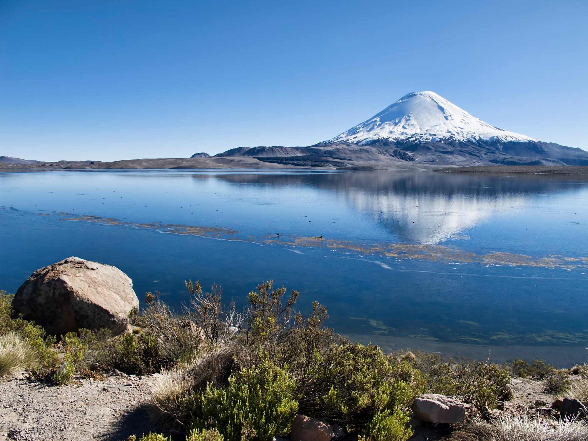
Snow-capped Parinacota volcano reflected in the still blue water of Lake Chungará, with rocks and shrubs in front

Chile

Arica, Iquique & the Far North

Parinacota volcano above Lake Chungará in Lauca National Park, high on the altiplano east of Arica. (Dan Lundberg / Wikimedia Commons · CC BY-SA 2.0)

Chile's northernmost strip, from the Peruvian border south through Arica and Tarapacá — a coastal desert of port cities and dry valleys rising to an Andean altiplano of volcanoes, lakes and Aymara villages, with the world's oldest artificial mummies and the ruins of the nitrate boom that made Chile rich.

Explore Arica, Iquique & the Far North

History

The Chinchorro people fished and gathered along this coast from about 7000 BC, and by around 5000 BC they were deliberately mummifying their dead, children included — the oldest known artificial mummification in the world, some two thousand years before Egypt's. Their sites in and around Arica were inscribed as a UNESCO World Heritage Site in 2021. Later cultures left geoglyphs on the desert hillsides, among them the Giant of Atacama at Cerro Unita and the many figures at Pintados, and the valleys and highlands came under Tiwanaku influence and then, in the 15th century, the Inca Empire.

Under Spain and, after independence, under Peru, Arica was the port for the silver of Potosí and the Bolivian highlands. Everything changed with nitrate, mined in the Tarapacá desert from the mid-19th century by British, Chilean and Peruvian companies. Disputes over the nitrate fields led to the War of the Pacific (1879–83): the naval Battle of Iquique in May 1879, where Captain Arturo Prat died boarding the Peruvian ironclad Huáscar, made him Chile's great naval hero, and Chilean troops stormed the Morro de Arica in June 1880. Chile kept Tarapacá, and the 1929 Treaty of Lima settled that Arica stayed Chilean while Tacna returned to Peru.

Nitrate made Iquique a boom town until synthetic fertiliser collapsed the trade after the First World War; in 1907 troops killed striking nitrate workers and their families at the Santa María school in Iquique. After the 1973 coup the military used Pisagua, north of Iquique, as a prison camp. Today the region lives from copper, the port and its free zone, and has been a main entry point for migrants arriving overland from Bolivia and Peru.

Culture & Customs

The far north is Chile's most Andean corner. Aymara communities live in the altiplano and the precordillera valleys, and many more have moved to Arica, Iquique and Alto Hospicio while keeping ties to their villages, with their fields, llama herds and patron-saint days. Quechua communities are also present. Whitewashed adobe churches with separate bell towers, such as those of Parinacota and Socoroma, anchor the village calendar.

The great event is the festival of La Tirana each July, when pilgrims fill a small desert village for the Virgen del Carmen and costumed dance troupes perform for days. Arica holds its own Carnaval Andino, Inti Ch'amampi, in January or February, with thousands of dancers from Andean dance groups. Andean music and dance belong here more than the central Chilean cueca.

The port cities have their own identity: Iquique has long had Chinese and Croatian communities from the nitrate era, and both cities are proud of their role in the War of the Pacific, with 21 May, the anniversary of the Battle of Iquique, a national holiday. People from the north often feel far from Santiago, and complaints of centralism are a common theme.

Daily Life

About 250,000 people live in Arica, near the Peruvian border, and Iquique has around 200,000, with Alto Hospicio, a fast-growing city of more than 100,000, on the plateau above it. Away from the coast the population thins to oasis towns such as Pica and Pozo Almonte and small Aymara villages, many of them half-empty outside festival times.

Copper dominates Tarapacá's economy, with large mines such as Collahuasi high in the Andes, and Iquique's free zone, ZOFRI, draws shoppers and traders from across Chile, Bolivia and Peru. Fishing and fishmeal, the port, trade with Bolivia through Arica, and farming in the Azapa and Lluta valleys — olives, tomatoes and vegetables grown year-round — make up much of the rest.

Life runs outdoors on the coast, with surfing, bodyboarding and evening walks along the seafront. Current issues are rising crime, water scarcity, the cost of housing, and the pressure of irregular migration across the altiplano border at Colchane, which has at times strained services in the northern towns.

Food

The coast eats fish and shellfish: ceviche, chupe de mariscos (a creamy seafood bake), fried fish from the market stalls and seafood empanadas. Arica's Azapa valley produces the purple aceituna de Azapa, a local olive, and Pica's oasis is famous for its small, unusually acidic limes, the limón de Pica.

Andean influence runs through the highland dishes: picante, a spicy stew of meat, potatoes and chilli, calapurca, a hearty soup cooked with heated stones, quinoa, and llama meat. The Chinese heritage of the nitrate ports shows in the many chifa restaurants, serving Chinese-Peruvian dishes, in Iquique and Arica.

Iquique's signature sweet is the chumbeque, a layered, turrón-like sweet with fruit fillings. Mote con huesillo is drunk on hot days, as in the rest of Chile, and Codpa's small valley vineyards make a traditional wine called pintatani.

Attractions & Natural Wonders

Arica, the northernmost city, is the base for the region's deep past. The Museo Arqueológico San Miguel de Azapa, run by the University of Tarapacá in the Azapa valley, displays Chinchorro mummies. The Morro de Arica headland rises above the port with its war museum, and the city's iron Cathedral of San Marcos, often linked to Gustave Eiffel's firm, and its beaches such as El Laucho and La Lisera fill the rest of a stay.

Route 11 climbs east through the Lluta valley to Putre, an Aymara town at about 3,500 metres used for acclimatising. Beyond lies Lauca National Park, where Lake Chungará, at about 4,500 metres, reflects the snowy cones of Parinacota and Pomerape, the Payachata twins on the Bolivian border. Vicuñas, vizcachas and flamingos are common, and the village of Parinacota keeps a whitewashed colonial church. Further south, the Las Vicuñas reserve and the Salar de Surire extend the altiplano.

Iquique is the beach city: Cavancha and Playa Brava along the seafront, the Cerro Dragón dune above town, and the wooden houses of Calle Baquedano from the nitrate era. Inland on the Pampa del Tamarugal stand the Humberstone and Santa Laura saltpetre works, ghost towns that are a UNESCO World Heritage Site, with the Pintados geoglyphs, La Tirana, the oasis town of Pica with its hot pools, and the Giant of Atacama further out.

Cities in Arica, Iquique & the Far North

Planning basics

Budget

The far north is one of Chile's cheaper areas for day-to-day costs, with inexpensive set lunches, markets and hostels in Arica and Iquique, and duty-free shopping in Iquique's free zone. Costs rise once the altiplano is involved: public transport to Lauca is sparse, so most visitors pay for a tour or hire a car, ideally a high-clearance one.

Daily Budget Midrange
USD 95–180 (seafront hotel, restaurant dinners, a guided altiplano tour or hire car)
Daily Budget Shoestring
USD 40–70 (hostel, market lunches, city buses and long-distance coaches)

Spend a night in Putre before going higher to Lake Chungará; the gradual climb makes altitude sickness far less likely.

Safety

The main hazards are natural: altitude sickness on the altiplano, intense sun, cold nights and the earthquake and tsunami risk that all of northern Chile shares. Petty theft and crime have risen in Arica, Iquique and Alto Hospicio, and parts of the Bolivian and Peruvian borders were mined between 1975 and 1990, with clearance under way since 2002.

Stay on marked roads near the borders, climb slowly to the altiplano, and learn the tsunami evacuation routes in the coastal cities. Check current official travel advice before travelling.

Climate

The coast is one of the driest inhabited places on Earth, yet mild all year thanks to the cold Humboldt Current, with morning cloud called camanchaca and almost no rain. The altiplano above 3,500 metres is another world: strong sun by day, frost at night all year, and the "altiplanic winter" storms of roughly December to March that can cut roads and flood valleys.

Summer
coast warm and sunny, about 20–28°C; afternoon storms and occasional road closures on the altiplano
Winter
coast mild and often overcast, about 14–20°C; altiplano dry and clear, well below freezing at night

Transportation

Arica and Iquique both have airports with flights of roughly two and a half hours from Santiago, and coaches link them along Route 5 in about four hours. Route 11 climbs from Arica through the Lluta valley to Putre and on to Lake Chungará and the Bolivian border, a road heavy with lorries. Arica also borders Tacna in Peru, a short crossing by bus or shared taxi.

A hire car gives freedom on the altiplano, but fuel stations are few; fill up in Arica or Putre and carry water and warm clothes.

Best Time to Visit

The coast works all year, and Arica and Iquique fill with Chilean holiday makers in January and February. For the altiplano, April to November is the drier, clearer season, though nights are bitterly cold in mid-winter. The La Tirana festival in mid-July and Arica's Carnaval Andino in January or February are the big cultural events.