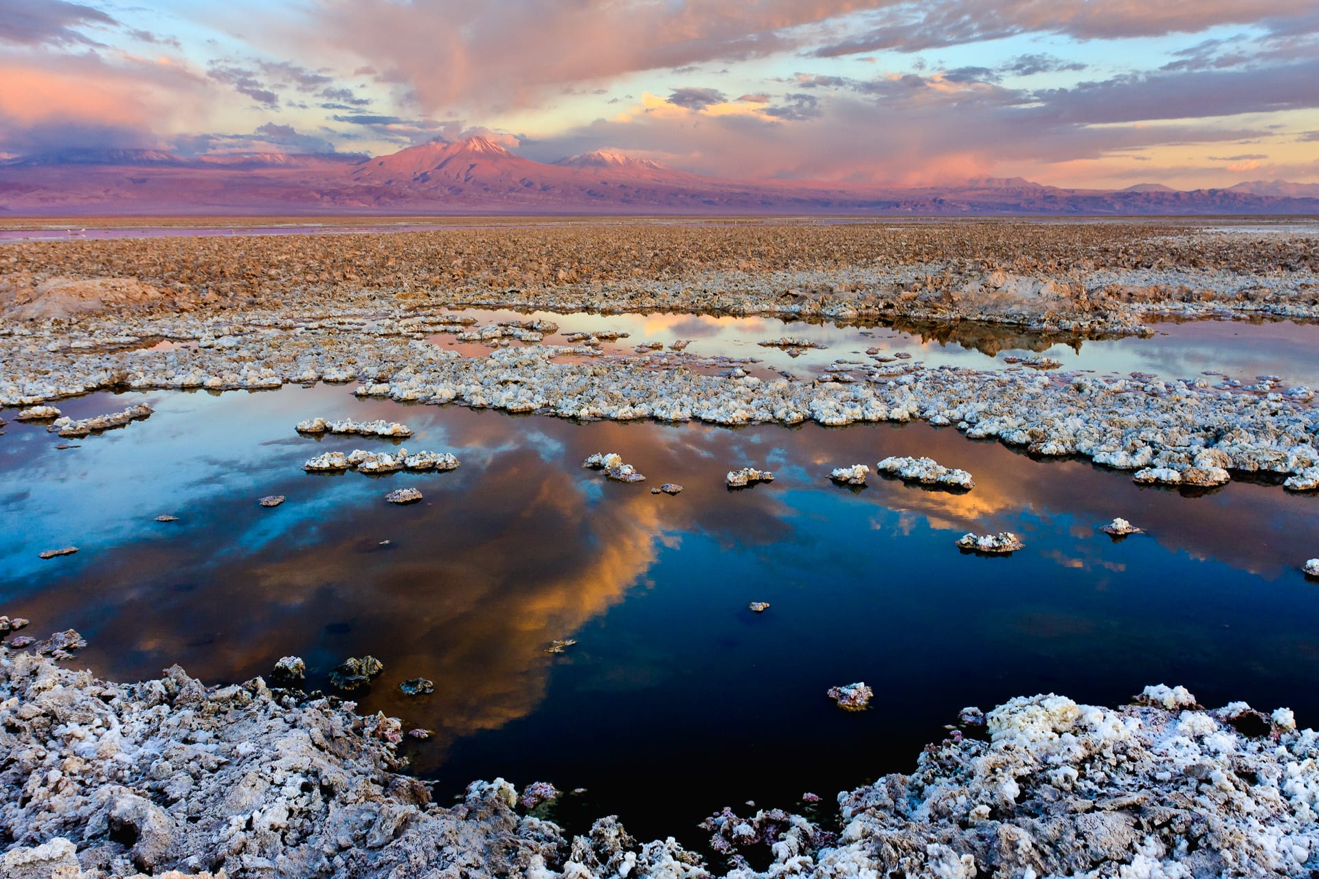
Crusted white salt around dark pools reflecting a pink sunset sky, with volcanoes along the horizon

Chile

San Pedro de Atacama & the North

The Salar de Atacama near Laguna Chaxa, with the Lejía and Miñiques volcanoes on the horizon. (Francesco Mocellin / Wikimedia Commons · CC BY-SA 3.0)

The heart of the Atacama Desert, covering the Antofagasta and Atacama regions of northern Chile — an oasis village beneath volcanoes, salt flats and geysers, the copper and lithium mines that power Chile's economy, world-class observatories, and a Pacific coast of mining ports and pale-sand beaches.

Explore San Pedro de Atacama & the North

History

People have lived around the oases of the Salar de Atacama for more than ten thousand years. The Atacameño, or Lickanantay, built villages such as Tulor, where round mud-walled houses date back some 2,500 years, traded llama caravans across the Andes, and came under Tiwanaku influence and then Inca rule; the stone fortress of Pukará de Quitor above San Pedro was built in the 12th century to defend the oases.

After independence, the coast north of about latitude 24° belonged to Bolivia, while Copiapó and the Atacama Region were Chilean silver country: the strike at Chañarcillo in 1832 made fortunes, and the Caldera–Copiapó railway of 1851 was one of the first in South America. When Bolivia raised taxes on a Chilean nitrate company in Antofagasta, Chile occupied the port in February 1879, starting the War of the Pacific. Bolivia ceded the coast by treaty in 1904, leaving it landlocked, and in 2018 the International Court of Justice ruled that Chile has no obligation to negotiate the sea access Bolivia seeks.

The 20th century belonged to mining. Nitrate towns such as Chacabuco and María Elena rose on the pampa, and the vast copper pit of Chuquicamata near Calama was nationalised in 1971. Chacabuco was used as a detention camp after the 1973 coup, and a military squad known as the Caravan of Death executed prisoners at Calama and Antofagasta that October. In 2010 the rescue of 33 miners trapped for 69 days in the San José mine near Copiapó was followed around the world.

Culture & Customs

The Lickanantay are the indigenous people of the Atacama's oases, and their communities in San Pedro, Toconao, Socaire and the surrounding ayllus — village territories — remain the heart of the oases. Their old language, Kunza, fell out of daily use generations ago, though words survive in place names and ceremonies. The feast of San Pedro, the village's patron saint, is celebrated on 29 June with traditional dances.

Mining shapes the culture of the cities. Antofagasta, Calama and Copiapó are working towns where many people commute to shifts at mines for days at a time, and incomes, rents and prices reflect it. Astronomy is part of local identity too: with some of the clearest skies on Earth, the region hosts major international observatories, and San Pedro has several stargazing operators.

In San Pedro itself the adobe streets, a strong European and Chilean backpacker presence, and rules against building high keep the look of an oasis village, though local groups debate water use and the pace of tourism.

Daily Life

Antofagasta, with about 400,000 people, is the largest city in northern Chile, a long strip of high-rises between the sea and a desert escarpment. Calama, serving Chuquicamata and other copper mines, has around 165,000; Copiapó, the capital of the Atacama Region, about 170,000. San Pedro is a village of a few thousand, and much of the interior is empty.

Copper is the backbone: the Antofagasta Region produces a large share of Chile's output, and the Salar de Atacama is one of the world's main sources of lithium, brine evaporated in vast ponds south of San Pedro. Ports such as Antofagasta, Mejillones and Caldera ship the minerals, and large solar and wind farms now cover parts of the desert.

Daily life follows mining shift patterns, with long rotations away from home. Water is the great argument, pitting mines, lithium producers, farmers and indigenous communities against each other over scarce aquifers. Housing costs, crime in the cities and dependence on commodity prices are other concerns.

Food

In the oases, Atacameño cooking uses what grows in the desert: quinoa, maize, broad beans, llama meat, and the fruit of the chañar and algarrobo trees, boiled into a syrup called arrope. Rica-rica, an aromatic Andean shrub, flavours sours, teas and ice creams, and dishes such as a llama stew or quinoa salads appear on San Pedro's restaurant menus alongside international food for visitors.

Antofagasta's coast eats seafood — ceviche, fried conger eel, machas (surf clams) and locos — and Caldera and Bahía Inglesa are known for ostiones, scallops farmed along this coast. Chinese restaurants are a staple in the mining cities, as across the north.

Further south, the Huasco valley in the Atacama Region grows olives and grapes for pisco, the grape brandy, and its own sweet wines. The everyday Chilean repertoire of empanadas, completos and pastel de choclo fills the rest of the menu.

Attractions & Natural Wonders

San Pedro de Atacama is the base for the desert's best-known sights. Around the village lie the adobe church of San Pedro, Pukará de Quitor, the ancient village of Tulor, and the Valle de la Luna, eroded ridges and dunes best seen at sunset. To the north, the El Tatio geysers at about 4,300 metres are visited at dawn, when the steam columns are tallest, with the hot pools of Puritama on the way back.

South of the village the Salar de Atacama, Chile's largest salt flat, holds the flamingo lagoon of Chaxa and the salt lake of Cejar, where bathers float. Higher up, the Miscanti and Miñiques lagoons sit beneath volcanoes within the Los Flamencos National Reserve. The ALMA radio telescope array on the Chajnantor plateau and the Paranal observatory south of Antofagasta, home of the Very Large Telescope, can be visited on arranged days.

On the coast, Antofagasta has the natural sea arch of La Portada and, south of the city, Mario Irarrázabal's giant hand sculpture, the Mano del Desierto. The nitrate ghost town of Chacabuco lies inland. Further south in the Atacama Region, Bahía Inglesa and Caldera have pale beaches, while Pan de Azúcar National Park protects desert coast. Inland from Copiapó, Nevado Tres Cruces National Park and the Laguna Verde lead to Ojos del Salado, the world's highest volcano.

Cities in San Pedro de Atacama & the North

Planning basics

Budget

San Pedro de Atacama is expensive for Chile: accommodation, restaurants and almost all excursions are priced for foreign visitors, and each tour to the geysers, lagoons or salt flat is a separate cost, as are park entry fees. Antofagasta, Calama and Copiapó are mining cities with high hotel prices on weekdays, while the smaller coastal towns are cheaper outside the summer holidays.

Daily Budget Midrange
USD 130–260 (adobe guesthouse or hotel, restaurant dinners, daily tours or a hire car)
Daily Budget Shoestring
USD 50–85 (hostel dorm in San Pedro, cooking for oneself, one shared tour a day)

Carry cash in San Pedro, where cash machines are few and can run dry; comparing several agencies on the main street keeps tour prices down.

Safety

The desert's real dangers are altitude, dehydration, sunburn and cold at the high sites, and long empty roads where fatigue and speeding lorries cause crashes. Theft happens in San Pedro's hostels, and Antofagasta and Calama have higher crime than the Chilean average. Earthquakes and tsunamis affect the coast.

Carry water and sun protection, avoid driving at night on desert highways, and follow tsunami signs on the coast. Check current official travel advice before travelling.

Climate

The interior is extreme desert: very little rain, intense sun and huge daily swings in temperature, with warm afternoons and nights that drop below freezing in winter. The high sites such as El Tatio and the altiplanic lagoons are much colder, and summer can bring storms and snow to the heights. The coast is mild and dry all year, with morning sea fog.

Summer
San Pedro hot by day, around 25–30°C, cool at night; occasional altiplanic storms close high roads
Winter
clear and dry; San Pedro 20°C by day and below freezing at night, El Tatio far colder at dawn

Transportation

Calama's airport, about 100 kilometres from San Pedro, has frequent flights from Santiago of about two hours; shuttles and buses connect it with the village. Antofagasta and Copiapó also have airports, and coaches run the length of Route 5. Around San Pedro most sights are visited on tours or by hire car, since public transport barely reaches them.

Spend a day or two in San Pedro before visiting El Tatio or the high lagoons, and take warm layers even in summer.

Best Time to Visit

San Pedro works all year. Spring and autumn (roughly September to November and March to May) bring pleasant days and bearable nights; January and February can close high routes after storms, and the Chilean holidays fill the village. In years with unusual rain, the desierto florido — the flowering desert — can carpet the plains of the Atacama Region in spring.