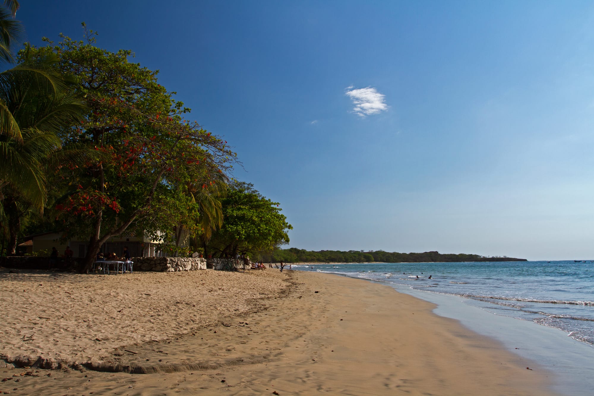
A wide sandy beach curving towards a wooded headland, with red-flowering trees and palms along the shore under a clear blue sky

Costa Rica

Guanacaste & the Nicoya Peninsula

The beach at Tamarindo, on the Pacific coast of Guanacaste. (Jarle Naustvik / Wikimedia Commons · CC BY 2.0)

Costa Rica's dry north-western province, stretching from the volcanoes of the Guanacaste range and the Nicaraguan border across cattle plains and the Tempisque wetlands to the Pacific beaches of the Nicoya Peninsula — a land of sabanero cowboys, marimba music and surf towns, with the country's sunniest coast.

Explore Guanacaste & the Nicoya Peninsula

History

Before the Spanish arrived, the Nicoya Peninsula and the Tempisque basin belonged to the Greater Nicoya cultural area, which also took in the Pacific coast of Nicaragua. Its people are best known for their painted polychrome pottery and carved jade, and at the time of the conquest the Chorotega, a people of Mesoamerican origin, lived here in chiefdoms. The Spanish arrived in the 1520s, and the chief Nicoya gave his name to the peninsula.

In colonial times Nicoya was for long periods governed from Nicaragua, and large cattle haciendas spread across the savannah. After independence the Partido de Nicoya voted to join Costa Rica, and 25 July 1824 is still celebrated as the Annexation of Nicoya, a national holiday. The border with Nicaragua was fixed by the Cañas–Jerez treaty of 1858. The province took its name, Guanacaste, from the broad-crowned tree that is now the national tree.

Guanacaste's great historical moment came in March 1856, when Costa Rican troops defeated the forces of the American filibuster William Walker at Hacienda Santa Rosa. For a century afterwards the province remained a remote cattle frontier, until the Inter-American Highway, the airport at Liberia and the bridge over the Tempisque tied it to the rest of the country. From the 1990s beach tourism, resort building and foreign settlement transformed the coast, while the protected areas around Santa Rosa became one of Costa Rica's World Heritage Sites.

Culture & Customs

Guanacaste sees itself as the home of Costa Rican folklore. The sabanero, the cowboy of the savannah, is its emblem, and the fiestas of Liberia, Santa Cruz and Nicoya still revolve around the tope horse parade and the corrida de toros, a bloodless bull-riding contest in which spectators may also enter the ring. The punto guanacasteco is regarded as the national dance, and the marimba, played by several musicians on one large wooden keyboard, is the sound of every provincial festival.

The Chorotega heritage survives most visibly in Guaitil, near Santa Cruz, where families make pottery with red, black and cream designs derived from pre-Columbian styles, using local clays and polishing stones. Guanacastecos speak with their own accent and vocabulary, and the bomba, a short, often cheeky rhymed verse shouted in the middle of a dance, is a provincial speciality.

Religious festivals mark the calendar in the old towns: Nicoya's church of San Blas, first built around 1544, is one of the colonial landmarks at their centre. The coast has a separate, newer culture of surfers, yoga retreats and foreign residents, and the gap between the beach towns and the inland villages is a real one.

Daily Life

Guanacaste has only a few hundred thousand people. Liberia, the provincial capital, is the largest town and has grown quickly around its airport; Nicoya, Santa Cruz, Cañas and Filadelfia are the other main centres. Beach towns such as Tamarindo, Playas del Coco and Nosara have large foreign populations, and the land between them is scattered ranches and villages.

Cattle, rice, sugar cane and melons are the traditional economy, and the Tempisque plains are irrigated from the Arenal reservoir. Tourism is now a major employer, from resort jobs in Papagayo to surf schools and building work on the peninsula. The province also produces much of the country's electricity from wind farms and the Miravalles geothermal fields. The Nicoya Peninsula is known internationally as one of the world's Blue Zones, where an unusual share of older people live into their nineties and beyond.

Daily life is shaped by heat and water. People rise early to work before midday, and the dry season brings water shortages in some coastal communities, where hotel and housing growth competes with villages for wells. Rising land prices, the cost of living for local families and pressure on the coast are the province's main political questions.

Food

Guanacaste's cooking is built on maize more than anywhere else in Costa Rica, a legacy of its Mesoamerican past. Pozol, a broth of maize kernels and meat, and tamales of many kinds belong to the same tradition. Rosquillas are crunchy rings of corn dough and cheese, and tanelas are sweeter corn pastries; both are eaten with coffee in the afternoon. Chorreadas are sweet corn pancakes served with sour cream, and tortillas are still patted out by hand and cooked on a clay griddle in many villages.

Drinks are corn-based too: chicheme is a purple maize drink, and horchata here is made from ground corn and spices rather than rice. Local cheeses such as queso bagaceño, from Bagaces, go into snacks and pastries, and cattle country means grilled beef at every fiesta.

On the coast the fish is fresh: ceviche of sea bass or snapper, whole fried fish with patacones, fried plantain rounds, and lobster and prawns in the resort towns. Mangoes and marañón, the cashew apple, fill the markets at the end of the dry season.

Attractions & Natural Wonders

The northern coast is Guanacaste's busiest. Tamarindo is the main surf and nightlife town, with Playa Grande and the Las Baulas National Park, a leatherback nesting beach, across the estuary. The Papagayo beaches lie further north, from the fishing town of Playas del Coco and the dive boats of Playa Hermosa to the resorts on the Papagayo Peninsula, while Playa Conchal, made of crushed shells, and Flamingo lie between.

On the Nicoya Peninsula's Pacific coast, Nosara combines surf breaks with protected forest, and just north the Ostional wildlife refuge sees olive ridley turtles come ashore in their thousands during mass nestings known as arribadas. Sámara has a calm bay suited to families. Inland, Barra Honda National Park protects limestone caves, and the old towns of Nicoya and Santa Cruz keep their colonial church and pottery villages.

The north-east is volcano and dry-forest country. Rincón de la Vieja National Park, reached from Liberia, has fumaroles, mud pots, hot springs and waterfalls on the Las Pailas trails. Santa Rosa National Park preserves the hacienda of the 1856 battle, dry forest and remote surf beaches, all part of the Área de Conservación Guanacaste World Heritage Site. Liberia itself has whitewashed colonial houses in its old quarter. To the south, Palo Verde National Park on the lower Tempisque is a wetland of international importance, reached by boat past crocodiles and flocks of waterbirds.

Cities in Guanacaste & the Nicoya Peninsula

Planning basics

Budget

Guanacaste's beaches are among the most expensive places in the country. Tamarindo, Papagayo and Nosara are priced for foreign visitors and residents, with resorts, boutique hotels and restaurants at close to US levels, and prices peak over Christmas and Easter. Liberia, Nicoya, Santa Cruz and the inland towns are much cheaper, and hostels exist in the main surf towns.

Daily Budget Midrange
USD 130–260 (beach hotel, restaurants, a rental car and a surf lesson or park tour)
Daily Budget Shoestring
USD 50–85 (hostel dorm in a surf town, soda meals, local buses)

Sleep and eat in Liberia or Santa Cruz to save money, and eat at sodas a street or two back from the beach.

Safety

Guanacaste is generally calm, but the beach towns share the country's problem of theft: break-ins to rental cars at beaches and trailheads, bags taken from the sand, and burglaries of holiday rentals. Drug-related violence has risen in parts of the province in recent years, mostly among local criminal groups. Rip currents are strong on many open beaches, crocodiles live in river mouths, and the dirt roads are dangerous after dark.

Leave nothing in a parked car, swim only where locals do and avoid river mouths, and do not drive the peninsula's unpaved roads at night. Check current official travel advice before travelling.

Climate

Guanacaste is the driest and hottest part of Costa Rica. The dry season from about December to April is almost rainless, the plains turn brown and the Papagayo winds blow hard from the north-east. The rains of May to November turn everything green, with a drier spell in July and heavy storms in September and October, when some peninsula roads flood.

Summer
dry season (December–April): sunny, dry and hot, 30–35°C by day, with strong winds early in the year
Winter
green season (May–November): humid, around 28–32°C, with afternoon storms that peak in September and October

Transportation

Daniel Oduber Quirós International Airport near Liberia has direct flights from North America and Europe and puts the Papagayo and Tamarindo beaches within about an hour. Buses link Liberia, Nicoya and Santa Cruz with San José, about four to five hours away, and with the main beach towns. The Nicoya Peninsula coast is joined by rough, unpaved roads with river crossings, so a high-clearance car helps.

Rent a four-wheel drive for the peninsula coast, ask locally before fording rivers in the rains, and fill up with fuel in the larger towns.

Best Time to Visit

December to April is the classic beach season, with near-guaranteed sun and the highest prices. May to August is cheaper and green, with good surf on the Pacific swells. September and October are the wettest months, when some lodges close and the dirt roads of the Nicoya Peninsula become difficult. Turtle nesting at Ostional peaks in the rainy months, and the dry season is best for birds at Palo Verde.