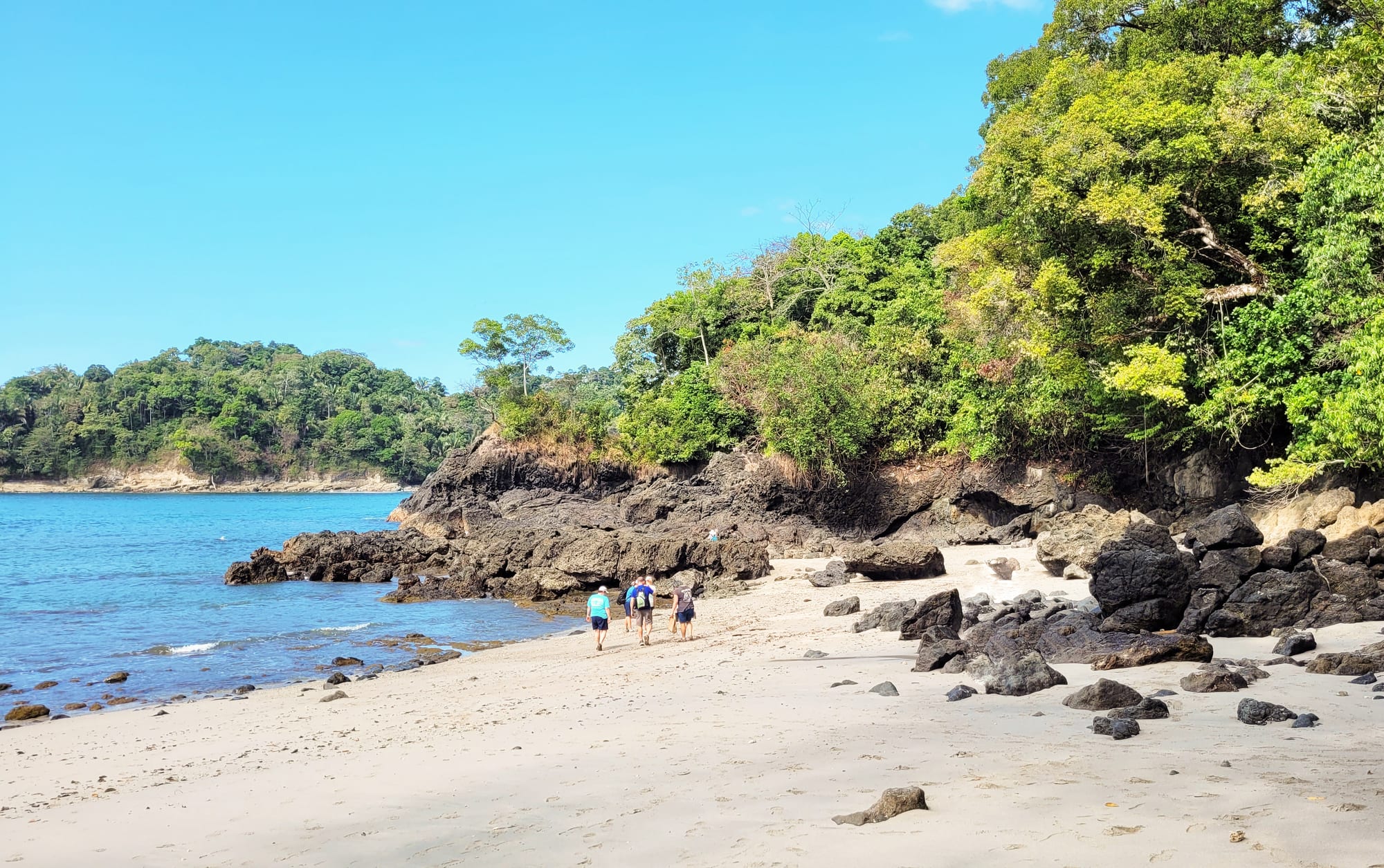
A pale sandy beach backed by dark rocks and dense green forest, with a calm blue bay and a wooded headland beyond

Costa Rica

Manuel Antonio, Monteverde & the Pacific Coast

A forest-backed beach inside Manuel Antonio National Park, near Quepos on the central Pacific coast. (Bernard Gagnon / Wikimedia Commons · CC0)

The long province of Puntarenas, which wraps around the Gulf of Nicoya and runs down Costa Rica's central and southern Pacific coast to Panama — from Monteverde's cloud forest and the port of Puntarenas to Jacó, Manuel Antonio, the whale-watching bay at Uvita and the rainforests of the Osa Peninsula and Corcovado.

Explore Manuel Antonio, Monteverde & the Pacific Coast

History

The southern Pacific was home to the Diquís culture, whose chiefdoms flourished along the Térraba river delta and, from around 600 AD, carved hundreds of nearly perfect stone spheres, some more than two metres across. Settlements with the spheres near Palmar Sur became a UNESCO World Heritage Site in 2014. The Boruca and Térraba peoples still live in the south, and the Ngöbe near the Panamanian border.

Spanish explorers reached the Gulf of Nicoya in the 1520s, and the south remained forest for most of the colonial era. In the 19th century the town of Puntarenas grew as the country's Pacific port, shipping Central Valley coffee to England. In the mid-20th century the United Fruit Company made Golfito the port of a major banana-growing region; the company closed there in 1985, and oil-palm plantations have replaced many of the old banana farms.

The central coast's modern identity came with conservation. Cabo Blanco, at the tip of the Nicoya Peninsula, became the country's first protected reserve in 1963, Manuel Antonio National Park followed in 1972, after the local community sought to stop development, and Corcovado in 1975, when large-scale logging was planned. In 1951 a group of Quakers from Alabama, who opposed the military draft, settled at Monteverde, drawn in part by Costa Rica's abolition of its army; they set aside part of their land as forest, the start of the reserves that followed. Gold miners were evicted from Corcovado in the 1980s.

Culture & Customs

Puntarenas has the character of a provincial port: porteños are known for their easy manner, their seafood and the long seafront Paseo de los Turistas.

The south keeps Indigenous traditions more strongly than most of the country. At Boruca, the Juego de los Diablitos, held around the New Year, is a mock battle in which men in carved balsa-wood devil masks fight a bull representing the Spanish conquerors, and the devils win. The masks are now a well-known craft sold across the country. San Vito, near the Panamanian border, was settled by Italian families in the 1950s and keeps some Italian names and food.

Monteverde has a culture of its own: the Quaker meeting house and Friends school survive, and its community of scientists, guides and artists has made the town a centre of conservation research. Along the coast, surf towns such as Jacó and Uvita have a mixed local and foreign population, and the Osa's villages keep a frontier independence shaped by gold panning, fishing and isolation.

Daily Life

Puntarenas is a long, thinly populated province. Its capital, Puntarenas, sits on a narrow sandspit reaching into the gulf and is the largest city; Quepos, Jacó, Golfito, Ciudad Neily, Puerto Jiménez and Buenos Aires are the other main towns, and the Nicoya Peninsula's southern tip, Monteverde and Isla del Coco are also part of the province.

The economy is a mix of fishing, tuna and sardine canning in Puntarenas, oil palm and pineapple in the south, and a tourism industry that has transformed Jacó, Manuel Antonio, Monteverde and Uvita. The Caldera port handles much of the country's Pacific trade. Away from the tourist centres the province is one of the poorest in Costa Rica, with poverty above the national average.

Life on the coast starts early to beat the heat, with fishing boats in before midday and a slow afternoon. In the Osa, many communities are still reached by gravel roads or boats, and electricity and mobile coverage can be patchy. The coast's growth has brought building booms, rising land prices, and debates over water and development near the national parks.

Food

Coastal cooking is built on fish and seafood. Ceviche, usually of sea bass marinated in lime with onion, coriander and sweet pepper, is sold everywhere, and a whole fried fish with rice, salad and patacones, flattened fried plantain, is the standard beach lunch. Arroz con camarones, rice with prawns, and sopa de mariscos, a seafood soup, are common in Puntarenas and Quepos.

Puntarenas is famous for the churchill, a heaped glass of shaved ice with fruit syrup, condensed milk, powdered milk and a scoop of ice cream, sold along the Paseo de los Turistas. Monteverde is known for its cheese: the Quaker settlers came to farm dairy cattle, and the town's cheese has been sold across the country since the 1960s.

The south adds tropical fruit, fresh palm heart and chocolate from small cacao farms, while the Indigenous communities around Boruca still prepare corn-based dishes and chicha, a fermented maize drink, for festivals.

Attractions & Natural Wonders

Monteverde's cloud forest is the region's inland highlight. The Monteverde Cloud Forest Reserve, the Santa Elena reserve and the Children's Eternal Rain Forest protect mist-draped forest full of mosses, orchids and birds, including the resplendent quetzal; hanging bridges, canopy zip lines and guided night walks are run from the town of Santa Elena.

On the central coast, Puntarenas has its seafront promenade and ferries to the southern Nicoya Peninsula, where Montezuma's waterfalls, the surf village of Santa Teresa and the Cabo Blanco reserve lie. South along the highway, crocodiles gather below the Tárcoles river bridge next to Carara National Park, and Jacó is a busy surf town. Near Quepos, Manuel Antonio National Park has forest trails and white-sand coves, with sloths, capuchins and squirrel monkeys.

The south is wilder. At Uvita, Marino Ballena National Park is known for its whale-tail sandbar and its humpback whales. The Osa Peninsula holds Corcovado National Park, a lowland rainforest with tapirs, scarlet macaws, jaguars and all four Costa Rican monkeys, entered from the ranger stations at Sirena and elsewhere. Drake Bay, on the north coast of the Osa, is reached by boat through the mangroves of the Sierpe river and is the base for Corcovado day trips and diving at Caño Island. Across the Golfo Dulce lie Golfito and Piedras Blancas National Park, and inland the Diquís sphere sites near Palmar Sur, Boruca and the Wilson Botanical Garden near San Vito. Far out in the Pacific, Cocos Island National Park, a World Heritage Site, draws divers for its hammerhead sharks.

Cities in Manuel Antonio, Monteverde & the Pacific Coast

Planning basics

Budget

Costs vary widely along this coast. Manuel Antonio is one of the most expensive destinations in the country, with hillside hotels and restaurants at close to US prices, and Monteverde's reserves, canopy tours and night walks add up. Drake Bay and the Osa lodges are costly because of their remoteness and the guide requirement for Corcovado. Jacó, Quepos town, Puntarenas and Uvita have cheaper hostels and sodas.

Daily Budget Midrange
USD 140–280 (hotel or lodge, restaurants, guided park visits, and boat transfers on the Osa)
Daily Budget Shoestring
USD 50–85 (hostel in Quepos, Monteverde or Uvita, soda meals, public buses)

Stay in Quepos rather than on the Manuel Antonio hill, and budget early for a Corcovado guide and lodge, which often come as a package.

Safety

Theft is the main risk: car break-ins at beach car parks, bags taken on the sand at Manuel Antonio and Jacó, and pickpocketing in Puntarenas and Jacó, where petty crime and drug dealing are more visible than elsewhere on the coast. Puntarenas province has seen rising drug-related violence in recent years, mostly among local gangs. Rip currents are strong at Jacó and on many open beaches, and Corcovado has river crossings, venomous snakes and crocodiles.

Keep valuables out of sight, swim only at patrolled or sheltered beaches, never feed the monkeys, and hike Corcovado with a licensed guide as the park requires. Check current official travel advice before travelling.

Climate

The central Pacific has a clear dry season from about December to April and heavy rains from May to November. The south is wetter: the Osa Peninsula receives some of the highest rainfall in the country and is humid all year, with October the most difficult month. Monteverde, at around 1,400 metres, is a different climate altogether: cool, windy and misty, with drizzle blown across the ridge even in the dry season.

Summer
dry season (December–April): hot on the coast, around 30–33°C; 16–22°C and breezy at Monteverde
Winter
green season (May–November): heavy afternoon and night rain on the coast, very wet on the Osa in September–October; mist and rain at Monteverde

Transportation

The Costanera highway runs down the coast from Caldera through Jacó, Quepos and Uvita towards the Panamanian border, and buses from San José serve all of them; Jacó is about two hours from the capital and Manuel Antonio about three. Monteverde is reached by a winding road from the Inter-American Highway. Ferries cross the Gulf of Nicoya from Puntarenas to the southern Nicoya Peninsula. Drake Bay is reached by boat from Sierpe or small plane, and Puerto Jiménez by road or air.

Take the boat to Drake Bay early in the day, when the sea is calmer, and pack light for wet landings on the beach.

Best Time to Visit

December to April is the best time for Corcovado's trails, the Osa boat crossings and Manuel Antonio's beaches, and the busiest. Humpback whales arrive in the Uvita area from both hemispheres, roughly from July to October and from December to March. Monteverde can be visited all year, though the clearest views come in the dry season. Some Osa lodges close in October.