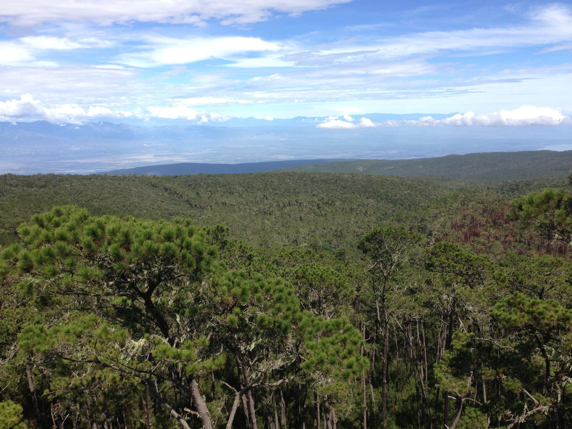
Pine forest covering rolling mountain slopes, with a wide hazy lowland and distant ranges under a blue sky

Dominican Republic

Barahona & the Southwest

Pine forest around Loma El Codo in Sierra de Bahoruco National Park, seen from a lookout tower. (Marcos Rodríguez Bobadilla / Wikimedia Commons · CC BY-SA 4.0)

The country's dry, mountainous south-west along the Haitian border, from the farming valley of San Juan de la Maguana to the salt lake of Enriquillo and the cliff-edged coast of Barahona and Pedernales — the least developed and most varied region, with cloud forest, desert scrub and deserted beaches within a few hours of each other.

Explore Barahona & the Southwest

History

At the time of the conquest the south-west belonged to two Taíno chiefdoms: Maguana, around the San Juan valley, ruled by Caonabo, and Jaragua to the west, whose ruler Anacaona was hanged by the Spanish after the massacre of her chiefs in 1503. San Juan de la Maguana was founded soon after. In 1519 the cacique Enriquillo rebelled and held out in the Bahoruco mountains for some fourteen years until the Spanish crown agreed a peace treaty with him, a rare outcome; the great salt lake now bears his name.

Through the colonial period the region was cattle land on the edge of Spanish and French Hispaniola, and the border between them moved several times. Barahona was founded as a town in 1802, during Toussaint Louverture's control of the whole island. After independence the south-west saw repeated fighting in the Haitian wars of the 1840s and 1850s, and the frontier was only fixed by treaties in 1929 and 1936.

In the early 20th century Olivorio Mateo, known as Papá Liborio, led a religious peasant movement in the San Juan valley until he was shot dead in 1922, during the US occupation; his followers remain. After the 1937 massacre of Haitians in the north-west, Trujillo's government imposed a strict border policy here too. In 1962 security forces attacked a Liborista community at Palma Sola, killing many. In 2004 flash floods destroyed much of Jimaní, and in recent years the government has been building a wall along parts of the border.

Culture & Customs

The south-west is the most rural and religiously diverse part of the country. Catholic practice mixes with Afro-Dominican saint worship and the Liborista tradition in the San Juan valley, and pilgrims visit sites linked to Papá Liborio. Salves, sung prayers with drums, and palos, drumming for the saints, are performed at village fiestas.

Relations with Haiti are closer and more tangled here than anywhere else in the country. Families, trade and labour cross the border, Haitian Creole is heard in the markets of Jimaní, Pedernales and Comendador, and the binational markets on the frontier bring the two countries together. At the same time, migration controls, deportations and disputes over land and water have made the border a sensitive political issue.

The region's craft is larimar, a sky-blue stone found in the Bahoruco mountains near Barahona and nowhere else in the world, cut into jewellery. San Juan de la Maguana keeps a patron saint's festival on 24 June, and Barahona's coast has fishing-village traditions.

Daily Life

San Juan de la Maguana, with around 143,000 people in its municipality, is the largest town and the market for the fertile San Juan valley. Barahona is the port and commercial centre of the south coast, and Neiba, Jimaní, Pedernales and Comendador are small provincial capitals.

This is one of the poorest parts of the country, with high rates of emigration to Santo Domingo and abroad. San Juan's irrigated valley grows beans, rice and vegetables for the national market, Neiba is known for its grapes, and the Bahoruco slopes around Polo grow coffee. Barahona has a sugar mill and a port, and larimar and gypsum are mined. Pedernales depends on fishing and cross-border trade, and the state is developing a large tourism zone around Cabo Rojo.

Life is slow and early: markets start at dawn, work stops in the midday heat, and evenings bring people into the parks and colmados. Water, electricity and poor roads are constant problems, and in the border towns much of the economy runs on the binational market days.

Food

The San Juan valley's signature is chenchén, maize cooked with milk to a creamy texture and served with beans and chivo guisado, goat stewed with herbs. Goats graze the dry scrub across the region, and roast and stewed goat is the festive meat.

The coast eats fish, lobster and conch landed at Barahona, Pedernales and La Cueva, fried or stewed, with tostones. Barahona is known for its coffee, grown on the Bahoruco slopes, and Neiba's grapes and wine are sold along the roadside. Beans from San Juan fill the country's pots of habichuelas.

Casabe, a flat cassava bread with Taíno roots, is still made in the border areas, and dulce de leche and coconut sweets are sold in the towns. As elsewhere, Presidente beer and rum are the drinks, and strong coffee starts the day.

Attractions & Natural Wonders

South of Barahona, the wild coast road runs between the Sierra de Bahoruco and the sea past pebble beaches and river mouths at San Rafael, Los Patos and Paraíso, with the Polo Magnético, a slope where cars appear to roll uphill, in the hills above. Larimar mines lie inland near Barahona.

Further west, Jaragua National Park covers the arid southern tip: the Laguna de Oviedo with its flamingos, Beata Island, turtle beaches and Bahía de las Águilas, an undeveloped white-sand bay reached by boat from La Cueva near Cabo Rojo. The Sierra de Bahoruco National Park rises behind, and the area forms part of the Jaragua-Bahoruco-Enriquillo UNESCO Biosphere Reserve.

Inland, Lake Enriquillo sits in a basin around 46 metres below sea level, the lowest point of any island country. Its salty water holds American crocodiles and Isla Cabritos, while rhinoceros iguanas wander the shore; the ancient petroglyphs of Las Caritas and the town of La Descubierta lie on the northern side. North again, San Juan de la Maguana's valley holds the Corral de los Indios, and Comendador in Elías Piña sits on the border.

Cities in Barahona & the Southwest

Planning basics

Budget

The cheapest region for travellers. Barahona, Paraíso and Pedernales have simple hotels and guesthouses at local prices, a handful of eco-lodges charge more, and San Juan de la Maguana and the border towns cater to Dominican travellers. The main costs are transport over long distances, boat trips to Bahía de las Águilas and park guides.

Daily Budget Midrange
USD 85–170 (eco-lodge or better hotel, restaurants, a hire car or driver, boat and park fees)
Daily Budget Shoestring
USD 35–60 (simple hotel, comedor meals, guaguas)

Carry enough cash in pesos: ATMs are few outside Barahona, San Juan and Pedernales.

Safety

Crime is lower than in the big cities, but the region is remote, with long stretches without phone signal, fuel or medical care. The border area has a heavy military presence, checkpoints and smuggling, and the situation across the frontier in Haiti, where armed gangs control large areas, is volatile; crossings can close without notice. Heat, flash floods and hurricanes are the main natural risks.

Carry identification for checkpoints, travel by day with water and fuel, and do not cross into Haiti without checking the latest official advice. Check current official travel advice before travelling.

Climate

One of the driest regions in the country. The Enriquillo basin and the Pedernales coast are semi-arid, with cactus scrub and very high temperatures, while the Sierra de Bahoruco and Sierra de Neiba catch enough moisture for pine and cloud forest, cool at altitude. The Barahona coast is hot, with storms in the wet season.

Summer
very hot, 33–38°C in the Enriquillo basin; cooler in the Bahoruco highlands
Winter
warm and dry, 28–31°C by day, with cool nights in the mountains

Transportation

There are no regular commercial flights; most visitors drive from Santo Domingo. Coaches and guaguas reach Barahona, San Juan de la Maguana, Jimaní and Pedernales. Distances are long and services thin, so a hire car or a driver gives most freedom, and a four-wheel drive helps on park tracks and mountain roads.

Distances between Barahona, Jimaní and Pedernales are long; fill up with fuel whenever possible.

Best Time to Visit

November to April, when the heat around Lake Enriquillo is bearable and the coast is dry; early morning is the time to see crocodiles and flamingos. Summer is extremely hot inland. Hurricane season, peaking from August to October, can wash out coastal and mountain roads.