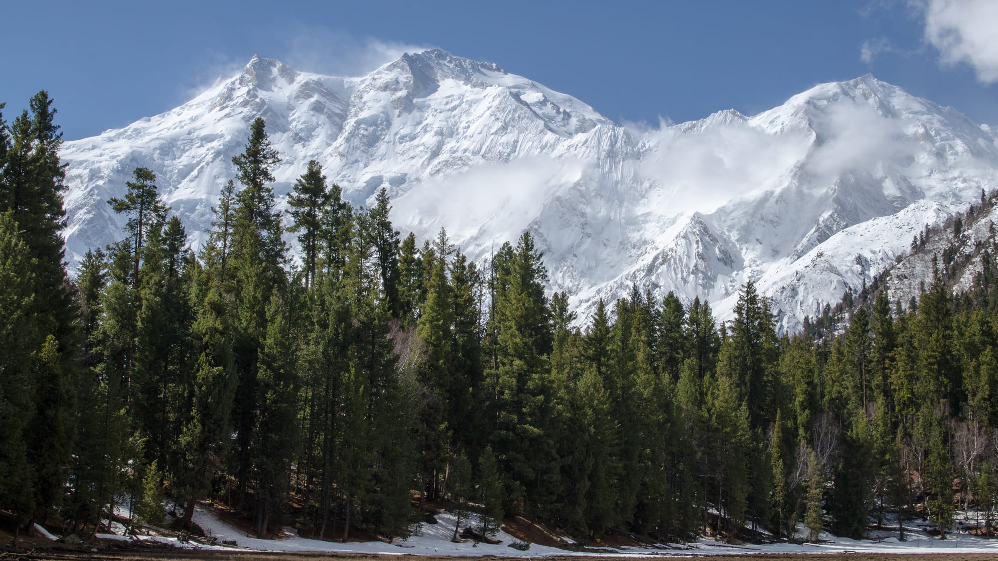
A massive snow-covered mountain wall rising above a dark pine forest with patches of snow on the ground

Pakistan

Gilgit-Baltistan & Azad Kashmir

Nanga Parbat seen from Fairy Meadows in the Diamer district of Gilgit-Baltistan. (Aasim85 / Wikimedia Commons · CC BY-SA 3.0)

The mountainous far north of Pakistan, where the Karakoram, Himalaya and Hindu Kush meet around K2, Nanga Parbat and the Hunza valley, with the forested hills of Azad Kashmir to the south. Both territories are administered by Pakistan and claimed by India as part of the former princely state of Jammu and Kashmir.

Explore Gilgit-Baltistan & Azad Kashmir

History

The Karakoram valleys were a branch of the Silk Road, and rock carvings and inscriptions along the Indus near Chilas record Buddhist pilgrims and merchants over many centuries. Baltistan, sometimes called "Little Tibet", was Buddhist until Islam spread there from around the 14th century, and local dynasties such as the Maqpons of Skardu ruled it. Hunza and Nagar were small kingdoms under their own rulers, the Mirs, until 1974.

In 1846 the British sold Kashmir to the Dogra ruler Gulab Singh, creating the princely state of Jammu and Kashmir, which also came to include Gilgit and Baltistan; the British kept a political agent in Gilgit to watch the Russian frontier. When the Hindu Maharaja acceded to India in October 1947, rebels in the western districts and Pashtun tribesmen from the north-west fought his forces, and in Gilgit local troops overthrew his governor and joined Pakistan. The 1947–48 war left a ceasefire line, renamed the Line of Control in 1972.

Since then Pakistan has administered Azad Kashmir, with its own president, prime minister and assembly, and Gilgit-Baltistan, known until 2009 as the Northern Areas; India claims both as part of Jammu and Kashmir, while India administers the larger part of the old state, which Pakistan claims. The Karakoram Highway, completed with China in the late 1970s, opened the north to trade and tourism. The Kargil war of 1999 was fought across the Line of Control, and the 2005 earthquake killed tens of thousands in Azad Kashmir and beyond, devastating Muzaffarabad.

Culture & Customs

The north is one of the most linguistically varied corners of Asia. Shina is spoken around Gilgit and Chilas, Burushaski — a language isolate with no known relatives — in Hunza and Nagar, Wakhi in upper Hunza, and Balti, a Tibetan language, in Baltistan. In Azad Kashmir most people speak Pahari-Pothwari, with Kashmiri and Gojri minorities, and culture there is close to that of northern Punjab.

Religion also differs from the rest of Pakistan. Most people in Hunza are Ismaili Muslims, followers of the Aga Khan, whose development network runs schools, clinics and the restoration of historic forts, and Hunza's literacy rates, for women as well as men, are among the highest in the country. Baltistan is largely Shia, and Gilgit-Baltistan is the only Shia-plurality area of a mainly Sunni Pakistan.

Polo is the region's great sport, played in its fast freestyle form, with an annual tournament against Chitral on the Shandur Pass. Folk music uses drums and the surnai shawm, and crafts include woollen weaving, embroidered caps and woodcarving in the old mosques and houses of Baltistan and Hunza.

Daily Life

Gilgit-Baltistan has fewer than 2 million people, and Azad Kashmir about 4 million. Gilgit and Skardu are the main towns of the north, while Muzaffarabad, the capital of Azad Kashmir, and Mirpur, Kotli and Rawalakot are its main centres. Mirpur has close ties with Britain, where many families settled after the Mangla Dam flooded their land in the 1960s, and remittances fund its large houses.

The northern economy relies on farming in irrigated terraces, trade with China over the Khunjerab Pass, government and army jobs, and, increasingly, domestic tourism, which has filled Hunza and Skardu with new hotels. Daily life follows the seasons: busy summers of harvests and visitors, long winters indoors when roads close and power cuts are frequent. Current issues include glacial lake floods and landslides, the lack of full constitutional status for Gilgit-Baltistan, electricity and flour prices, and pressure on water and land from tourism.

Food

Northern cooking is simple and built on what grows in the valleys. Apricots are eaten fresh, dried and pressed for oil, and walnuts, mulberries, cherries and apples follow the seasons. Chapshuro, a popular dish of Hunza and Nagar, is often likened to a local pizza, and mamtu are dumplings served with yogurt and sauces. Buckwheat bread is a staple in Hunza, where apricots and cherries are also made into jams, dried fruit and juices, and yogurt and cheese appear in both savoury and sweet dishes.

In Baltistan, salty butter tea is drunk in the Tibetan way. In Azad Kashmir, pink noon chai, a salted milk tea, and Kashmiri-style meat dishes and rice are standard.

Attractions & Natural Wonders

The Karakoram Highway is the spine of the region, climbing past the rock carvings of Chilas and the viewpoint where the Karakoram, Himalaya and Hindu Kush meet, then through Gilgit into the Hunza valley. There, Karimabad holds the Baltit Fort and Altit Fort, with views of Rakaposhi and the Eagle's Nest lookout above. Further north are Attabad Lake, formed by a landslide in 2010, the Passu Cones and the Hussaini suspension bridge, and the highway ends at the Khunjerab Pass on the Chinese border within Khunjerab National Park.

South of the highway near Raikot Bridge, a jeep track and a walk lead to Fairy Meadows below Nanga Parbat. East along the Indus, Skardu has the Kachura lakes, Satpara Lake and the Katpana cold desert, with the restored Shigar Fort and Khaplu Palace in neighbouring valleys and the Deosai Plains to the south. Beyond Askole the Baltoro glacier trek leads to Concordia and K2 base camp, surrounded by K2, Broad Peak and the Gasherbrums.

In Azad Kashmir, the Neelum valley runs north-east from Muzaffarabad through Keran, Sharda, with its ruined ancient temple of learning, and Kel to Arang Kel and Taobat, with Ratti Gali lake high above. Around Rawalakot, Banjosa Lake lies among pine forests.

Cities in Gilgit-Baltistan & Azad Kashmir

Planning basics

Budget

The north is more expensive than the rest of Pakistan because almost everything is trucked up the Karakoram Highway. Guesthouses in Hunza and Skardu range from basic to boutique, with prices rising sharply in July and August; jeep hire, porters and guides are the big costs, and a K2 base camp trek needs a licensed operator and a permit. Azad Kashmir is cheaper, with simple hotels.

Daily Budget Midrange
USD 55–130 (good hotel, restaurants, a jeep with driver or domestic flights)
Daily Budget Shoestring
USD 15–30 (guesthouse, local food, shared minibuses)

Bring enough cash from Islamabad, Gilgit or Skardu, and budget separately for trekking operators, porters and permits.

Safety

Gilgit-Baltistan and Hunza are among the safest parts of Pakistan for visitors, and the main dangers are natural: landslides and floods, altitude sickness and remote, high-risk trekking and climbing. Militants did kill foreign climbers at the Nanga Parbat base camp in 2013. Governments advise against travel near the Line of Control, which includes much of the Neelum valley, because of cross-border firing, which flared again in 2025, and some areas require a permit.

Acclimatise slowly, trek with licensed operators, carry permits and passport copies, and check whether a No Objection Certificate is needed for areas near the Line of Control. Check current official travel advice before travelling.

Climate

Mountain climates vary with altitude. The valleys of Gilgit, Hunza and Skardu are dry, with hot summer days, cool nights and cold, snowy winters, while the glaciers and high peaks are frozen all year and the Deosai Plains lie under snow for much of it. Azad Kashmir is wetter and greener, with monsoon rain in summer and snow in the upper Neelum valley in winter.

Summer
25–35°C in Gilgit and the lower valleys; cool on the Deosai Plains and around Fairy Meadows
Winter
freezing with snow in Hunza and Skardu; passes and high valleys closed

Transportation

Flights from Islamabad to Gilgit and Skardu save a long drive but are often cancelled in bad weather. By road, the Karakoram Highway takes the best part of a day or more from Islamabad to Gilgit, with the summer route over the Babusar Pass a shorter alternative. Jeeps run from the highway to Fairy Meadows, and to the trailhead at Askole for the Baltoro trek. Muzaffarabad is a few hours by road from Islamabad, with the Neelum valley road beyond it.

Leave spare days for flight cancellations and landslides, and use experienced local jeep drivers on mountain roads.

Best Time to Visit

May to October is the season. April brings apricot blossom in Hunza, June to August suits trekking to K2 base camp, Fairy Meadows and the Deosai Plains, and October is the time for autumn colour in Hunza. Winter is cold and quiet, with many hotels closed, and the monsoon can bring landslides on the roads in July and August.