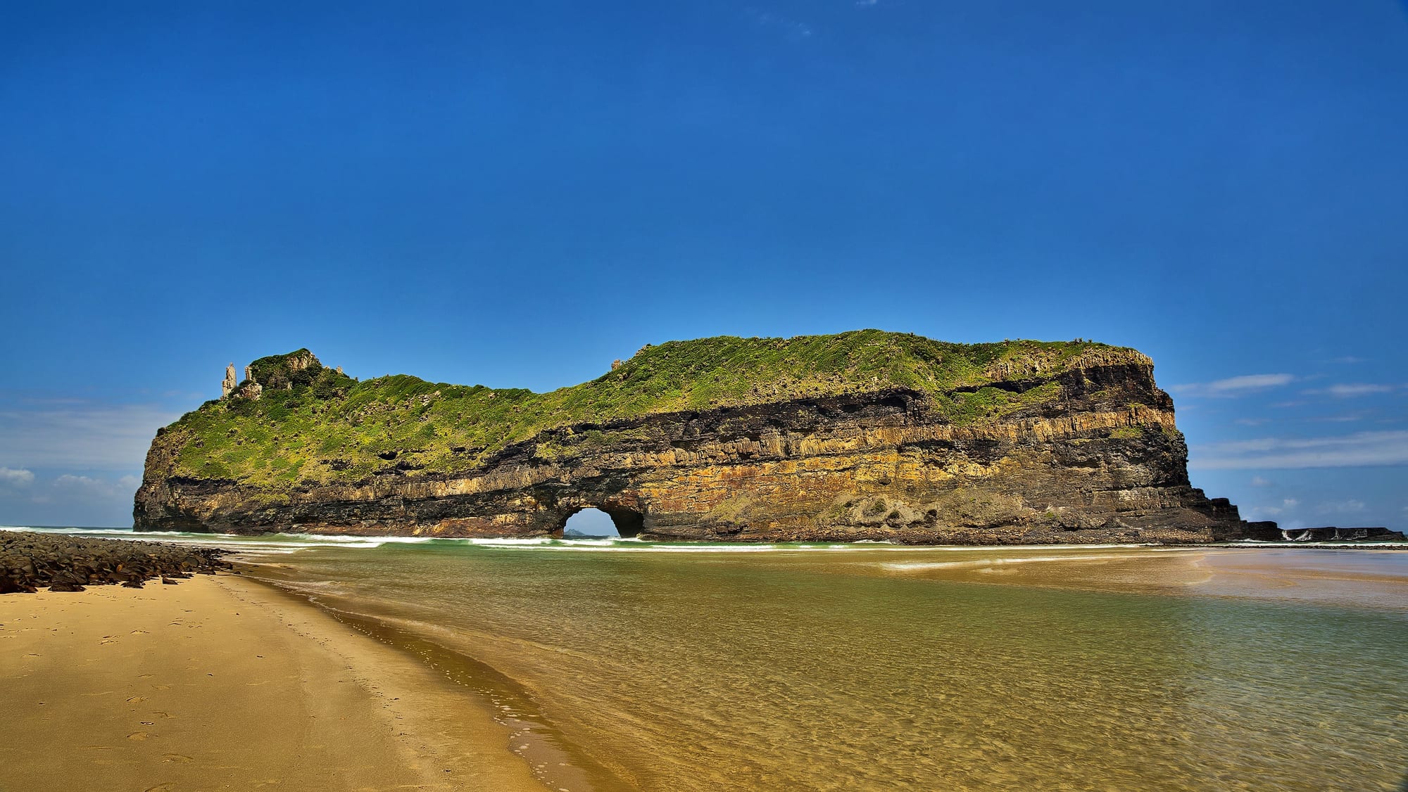
A long green-topped rock island with an arch at sea level, standing off a sandy river mouth under a deep blue sky

South Africa

The Eastern Cape & the Wild Coast

Hole-in-the-Wall, the rock arch at the mouth of the Mpako River south of Coffee Bay on the Wild Coast. (Vincentvanoosten / Wikimedia Commons · CC0)

South Africa's south-eastern province, between the Garden Route and KwaZulu-Natal — the heartland of the Xhosa people and of the century of frontier wars, with Addo's elephants and Gqeberha on the coast, the green hills and cliffs of the Wild Coast, the university town of Makhanda and the high southern Drakensberg.

Explore The Eastern Cape & the Wild Coast

History

San rock art is scattered through the mountains of the interior, and Khoekhoe herders grazed the coastal plains west of the Fish River. Xhosa-speaking farmers had settled the country further east for centuries by the time Dutch trekboers pushed in from the west in the 18th century. The Fish River became a contested boundary, and from 1779 to 1879 colonists and Xhosa chiefdoms fought a series of nine frontier wars over land and cattle.

The British, who took over the Cape in 1806, fortified the frontier and founded Grahamstown as a military post in 1812, and in 1820 brought several thousand British settlers to farm the Albany district. The Xhosa lost territory with each war. In 1856–57 the prophecy of the young woman Nongqawuse, who foretold that the dead would rise if the cattle were killed, led to a mass cattle-killing and a famine in which tens of thousands died, and the colony then annexed more land.

The region produced a large share of the leaders who fought segregation, many educated at the mission college at Lovedale and the University of Fort Hare in Alice. Nelson Mandela was born at Mvezo in 1918 and grew up in Qunu; Oliver Tambo, Govan Mbeki, Robert Sobukwe and Steve Biko were Eastern Cape men too. Under apartheid, Transkei in 1976 and Ciskei in 1981 were declared nominally independent homelands, recognised only by South Africa and the other homelands; Biko died in police custody in 1977, and Ciskei soldiers shot marchers at Bhisho in 1992. The present province, formed in 1994, joined the homelands with the eastern part of the old Cape Province.

Culture & Customs

The Eastern Cape is the heartland of isiXhosa, spoken at home by about four in five people, and of the Xhosa clan system in which people introduce themselves by their clan name. The main groups include the Gcaleka and Rharhabe Xhosa, the Thembu (Mandela's people), the Mpondo along the northern Wild Coast, and the Mfengu. Afrikaans is widely spoken in the Karoo towns and among coloured communities around Gqeberha, and English in Makhanda and the older settler towns.

Traditional life remains strong in the former Transkei. Homesteads of round huts are spread across the hills, people of some communities still wear ochre-dyed cloth and beadwork on ceremonial occasions, and cattle remain a measure of wealth and a centre of ritual. Ulwaluko, the initiation of young men, sends youths, their bodies smeared with white clay, to seclusion lodges in the hills after circumcision, from which they return as men. The practice carries deep meaning and also, in some seasons, deadly health risks that dominate provincial news.

Makhanda's National Arts Festival, held each winter since 1974, is one of the largest arts festivals in Africa. The province also has a strong choral tradition rooted in its mission schools and churches.

Daily Life

About 7.2 million people live in the Eastern Cape. The Nelson Mandela Bay metro, centred on Gqeberha — renamed from Port Elizabeth in 2021 — has around 1.2 million people, and Buffalo City, around East London, is the second-largest urban area. Mthatha, Qonce (formerly King William's Town) and Makhanda are the main smaller towns, and Bhisho is the provincial capital.

The economy has two faces. The coastal cities are centres of the motor industry, with the Volkswagen plant at Kariega near Gqeberha and Mercedes-Benz at East London, plus the ports of Gqeberha and Ngqura. The interior, especially the former homelands, is one of the poorest parts of the country, where many households depend on social grants and money sent home by relatives working in Cape Town and Gauteng. Unemployment is among the highest of any province, and emigration to other provinces is long-standing.

Life in the rural east follows a slower rhythm of fetching water, herding, church on Sundays and minibus taxis to town on grant day. Service delivery, failing roads, water cuts and troubled hospitals are the staple local issues, alongside the future of the motor plants.

Food

Umngqusho, samp — dried, stamped maize kernels — cooked slowly with sugar beans, is the Xhosa staple and was often described as Mandela's favourite dish. Umvubo, sour milk mixed with crumbled maize porridge, and umphokoqo, a dry, crumbly porridge, are everyday foods, and meat is eaten above all at ceremonies, when an animal is slaughtered for guests and ancestors. Umqombothi, a thick, slightly sour home-brewed beer of maize and sorghum, is part of every important gathering.

The coast between Bathurst and East London is pineapple country, and Bathurst's giant fibreglass pineapple advertises the crop. Chicory is grown around Alexandria. Karoo lamb, fed on the dry scrubland of the interior, is prized for its flavour.

On the coast, fresh fish is a staple of the seaside towns, and Port St Francis is the harbour of the squid fishery. Braais are the default weekend meal in town and township alike.

Attractions & Natural Wonders

In the west, Addo Elephant National Park lies an hour north of Gqeberha, with its elephants, buffalo, lions and a marine section offshore that takes in the seabird islands of Algoa Bay. Gqeberha has its beachfront at Summerstrand and the Red Location Museum in New Brighton township. Jeffreys Bay's Supertubes is a famous right-hand point break, and further west the Tsitsikamma coastal forest and Storms River mouth form part of the Garden Route National Park.

Makhanda (Grahamstown), with its cathedral, Rhodes University and settler museums, is the gateway to the frontier country, and Alice holds the University of Fort Hare. Inland, the Karoo holds Graaff-Reinet and the Valley of Desolation in Camdeboo National Park, the Owl House of sculptures at Nieu-Bethesda, and the Mountain Zebra National Park near Cradock.

The Wild Coast runs north-east from the Great Kei River towards KwaZulu-Natal: cliffs, grassy headlands, river mouths and forests with few towns. Coffee Bay is the classic base, with Hole-in-the-Wall a short way south, and Port St Johns sits at the mouth of the Mzimvubu River, with Mkambati Nature Reserve's grasslands and forested ravines near the northern end. Qunu and Mthatha's Nelson Mandela Museum mark Mandela's childhood.

In the north-east, the southern Drakensberg reaches into the province around Rhodes, Barkly East and Lady Grey, a region of high passes such as Naude's Nek, trout rivers, San paintings and the Tiffindell ski resort.

Cities in The Eastern Cape & the Wild Coast

Planning basics

Budget

The Eastern Cape is one of the cheaper provinces to travel in. Guesthouses in Gqeberha, Makhanda and the Karoo towns cost less than their Western Cape equivalents, and Wild Coast backpacker lodges are among the cheapest beds in the country. Private game reserves around Addo and Kenton are the big expense.

Daily Budget Midrange
USD 120–250 (guesthouse or lodge, car hire, restaurant meals, guided game drives)
Daily Budget Shoestring
USD 45–75 (backpacker lodge, self-catering, Addo rest-camp or day visits)

Self-drive Addo on a day permit from Gqeberha, and budget for a high-clearance vehicle or a lodge transfer on the Wild Coast.

Safety

Addo, the Garden Route edge, Makhanda and the Karoo towns see few problems beyond normal precautions. Gqeberha and East London have the same urban crime patterns as other South African cities. The Wild Coast's main risks are the roads — cattle, pedestrians and potholes — plus isolated opportunistic theft and strong rip currents on unguarded beaches.

Avoid driving after dark, swim only where locals advise, and hike the Wild Coast with a guide or lodge-arranged transfers. Check current official travel advice before travelling.

Climate

The coast is mild all year, with rain in every season west of East London and a subtropical summer-rain pattern on the Wild Coast. Inland the Karoo is dry, hot in summer and frosty on winter nights, and the high ground around Rhodes and Barkly East is among the coldest in South Africa, with regular winter snow.

Summer
warm on the coast, 22–28°C and humid on the Wild Coast; 30°C and more in the Karoo
Winter
mild on the coast, 8–20°C; well below freezing at night in the north-eastern highlands

Transportation

Gqeberha and East London have airports with flights to Johannesburg and Cape Town, and Mthatha has a smaller one. The N2 links Gqeberha with the Garden Route to the west and runs through Makhanda and East London to Mthatha. Addo is about an hour's drive from Gqeberha. On the Wild Coast, access roads from the N2 to Coffee Bay, Port St Johns and the river mouths are slow, often potholed, and crossed by livestock.

Drive the Wild Coast by day only, allow extra time on the access roads, and use a shuttle from Mthatha to Coffee Bay if not self-driving.

Best Time to Visit

March to May and September to November bring settled, mild weather on the coast and good game viewing at Addo. Summer suits the Wild Coast beaches and the Jeffreys Bay surf, though December holidays fill the resorts; the winter swells from June to August draw surfers too. Makhanda's National Arts Festival runs in late June and early July, and the highlands are best for hiking in spring and autumn.