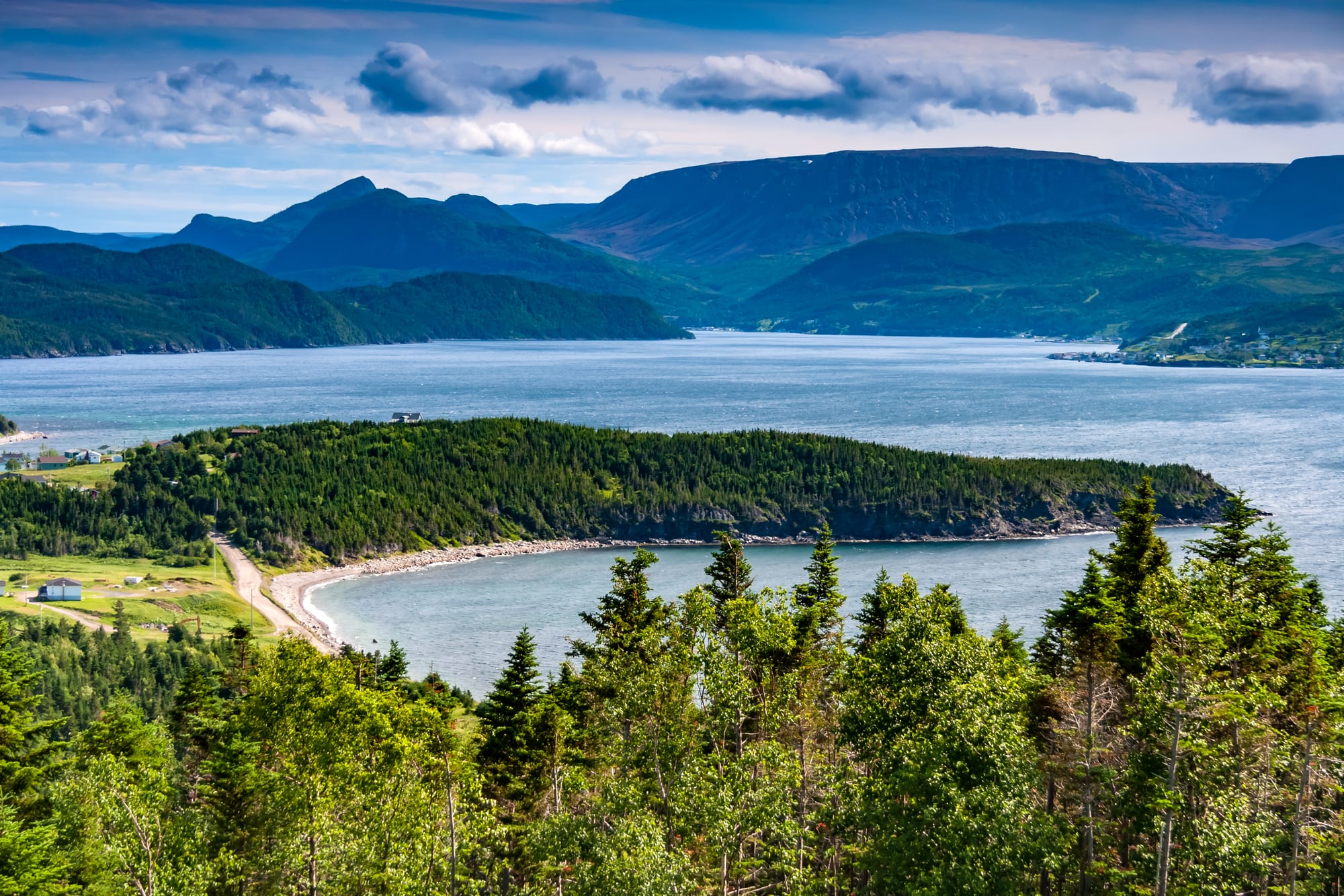
A forested headland and curving beach on a wide blue bay, with flat-topped mountains beyond under broken cloud

Canada

Newfoundland & Labrador

Bonne Bay seen from the Norris Point lookout in Gros Morne National Park, with the Tablelands in the distance. (Michel Rathwell / Wikimedia Commons · CC BY 2.0)

Canada's easternmost province, made up of the island of Newfoundland and the vast, thinly peopled mainland of Labrador — a place of outport fishing villages, icebergs and whales, the Viking site at L'Anse aux Meadows, and a distinct identity from its years as a separate dominion before joining Canada in 1949.

Explore Newfoundland & Labrador

History

Maritime Archaic peoples buried their dead at Port au Choix around 4,000 years ago, and Palaeo-Inuit cultures followed. By the time Europeans arrived, the Beothuk lived on the island of Newfoundland, the Innu across interior Labrador and the Inuit on its northern coast, with Mi'kmaq later settling on the island. Norse voyagers built a short-lived camp at L'Anse aux Meadows around 1000 AD. John Cabot's voyage of 1497 opened the Grand Banks cod fishery to English, French, Portuguese and Basque fishermen, and Basque whalers worked from Red Bay in Labrador in the 16th century. The Beothuk, pushed from the coast and its resources, died out; Shanawdithit, the last known Beothuk, died in 1829.

England and France fought over the island until the Treaty of Utrecht of 1713 confirmed British control, though French fishing rights on the "French Shore" lasted until 1904. Irish and West Country English settlers filled hundreds of outports. Newfoundland gained responsible government in 1855 and became a dominion. At Beaumont-Hamel on 1 July 1916 the Newfoundland Regiment was almost wiped out, and the day is still marked as Memorial Day. War debts and the Depression led it to give up self-government in 1934 for a British-appointed commission.

In two referendums in 1948, voters chose between restored self-government and confederation; confederation won the second narrowly, and Newfoundland joined Canada on 31 March 1949 under Joey Smallwood. Resettlement programmes then moved people out of many small outports. The cod moratorium of 1992 ended a way of life for more than 35,000 fishers and plant workers, while offshore oil brought new wealth. Labrador Inuit gained the self-governing region of Nunatsiavut in 2005, and Prime Minister Justin Trudeau apologised to former students of the province's residential schools.

Culture & Customs

Newfoundlanders often feel as much a people as a province. Their English, rooted in the speech of south-east Ireland and the English West Country, varies from bay to bay and has its own dictionary; "b'y" is everyday speech. The island keeps its own time zone, half an hour ahead of Atlantic time. Many families are Irish Catholic or English Protestant in background, a divide that once shaped schools and politics.

Music is at the heart of social life: jigs and reels on the accordion and fiddle, kitchen parties and bands in the pubs of George Street in St. John's. Christmas brings mummering, when disguised neighbours visit houses to be guessed. The Royal St. John's Regatta on Quidi Vidi Lake, held since the early 19th century, is a civic holiday, and bonfires, garden parties and "come from away" hospitality, famous after the planes diverted to Gander on 11 September 2001, are part of the image.

Labrador has a different mix. Inuit communities such as Nain and Hopedale were shaped by Moravian missions, the Innu live at Sheshatshiu and Natuashish, and the NunatuKavut Community Council represents descendants of mixed Inuit-European people in central and southern Labrador, whose rights claims are opposed by other Indigenous groups and were turned down by the federal government in 2026. The Mi'kmaq of Miawpukek, in the island's south, are among the province's First Nations.

Daily Life

About 540,000 people live in the province, roughly 40% of them around St. John's, whose metropolitan area has about 220,000 people. Mount Pearl and Conception Bay South adjoin it; Corner Brook, Gander and Grand Falls-Windsor are the main island towns outside the Avalon, and Labrador, with only about 6% of the province's people, centres on Happy Valley-Goose Bay and the mining town of Labrador City.

Offshore oil fields such as Hibernia, nickel from Voisey's Bay, iron ore in western Labrador, hydroelectricity from Churchill Falls, fisheries for crab, shrimp and some cod, and public services support the economy. The collapse of the cod fishery caused widespread out-migration from rural areas.

Outport life still follows the season: gardens and berry picking, wood cut for winter, trouting and moose hunting. Rural services and the cost of the Muskrat Falls hydro project, completed in 2023 after years of delays and cost overruns, are political issues.

Food

Newfoundland cooking comes from a history of salt fish, root cellars and long winters. Jiggs dinner — salt beef boiled with cabbage, potatoes, carrot and turnip, served with pease pudding — is the Sunday meal. Fish and brewis combines salt cod with softened hard bread and scrunchions, crisp fried pork fat. Toutons are fried bread dough eaten with molasses, and cod tongues are fried with scrunchions.

Seal flipper pie is a traditional dish of the spring seal hunt. Wild berries matter: bakeapples, the local name for cloudberries, and partridgeberries become jams, pies and sauces, and figgy duff is a boiled raisin pudding.

Screech, a rum imported from Jamaica and bottled in the province, is used in the "screech-in" ceremony for visitors, which involves kissing a cod. Quidi Vidi Brewery makes a lager with water from icebergs.

Attractions & Natural Wonders

St. John's climbs from its harbour in rows of brightly painted houses. Signal Hill, with the Cabot Tower, looks over the Narrows; nearby are the fishing village of Quidi Vidi, The Rooms museum and gallery, and Cape Spear, Canada's most easterly point. South of the city, boat tours at Witless Bay pass puffin colonies and, in season, whales. Cape St. Mary's has a large gannet colony.

On the west coast, Gros Morne National Park, a UNESCO World Heritage Site, has the orange Tablelands, where rock from the Earth's mantle is exposed, and boat trips on Western Brook Pond, a landlocked fjord; Bonne Bay, Norris Point and Rocky Harbour are the bases. The Viking Trail runs north past Port au Choix to L'Anse aux Meadows, a UNESCO World Heritage Site.

The north-east coast forms part of Iceberg Alley. Twillingate's Long Point Lighthouse is a classic place to watch bergs from the cliffs or from a boat. Fogo Island, a short ferry ride away, has outports such as Tilting, walking trails, artists' studios and the Fogo Island Inn. Across the Strait of Belle Isle, Red Bay in southern Labrador preserves the Basque whaling stations, and in the far north the Torngat Mountains National Park protects bare peaks, fjords and polar bear country that Inuit have used for thousands of years.

Cities in Newfoundland & Labrador

Planning basics

Budget

Prices are close to the Canadian average, but distance adds cost: flights in and out are expensive, hire cars are limited and book out in summer, and a road trip across the island is long. St. John's has the widest choice of places to stay; outports offer B&Bs and cottages. Labrador and Torngat trips, which need charter flights or expedition cruises, cost far more.

Daily Budget Midrange
USD 160–300 (B&B or mid-range hotel, restaurant meals, hire car, boat tours)
Daily Budget Shoestring
USD 80–120 (hostel or campground, groceries and fish and chips, shared transport)

Book hire cars and summer accommodation early, especially around Gros Morne, Twillingate and the northern peninsula.

Safety

Crime is low. The main hazards are moose on the highways — the island has a large moose population and collisions are frequent — along with fog, sudden storms, cold water, rough seas at coastal viewpoints, and isolated hiking trails with no phone signal. In Labrador and the Torngats, polar bears are a real risk.

Slow down at dusk for moose, carry warm and waterproof layers even in summer, and hike in the Torngats only with an armed bear guard. Check current official travel advice before travelling.

Climate

The island has a cool, wet, windy maritime climate, with fog around the Avalon peninsula and changeable weather all year; St. John's is one of Canada's windiest and foggiest cities. Labrador is far colder, with a subarctic interior and Arctic conditions in the north, where sea ice lingers into early summer.

Summer
cool to mild, 15–22°C on the island, cooler on the coast and in Labrador
Winter
around -8 to 0°C in St. John's with heavy snow and storms; -20°C and colder in inland Labrador

Transportation

Most visitors fly into St. John's, or into Deer Lake for Gros Morne and the west coast. Car ferries cross from North Sydney in Nova Scotia to Port aux Basques year-round and to Argentia in summer. The Trans-Canada Highway crosses the island, and St. John's to Gros Morne is a long day's drive. Fogo Island and Twillingate's neighbouring islands are reached by ferry or causeway, while Labrador relies on flights, the Trans-Labrador Highway and a coastal ferry.

Distances look short on the map but take long to drive; avoid night driving because of moose.

Best Time to Visit

June to September. Icebergs drifting down Iceberg Alley are usually best seen from May to June, humpback whales and puffins from about June to August, and July and August bring the warmest weather and most festivals. September is quieter, with autumn colour in Gros Morne. The Torngat Mountains are generally visited only in the short summer.