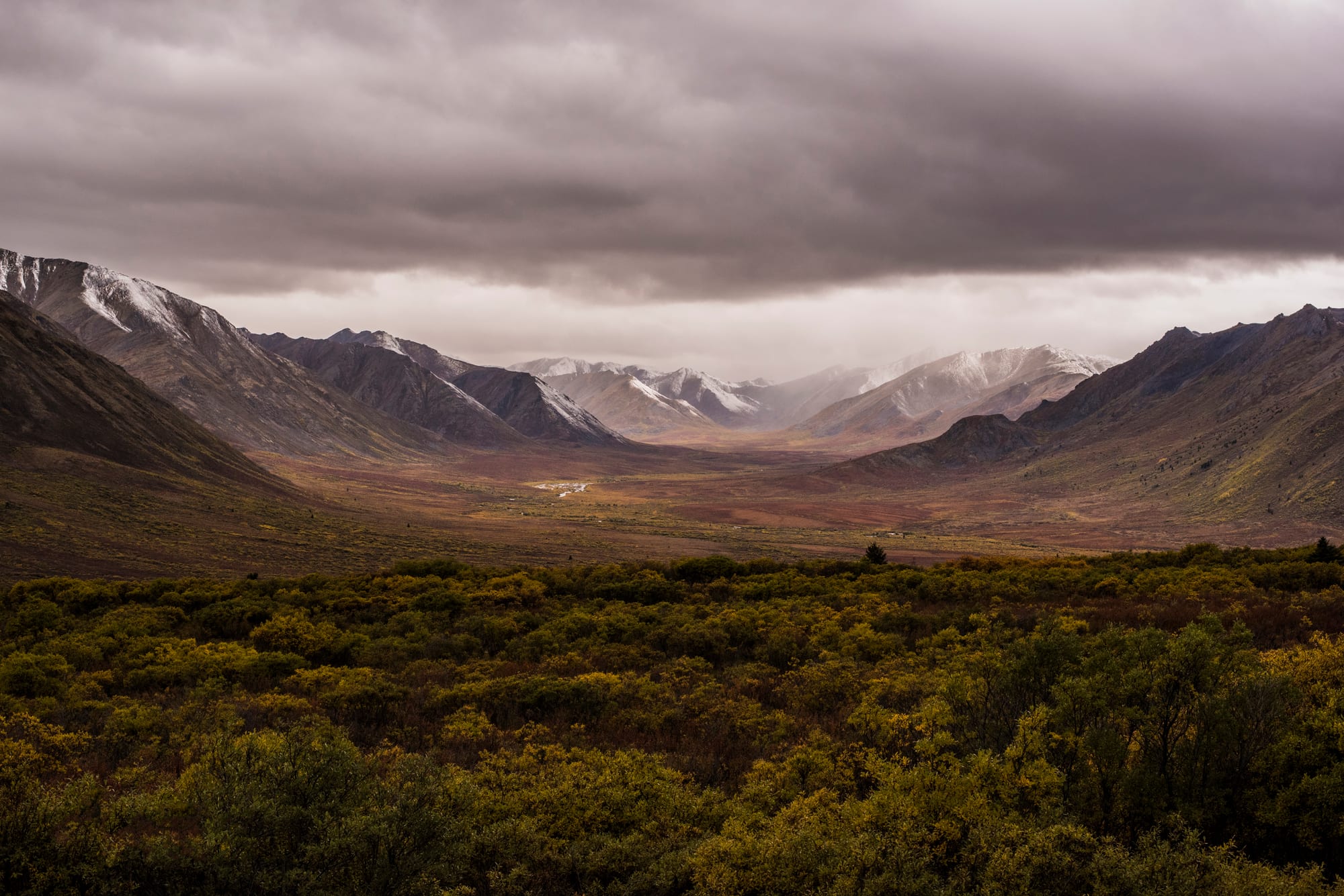
A wide valley of autumn shrubs leading to snow-dusted grey mountains under heavy dark cloud

Canada

The North

Autumn in Tombstone Territorial Park, in the Ogilvie Mountains north of Dawson City, Yukon. (LaurieSchamber / Wikimedia Commons · CC BY-SA 4.0)

Canada's three northern territories — Yukon, the Northwest Territories and Nunavut — cover about 40% of the country but hold only around 130,000 people, about half of them Indigenous; a land of mountains, boreal forest, tundra and Arctic islands, gold-rush towns and aurora skies.

Explore The North

History

People crossed into Yukon from Beringia during the last Ice Age, and Dene and other First Nations — among them the Gwich'in, Tutchone, Tlingit, Tłı̨chǫ and Dehcho Dene — lived by hunting, fishing and trade for thousands of years. In the Arctic, Dorset peoples were followed by the Thule, the ancestors of today's Inuit, from around 1000 AD. Martin Frobisher reached Baffin Island in 1576, the Hudson's Bay Company's fur trade spread along the Mackenzie River, and the Franklin expedition vanished in the 1840s searching for the Northwest Passage; its ships were found in 2014 and 2016.

In 1896 George Carmack, Skookum Jim and Dawson Charlie found gold on a tributary of the Klondike River. Tens of thousands of stampeders crossed the Chilkoot and White passes in 1897–98, Dawson City grew to about 17,000 people by the summer of 1898, and Yukon became a separate territory in 1898. The Alaska Highway, built in 1942, made Whitehorse the hub, and the capital moved there in 1953.

The 20th century brought mining at Yellowknife, government settlement of Inuit in permanent communities, residential schools, the killing of sled dogs, and the 1953 relocation of Inuit families to the High Arctic, for which the federal government apologised in 2010. Land claims reshaped the region: Yukon's Umbrella Final Agreement in 1993, the Inuvialuit and Tłı̨chǫ agreements, and the Nunavut Land Claims Agreement of 1993, which led to the creation of Nunavut from the eastern Northwest Territories on 1 April 1999.

Culture & Customs

Indigenous peoples make up about half of the North's population: around a fifth in Yukon, about half in the Northwest Territories and more than four in five in Nunavut. The Northwest Territories recognises eleven official languages, nine of them Indigenous, and in Nunavut Inuktut — Inuktitut and Inuinnaqtun — is a language of government and schools alongside English and French. Both territories use consensus government, without political parties in the legislature.

Inuit art is known worldwide, particularly the prints and carvings of Kinngait (Cape Dorset), where Kenojuak Ashevak worked. Throat singing, drum dancing and Arctic sports are practised at community gatherings and at the Arctic Winter Games, while Iqaluit's Toonik Tyme festival mixes traditional Inuit activities with modern events. Dene drum dances and hand games are part of community life.

Yukon keeps a frontier flavour from the gold rush: Robert Service's poems, vaudeville shows at Dawson City, the "Sourtoe Cocktail" served with a human toe, and long-distance sled dog racing such as the Yukon Quest. Across the North, sharing game with relatives and elders remains an important custom.

Daily Life

Yukon has about 45,000 people, around three-quarters of them in Whitehorse. The Northwest Territories has a similar number, about half in Yellowknife; Hay River, Inuvik and Fort Smith are the next towns. Nunavut's roughly 40,000 people live in about 25 communities, the largest being Iqaluit with about 8,000, followed by Rankin Inlet and Arviat.

Government is the largest employer. Mining drives the private economy — diamonds north-east of Yellowknife, gold in Nunavut, iron ore at Mary River — along with tourism and construction. The cleanup of arsenic waste at Yellowknife's former Giant Mine is a long-term project.

Seasons shape everything: snowmobiles, ice roads and short winter days give way to summer fishing, hunting and camping under the midnight sun. In Nunavut many families still hunt caribou, seal and char. The high cost of food and the housing shortage are serious issues, alongside climate change, which is thinning sea ice, thawing permafrost under buildings and worsening wildfire seasons.

Food

Country food — meat and fish hunted or caught on the land — is central in Inuit and Dene homes. Inuit eat caribou, seal, Arctic char and whale, often raw or frozen; maktaaq, whale skin with a layer of fat, is prized, and char is also dried or smoked. Bannock, a simple pan-fried or baked bread probably introduced by fur traders, is eaten across the North. Dene cooking uses moose, caribou, whitefish and berries, and dried meat is a staple on the land.

In Yukon, Klondike prospectors kept sourdough starter alive through the winter, and long-time residents are still called "sourdoughs". Restaurants in Whitehorse, Dawson and Yellowknife serve local game, Arctic char and fish from Great Slave Lake, and Yukon Brewing and small breweries in Yellowknife make local beers.

In the smaller Arctic communities, store food is flown in at high prices, and country food shared through community freezers and hunters' networks matters for nutrition as well as tradition.

Attractions & Natural Wonders

In Yukon, Whitehorse offers the sternwheeler SS Klondike, the Yukon Beringia Interpretive Centre and Miles Canyon on the Yukon River. The Klondike Highway leads to Dawson City, with Diamond Tooth Gerties casino, Robert Service's cabin, Bonanza Creek and Dredge No. 4; the Tr'ondëk-Klondike area is a UNESCO World Heritage Site. North of Dawson the Dempster Highway crosses Tombstone Territorial Park. In the south-west, Kluane National Park holds Mount Logan and vast ice fields.

In the Northwest Territories, Yellowknife's Old Town, the Prince of Wales Northern Heritage Centre and houseboats on Great Slave Lake are the daytime sights, and nights from late August to April bring the northern lights, often watched from lodges outside town. Nahanni National Park Reserve, one of the first UNESCO World Heritage Sites, has Virginia Falls and the canyons of the South Nahanni, and Wood Buffalo National Park, shared with Alberta, protects wood bison. Inuvik and Tuktoyaktuk lie on the Mackenzie Delta and the Arctic coast.

In Nunavut, Iqaluit has the Nunatta Sunakkutaangit Museum, the igloo-shaped St Jude's Cathedral and Sylvia Grinnell Territorial Park. Beyond it, Auyuittuq National Park and the Akshayuk Pass near Pangnirtung, the floe edge at Pond Inlet and the wrecks of Franklin's ships attract expedition travellers.

Cities in The North

Planning basics

Budget

The North is by far the most expensive part of Canada. Flights are the main cost, hotels in Whitehorse, Yellowknife and Iqaluit charge big-city rates, and food and fuel prices rise the further north goods must be flown. Yukon, reachable by road, is the cheapest territory; Nunavut, reachable only by air or summer sealift, is the dearest, and guided trips to places such as Nahanni cost several thousand dollars.

Daily Budget Midrange
USD 250–500 (hotel, restaurant meals, aurora tours or guided day trips; more in Nunavut)
Daily Budget Shoestring
USD 110–180 (campground or hostel in Whitehorse or Dawson, groceries, a hire car shared)

Book aurora packages, Nahanni floatplanes and summer Dawson City accommodation well ahead; budget for high grocery prices in Nunavut.

Safety

Crime is low for visitors, and the real dangers are the environment: extreme cold, isolation, long stretches with no services or mobile signal, grizzly and black bears, polar bears along the Arctic coast and in Nunavut, and summer wildfires — Yellowknife was evacuated in 2023. Weather frequently grounds flights.

Travel with local guides in the backcountry and polar bear country, carry winter survival gear when driving, and follow wildfire notices. Check current official travel advice before travelling.

Climate

Subarctic in Yukon and the southern Northwest Territories, with short, warm summers under nearly endless daylight and long, very cold winters; Arctic across most of Nunavut and the far north, where summer is brief and cool and winter brings weeks of darkness. The air is dry, and Yellowknife has cold, clear winter nights.

Summer
warm in Whitehorse, Dawson and Yellowknife, often 18–25°C; around 10°C in Iqaluit
Winter
long and severe, typically -15 to -30°C, colder during cold snaps; Nunavut often below -30°C with wind

Transportation

Flights connect Whitehorse with Vancouver and other southern cities, and Yellowknife and Iqaluit with the south; small airlines serve the scattered communities. Yukon has a road network: the Klondike Highway links Whitehorse to Dawson City, and the gravel Dempster Highway runs to Inuvik, with an all-weather road on to Tuktoyaktuk on the Arctic Ocean since 2017. No road links Nunavut to the rest of Canada; its communities are reached by air, or by snowmobile and boat locally. Nahanni is reached by floatplane, mostly from Fort Simpson.

Allow spare days for weather delays on northern flights, and carry spare tyres and fuel on gravel highways.

Best Time to Visit

June to August for hiking, canoeing, Dawson City and the midnight sun. For the aurora, visit from late August to April, when nights are dark; late winter (February–March) combines aurora with dog-sledding and snow festivals, and September adds autumn tundra colours. Nunavut's travel season is short, mainly from spring for snow travel and July to August on the water.