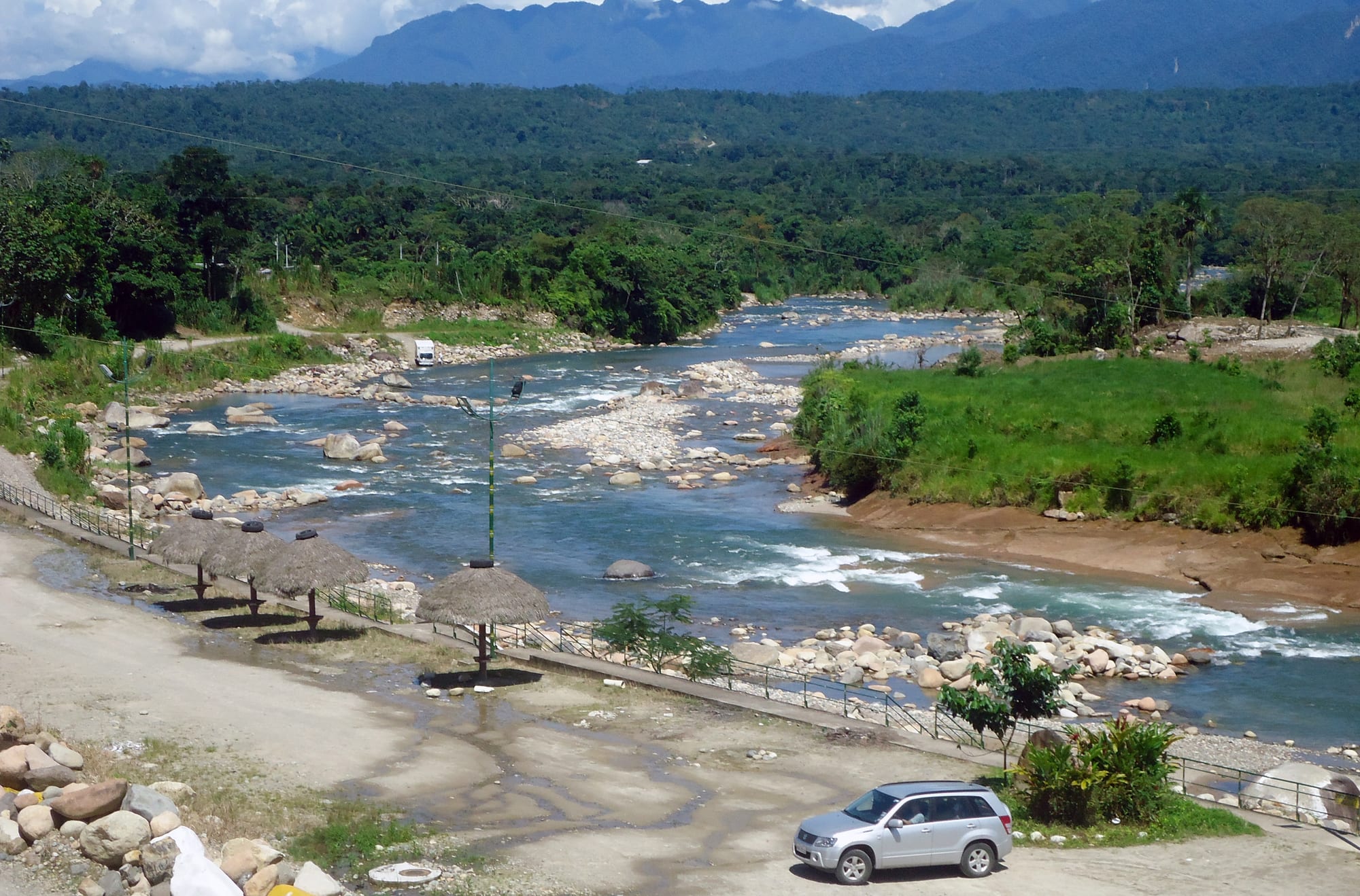
A clear, rocky river winding through green lowland forest, with thatched shelters on the bank and forested mountains behind

Ecuador

The Amazon

The Misahuallí river at Archidona in Napo province, where the Andean foothills meet the Amazon rainforest. (David C. S. / Wikimedia Commons · CC BY-SA 3.0)

Ecuador's Oriente, the rainforest lowlands and Andean foothills east of the mountains — close to half the country's land but only a few per cent of its people, home to Kichwa, Shuar, Waorani and other Indigenous nations, the river lodges of the Napo, the Cuyabeno and Yasuní reserves, and the oilfields that fund the national budget.

Explore The Amazon

History

People lived in the upper Amazon long before the Inca. At Santa Ana–La Florida in Zamora Chinchipe, archaeologists of the Mayo-Chinchipe culture have found the oldest known evidence of cacao use, from about 5,300 years ago. The Shuar and related peoples held the southern forests against both Inca and Spanish incursions, destroying the Spanish town of Sevilla de Oro in a revolt in 1599.

In 1541 Gonzalo Pizarro led an expedition from Quito in search of cinnamon and gold; his lieutenant Francisco de Orellana went ahead down the Napo and ended up sailing the whole length of the Amazon to the Atlantic, the first European to do so. Missionaries followed, and in the late nineteenth century the rubber boom brought forced labour and violence to the rivers. Ecuador's claim to a much larger Amazon was cut back after the 1941 war with Peru, and fighting flared again in the Cordillera del Cóndor in 1981 and 1995 before the 1998 peace agreement fixed the border.

The modern Oriente was made by oil. A Texaco-Gulf consortium struck crude at Lago Agrio in 1967, a pipeline over the Andes opened in 1972, and roads, settlers and towns followed. Pollution from that era produced a long legal battle with Chevron, which acquired Texaco, while Indigenous organisations, from the Shuar Federation founded in 1964 to the Kichwa of Sarayaku, who won a case at the Inter-American Court of Human Rights, became leading defenders of their land. In 2023 Ecuadorians voted in a national referendum to halt oil extraction in Block 43 inside Yasuní.

Culture & Customs

Many of Ecuador's Indigenous nationalities live here. Amazonian Kichwa communities line the Napo and the rivers of Pastaza; the Shuar and the Achuar live in the south-east; the Waorani hold territory in and around Yasuní; and smaller nations include the Cofán, Siona, Secoya, Sápara and Shiwiar. Two groups related to the Waorani, the Tagaeri and Taromenane, live in voluntary isolation, protected by an untouchable zone in the south of Yasuní. The oral heritage of the Sápara is recognised by UNESCO.

Community life revolves around the chakra, a forest garden of cassava, plantain and fruit trees, around shared chicha, and around the minga work party. Among the Kichwa, guayusa tea is a daily drink, often accompanied by stories and the interpretation of dreams. Shamans, known as uwishin among the Shuar, still hold authority, and handicrafts include Kichwa pottery painted with forest designs, seed and feather jewellery, and balsa carvings.

Alongside Indigenous communities live colonos, settlers from the highlands and coast who arrived with the oil roads. Towns hold fiestas with beauty contests, Amazonian music and plenty of beer, and the capital's jokes about the Oriente are answered here with fierce local pride.

Daily Life

Fewer than a million people live across the six provinces. The main towns are Nueva Loja, better known as Lago Agrio, and Francisco de Orellana, or Coca, both oil towns; Tena and Puyo in the foothills; Macas in Morona Santiago; and Zamora in the south, each with a few tens of thousands of people.

Oil from the northern fields around Lago Agrio, Shushufindi and Coca has been Ecuador's largest export for decades, and the Amazon also has large copper and gold mines, palm-oil plantations, cattle ranching, cacao, naranjilla and timber. Tourism matters around Tena, Puyo and the lodge circuit, and many communities run their own lodges and guided visits.

Life follows the rivers and the rain, with markets early, work done before the midday heat and evenings outside. Current issues include oil spills and the implementation of the 2023 Yasuní vote; illegal gold mining along rivers; roads eroding into rivers, as when erosion on the Coca river after the collapse of San Rafael Falls in 2020 destroyed bridges and oil pipelines; and the struggle of Indigenous communities for land titles and prior consultation.

Food

Amazonian cooking draws on the chakra and the river. Maito is the signature dish: fish, frogs or poultry wrapped in bijao leaves and grilled over coals, served with boiled cassava. Ayampaco is another cassava-based dish of the region. Chontacuros, the fat larvae of the palm weevil, are a traditional Amazonian food, and caldo de carachama is a soup of armoured catfish.

Chicha de yuca, a thick fermented cassava drink prepared by women, is offered to visitors in Kichwa and Shuar homes, and chicha de chonta is made from the fruit of the peach palm when it ripens. Guayusa, the leaf of a caffeinated holly, is brewed like tea. Fruits include the tart arazá, the naranjilla used for juice everywhere, and the pitahaya of Palora in Morona Santiago; ishpingo, a forest spice, flavours the colada morada drunk for the Day of the Dead in November. Fine-aroma cacao is also grown, and several community cooperatives make chocolate.

Attractions & Natural Wonders

In the north-west foothills, Tena sits where the Tena and Pano rivers meet and is Ecuador's rafting centre. Nearby is Puerto Misahuallí, a river village with a troop of capuchin monkeys, community lodges and canoe trips down the Napo.

Downstream from Coca, the Napo river lodges stand on blackwater lakes along the Yasuní boundary, with canopy towers for birdwatching and clay licks where parrots and parakeets gather. Yasuní National Park, a UNESCO biosphere reserve, protects a huge area of rainforest, with giant otters, monkeys, jaguars and one of the highest concentrations of tree, amphibian and insect species recorded anywhere. To the north, the Cuyabeno Wildlife Reserve in Sucumbíos is a flooded forest of lagoons, best explored by canoe, with pink river dolphins, hoatzins and caimans, and visits to Siona and Cofán communities.

In the south, Puyo, reached down the Pastaza gorge from Baños, has the Omaere ethnobotanical park and riverside walks, and is the base for visits to the Shuar and Kichwa communities of the Oriente, some reached only by light plane from Shell. Near Zamora the Bombuscaro entrance leads into the eastern side of Podocarpus National Park, known for its birds.

Cities in The Amazon

Planning basics

Budget

Two very different price levels. Tena, Puyo, Macas and Misahuallí are as cheap as anywhere in Ecuador, with basic hostels, set lunches and cheap buses, and community tourism projects near them charge modest rates. A stay deep in the forest is another matter: the lodges on the lower Napo and in Yasuní and Cuyabeno sell all-inclusive packages of three or four nights with transport, guides and meals, and the remote Napo lodges are among the most expensive places to stay in mainland Ecuador.

Daily Budget Midrange
USD 100–350 per person per day at a Cuyabeno or Napo jungle lodge, all-inclusive
Daily Budget Shoestring
USD 25–45 in the foothill towns (hostel, almuerzos, buses, a day's rafting extra)

Compare what lodge packages include (flights, park fees, guide ratios) and book through established operators rather than on the street in Coca or Lago Agrio.

Safety

The foothill towns and the lodge circuit are generally calm, but Lago Agrio and Coca have more crime, and Sucumbíos along the Colombian border is part of the northern border zone where armed groups and drug trafficking operate and which should be avoided. Illegal gold mining has brought violence and pollution to parts of the region. Health risks are real: yellow fever vaccination is recommended, malaria and dengue occur in parts of the lowlands, and rivers rise fast after rain. Unregulated ayahuasca ceremonies carry risks of their own.

Stay with established lodges and licensed guides, avoid the border areas of Sucumbíos, raft only with certified operators, and get vaccinated and use repellent. Check current official travel advice before travelling.

Climate

Hot, humid and wet all year, with no true dry season. Lowland days reach about 30°C, and heavy downpours can come in any month, usually in the afternoon or night. The foothills around Tena, Puyo and Macas are a little cooler and even wetter, and nights there can be fresh. River levels matter more than temperature: some of Cuyabeno's lagoons can shrink in the drier spells around December to February.

Summer
roughly December–March is a little less rainy in the north, 25–32°C, with lower rivers
Winter
roughly April–July is the wettest period, with high rivers, 22–30°C

Transportation

Short flights link Quito with Coca and Lago Agrio in well under an hour, and buses take about five hours from Quito to Tena, seven or more to Lago Agrio, and about an hour and a half from Baños down the Pastaza gorge to Puyo. From Coca, motor canoes run downriver to the Napo lodges in two to three hours or more; Cuyabeno lodges are reached by road from Lago Agrio and then canoe. Many Pastaza communities are reachable only by light aircraft from Shell.

Lodges arrange all transfers from Coca or Lago Agrio; allow a buffer day, as rain and river levels can delay canoes and flights.

Best Time to Visit

The forest can be visited year-round, and wildlife is always present; wetter months mean higher water, easier canoe access and flooded forest, drier spells mean more trails and exposed river beaches. Rafting around Tena is possible most of the year, though flash floods can close rivers after heavy rain. Ecuadorian holiday periods fill the foothill towns.