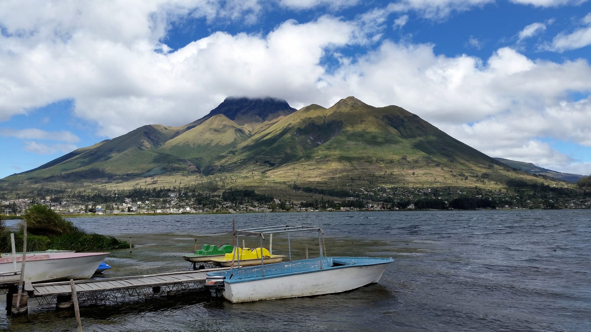
Small boats moored at a wooden jetty on a lake, with a green volcano and a lakeside town behind under white clouds

Ecuador

Quito & the Northern Andes

Lake San Pablo and Imbabura volcano in Imbabura province. (David C. S. / Wikimedia Commons · CC BY-SA 4.0)

Ecuador's central and northern highlands, running from the Colombian border through Quito and down the Avenue of the Volcanoes to Riobamba — a double chain of snow peaks, páramo and farmed valleys, home to the capital, the Otavalo market, the Quilotoa crater and the spa town of Baños.

Explore Quito & the Northern Andes

History

Before the Inca, the northern highlands belonged to chiefdoms such as the Caranqui and Cayambe around today's Ibarra, the Panzaleo around Latacunga and the Puruhá around Riobamba. The Inca pushed north in the late fifteenth century and met long resistance from the Caranqui; tradition links the lake of Yahuarcocha, "lake of blood", near Ibarra with a massacre at the end of that war. Quito became the northern centre of the empire, and it was the scene of the struggle between Atahualpa and his half-brother Huáscar just before the Spanish arrived.

Sebastián de Benalcázar founded San Francisco de Quito in December 1534 on the ruins of the Inca town. As seat of the Audiencia of Quito, it grew into a city of convents and churches whose painters and sculptors, the Quito School, supplied religious art across the Andes. Textile workshops, or obrajes, worked by Indigenous labour made the valleys rich, while earthquakes repeatedly reshaped them: the 1797 quake destroyed old Riobamba, which was rebuilt on a new site.

A junta in Quito deposed the Spanish authorities on 10 August 1809, a date Ecuadorians celebrate as the first cry of independence, and Antonio José de Sucre's victory on the slopes of Pichincha in May 1822 ended Spanish rule. Ecuador's first constituent assembly met in Riobamba in 1830. The railway from Guayaquil reached Quito in 1908, climbing through the Devil's Nose switchbacks at Alausí. In the modern era the highlands have been the heartland of Indigenous politics: the 1990 uprising launched CONAIE as a national force, and Quito has been the stage for the protests that toppled presidents in 1997, 2000 and 2005 and for large national strikes in 2019 and 2022.

Culture & Customs

This is Ecuador's most Indigenous region outside the Amazon. Kichwa-speaking peoples — the Otavalo, Cayambe, Salasaca, Puruhá and many others — keep distinct dress that marks each community, from the Otavalo men's long braid, white trousers and dark poncho to the Salasacas' black ponchos near Ambato. Communal work in the minga still builds roads and irrigation channels, and the Otavalo have built a trading culture that has taken their weaving to markets worldwide.

The festival calendar is dense. Inti Raymi fills Otavalo and Cotacachi with dancing around the June solstice; Latacunga's Mama Negra parades a blackfaced figure through town in honour of the Virgin of La Merced; the Diablada de Píllaro sends hundreds of masked devils through the streets at New Year; and Ambato's Fiesta de las Flores y las Frutas comes at Carnival. Guaranda's Carnival is one of the country's liveliest. In the Chota valley of Imbabura and Carchi, Afro-Ecuadorian communities play bomba music and have produced many of the national football team's players.

Crafts are tied to particular towns: leather in Cotacachi, woodcarving in San Antonio de Ibarra, weaving around Otavalo, and naïve paintings on sheepskin from Tigua near Zumbahua. Quiteños take pride in their colonial city and its manners, and the capital's rivalry with Guayaquil is a staple of national banter.

Daily Life

Quito's metropolitan district has around 2.7 million people strung along a narrow valley, with the colonial centre in the south-centre, the business district and La Mariscal to the north, and sprawling working-class suburbs at both ends and in the valleys of Los Chillos and Tumbaco below. The other main towns are Ambato, a commercial centre of a few hundred thousand, Riobamba, Ibarra, Latacunga, Tulcán on the Colombian border and the smaller Otavalo and Guaranda.

Government employment anchors the capital, and the region grows much of Ecuador's food: potatoes, maize, dairy and beans, while the greenhouses around Cayambe, Tabacundo and Latacunga produce the roses that make Ecuador one of the world's big flower exporters. Ambato is a trading hub for textiles and leather, and Tulcán lives off cross-border commerce.

The day starts early, when light comes around six all year; the markets are busiest in the morning, lunch is the main meal, and evenings are cold enough for a jacket. Current issues include the cost of living, migration from rural villages to the cities and abroad, pressure on Quito's water and traffic, and rising crime, which has reached the capital though at lower levels than on the coast.

Food

Highland cooking is built on potatoes, maize and pork. Hornado, whole roast pig served with mote hominy and llapingachos (fried potato-and-cheese patties), fills market stalls from Ibarra to Riobamba, while fritada is pork simmered and then fried in its own fat. Latacunga is known for chugchucaras, a heavy plate of fried pork, mote, plantain, popcorn and empanadas. Cuy, roast guinea pig, is festival food around Ambato and in Chimborazo, and locro de papa, a creamy potato soup with cheese and avocado, is eaten everywhere.

Quito has its own specialities: yahuarlocro, a potato soup with sheep's blood and offal, and at the Day of the Dead in November, colada morada, a spiced purple-corn and fruit drink, with guaguas de pan, bread shaped like swaddled babies. Ibarra is famous for helados de paila, sorbets churned by hand in bronze pans over ice. Cayambe sells bizcochos, crisp biscuits, with dulce de leche, and Baños is the home of melcocha, sugarcane taffy pulled on wooden pegs in shop doorways. To keep out the cold there is canelazo, hot cinnamon and naranjilla juice often laced with sugarcane spirit.

Attractions & Natural Wonders

Quito's historic centre holds the gold-lined Jesuit church of La Compañía, the monastery of San Francisco on its broad plaza, the Plaza Grande with the cathedral and presidential palace, the Gothic Basílica del Voto Nacional and the winged Virgin on El Panecillo. The TelefériQo cable car climbs the flank of Pichincha for views over the city, and north of Quito the Mitad del Mundo monument marks the equator. The cloud forests around Mindo, north-west of the capital, draw birdwatchers for hummingbirds and tanagers.

North of Quito, Otavalo's market spills out from the Plaza de los Ponchos, busiest on Saturdays, and nearby lie the village of Peguche and its waterfall, the crater lake of Cuicocha below Cotacachi volcano, the lakes of San Pablo and Mojanda and the colonial town of Ibarra. Near the border, the El Ángel reserve protects páramo dotted with frailejones, and Tulcán's cemetery is famous for its sculpted topiary.

South of Quito begins the Avenue of the Volcanoes, the name given to the valley between two lines of peaks. Cotopaxi National Park circles its snow cone, with the Limpiopungo lagoon below and a refuge used by climbers. From Latacunga, the Quilotoa loop links Zumbahua, the Quilotoa crater and its lake, Chugchilán, Isinliví and Sigchos by footpath and back road. Baños sits beneath Tungurahua, with hot springs, the Ruta de las Cascadas down the Pastaza gorge to the Pailón del Diablo waterfall. The avenue ends at Riobamba, the base for Chimborazo, Ecuador's highest peak, and for Alausí, where the railway zigzags down the Devil's Nose, while Salinas de Guaranda in Bolívar is known for its cooperative cheese and chocolate workshops.

Cities in Quito & the Northern Andes

Planning basics

Budget

The highlands are good value. Quito's hotels in La Mariscal and the old town cost a little more than the rest of the region, while Otavalo, Latacunga, Baños and the Quilotoa villages have plenty of cheap hostels and family guesthouses, often with dinner and breakfast included on the loop. Buses between the towns are very cheap; guided volcano climbs and park tours are the main extra cost.

Daily Budget Midrange
USD 60–130 (hacienda or boutique hotel, guided day tours, taxis)
Daily Budget Shoestring
USD 25–45 (hostel, almuerzo set lunches, local buses)

Carry small notes for buses and village guesthouses; hire volcano guides only through licensed agencies.

Safety

The highland route is calmer than the coast, but Quito has real street crime: pickpocketing and bag-snatching in the old town, on buses and at the bus terminals, robberies on unlit streets and some viewpoints after dark, and occasional express kidnappings in unregistered taxis. The national security measures introduced after the January 2024 "internal armed conflict" declaration, including military patrols, also apply here. Natural hazards are serious: Cotopaxi, Tungurahua and other volcanoes are active, and altitude sickness is common on the high páramo.

Use registered or app taxis, keep phones out of sight in the old town, climb volcanoes only with licensed guides and follow any ash or eruption alerts. Check current official travel advice before travelling.

Climate

Altitude, not season, sets the temperature. Quito, at about 2,850 metres, has mild days and cool nights all year, with a drier spell from June to September and afternoon rain for much of the rest of the year. The páramo above 3,500 metres around Cotopaxi, Quilotoa and Chimborazo is cold, windy and often misty, while Baños, lower down at about 1,800 metres, is warmer and wetter, and the Chota valley north of Ibarra is hot and dry.

Summer
June–September is the drier season: sunny mornings, 18–22°C by day in Quito, cold nights and strong winds on the páramo
Winter
October–May is wetter, with afternoon storms; days still reach about 18–20°C in Quito, and snow can fall on the high passes

Transportation

Quito's airport lies at Tababela, roughly an hour from the city. The Panamericana runs the length of the region, and frequent buses link Quito with Otavalo and Ibarra in about two to three hours, Latacunga in about two, Ambato and Baños in three to four, and Riobamba in about four. The Quilotoa villages are served by slower local buses from Latacunga, and Quito itself has a metro line as well as trolleybuses and taxis.

Use the southern Quitumbe terminal for buses south and Carcelén for the north; allow a day to adjust to the altitude before hiking.

Best Time to Visit

June to September gives the clearest volcano views and the best conditions for walking the Quilotoa loop or climbing; this is also when Otavalo and Cotacachi celebrate Inti Raymi around the June solstice. The wetter months are still perfectly travelable, with clear early mornings. Quito's founding fiestas fill early December, and Carnival and Holy Week bring crowds and processions.