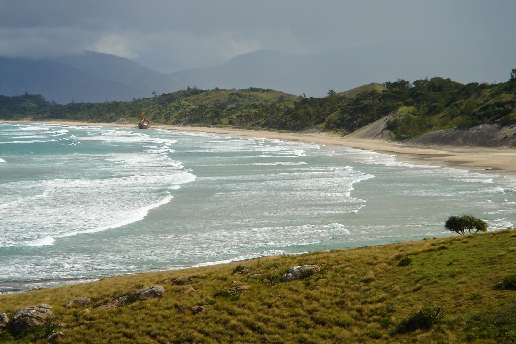
Surf rolling onto a long sandy beach below grassy slopes, with a shipwreck offshore and cloud-covered mountains behind

Madagascar

Isalo, Toliara & the South

A beach on the coast at Fort Dauphin, where the southern mountains meet the Indian Ocean. (krishna naudin / Wikimedia Commons · CC BY-SA 2.0)

The hot, dry south and south-west of Madagascar, from Morondava's baobabs through the port of Toliara and the reef-sheltered fishing villages of Ifaty and Anakao to the spiny forest of the far south and Fort Dauphin on the south-east corner — land of the Sakalava, Vezo, Mahafaly, Antandroy and Antanosy, reached by the RN7 past the Isalo massif.

Explore Isalo, Toliara & the South

History

The south-west was settled by peoples who became the Vezo fishers of the coast, the Masikoro farmers and herders inland, and the Mahafaly and Antandroy of the dry far south, with the Antanosy around Fort Dauphin. In the 17th century the Sakalava founded the kingdom of Menabe, around the Tsiribihina and Morondava rivers, and from there expanded north; the Sakalava of Menabe still honour their royal ancestors.

Europeans arrived early. Portuguese sailors reached the south-east coast in the 16th century, and in 1643 the French East India Company founded Fort Dauphin, whose governor Étienne de Flacourt wrote the first detailed European account of the island; conflict with the Antanosy led to its abandonment in 1674. Toliara, founded near St Augustine's Bay, later became a port for European traders.

The south resisted the Merina, who never fully controlled it, and the French conquered it only in the early 20th century. Under colonial rule, the prickly pear cactus that sustained Antandroy cattle through dry seasons was wiped out in the 1920s by an introduced insect, causing famine. Since independence, repeated droughts, known as kere, have brought hunger to the far south, most recently in the early 2020s. A mineral sands mine near Fort Dauphin and tourism along the RN7 are the main modern investments.

Culture & Customs

The south is the most distinctive part of Madagascar culturally. The Vezo are defined by their way of life, fishing from pirogues under sail and paddle and moving along the coast with the seasons. The Mahafaly and Antandroy build large stone tombs topped with carved wooden posts called aloalo, which often tell the story of the dead person's life, and the skulls of zebu sacrificed at the funeral; a wealthy family's funeral can last days and consume many cattle.

Zebu are the measure of wealth and status among the Bara, Mahafaly and Antandroy, and cattle raiding was once a rite of passage for young men before it became organised crime. Among the Sakalava of Menabe, royal relics are honoured in the fitampoha ceremony in Belo-sur-Tsiribihina, held at intervals of several years.

Religion blends Christianity with strong ancestral belief, and fady are strict: certain foods, places and days are forbidden to certain clans. Tsapiky, a fast guitar-led music, comes from the south-west around Toliara and is played at celebrations and funerals.

Daily Life

Toliara, with about 170,000 people, is the region's city and port. Morondava, Fort Dauphin (Tolagnaro), Ambovombe, Belo-sur-Tsiribihina, Sakaraha and Betioky are the other main towns, and much of the rural population lives in scattered villages far from paved roads.

The economy rests on cattle, fishing, cassava, maize and sweet potatoes in the dry south, rice in the river valleys of Menabe, sisal around Amboasary, and mining, including the mineral sands mine near Fort Dauphin and sapphire diggings around Sakaraha. Tourism centres on Isalo, Ifaty, Anakao, Morondava and Fort Dauphin.

Life is shaped by water: in the far south, people may walk long distances to find water, and in drought years many migrate north in search of work. Deforestation for charcoal and farming threatens the spiny forest, and insecurity from dahalo raids weighs heavily on rural communities.

Food

Rice is less dominant here than anywhere else in Madagascar. In the dry south, cassava, maize and sweet potato are staples, eaten boiled, pounded or grilled, and the fruit of the prickly pear, where it grows again, is still an important food in lean seasons. Zebu meat is eaten mainly at funerals and ceremonies, when cattle are sacrificed, and sour milk and curds are traditional foods of the herding peoples.

On the coast, the Vezo live on fish, octopus, squid, crab and sea urchins, grilled or cooked with coconut or tomato, and dried and salted fish is traded inland.

Tamarind flavours juices and sweets, and on the west coast the fruit of the baobab is eaten in the short season when it ripens, near the end of the rains.

Attractions & Natural Wonders

Along the RN7, Isalo National Park, just across the line in the Ihorombe region but approached on the road to Toliara, is a sandstone massif of canyons, natural swimming pools and palm oases around Ranohira. Further on, Zombitse-Vohibasia National Park protects dry forest with birds and lemurs.

Toliara is the base for the coast. To the north, Ifaty and Mangily have beaches behind the reef, snorkelling and the spiny forest of the Reniala reserve, with baobabs and octopus trees. To the south, Anakao, reached by boat, has Vezo villages and the island of Nosy Ve, with red-tailed tropicbirds, while Lake Tsimanampetsotsa, an alkaline lake with flamingos, lies further south.

In the far south, the spiny forest reaches its most striking form around Cap Sainte-Marie, the island's southernmost point, and near Amboasary, where the Berenty reserve shelters ring-tailed lemurs and sifakas along the Mandrare river. Fort Dauphin sits on a peninsula with beaches and mountains behind the town, and Andohahela National Park, which spans rainforest and spiny forest.

In the west, Morondava's Avenue of the Baobabs is the island's best-known view, and Kirindy forest, to the north, is known for the fossa. Beyond the Tsiribihina, the Tsingy de Bemaraha, a UNESCO World Heritage Site of limestone pinnacles and gorges, lies just over the region's northern boundary in Melaky and is reached by track from Morondava.

Cities in Isalo, Toliara & the South

Planning basics

Budget

The south is inexpensive on the ground, with cheap guesthouses in Toliara, Morondava and Fort Dauphin and simple beach bungalows in the Vezo villages. Distances drive up the cost: a 4x4 with driver on the RN7 or the Bemaraha track, boat transfers to Anakao and flights to Fort Dauphin are the main expenses, and Isalo has some upmarket lodges. Cash machines exist in Toliara, Morondava and Fort Dauphin; elsewhere carry cash.

Daily Budget Midrange
USD 80–210 (lodge or beach hotel, 4x4 with driver, park fees and guides, boat transfers)
Daily Budget Shoestring
USD 25–40 (guesthouse or bungalow, hotely meals, taxi-brousse)

Arrange the Bemaraha trip and the Anakao boat through established operators and settle all prices before setting out.

Safety

The south has the most serious security problems in Madagascar for travellers. Dahalo cattle-raiding gangs are active in rural areas, highway robbery has occurred on the RN7 and southern roads, and theft is common in Toliara after dark. Drought and hunger affect the far south. Add strong currents on exposed beaches, extreme heat, rough tracks and malaria.

Travel only in daylight with a reputable driver or guide, avoid remote tracks without local advice, and carry plenty of water. Check current official travel advice before travelling.

Climate

The driest part of Madagascar. Toliara and the south-west coast receive little rain, the far south is semi-arid and prone to long droughts, and the west around Morondava has a short, heavy rainy season. Summers are very hot, often above 35°C inland, while winter nights on the Isalo plateau can be cold. Fort Dauphin, facing the trade winds, is greener, wetter and windier.

Summer
very hot, 28–38°C, with short heavy rains mainly from December to March
Winter
warm and dry by day, 24–28°C, with cool nights inland down to about 10°C

Transportation

The RN7 runs from Fianarantsoa through Ihosy and Ranohira, for Isalo, to Toliara, a journey of two or three days from Antananarivo. Toliara, Morondava and Fort Dauphin have flights to the capital. Ifaty lies north of Toliara by road, Anakao is about an hour away by boat, and Morondava is reached by road from Antsirabe. The track from Morondava to Bemaraha crosses rivers by ferry and takes a full day. Fort Dauphin is most easily reached by air.

Fly into Fort Dauphin or Toliara rather than driving the southern roads, and never travel between towns after dark.

Best Time to Visit

April to November is the main season. The Tsingy de Bemaraha and the tracks north of Morondava are usually open only in the dry months, roughly June to November, and the Avenue of the Baobabs is best in the dry season light. Humpback whales visit the waters off the south coast. The hot rainy months can cut tracks and make Isalo hikes gruelling.