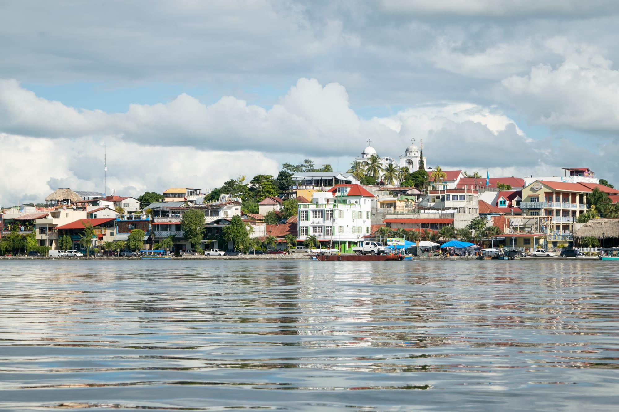
Colourful hotels and houses along a waterfront, with a white twin-domed church on the hilltop, seen across calm lake water

Guatemala

Tikal, the Verapaces & the Caribbean

The island town of Flores seen from Lake Petén Itzá in Petén. (Edgouno / Wikimedia Commons · CC BY-SA 4.0)

Northern and eastern Guatemala, from the rainforests and Maya cities of Petén through the misty Q'eqchi' hills of Alta and Baja Verapaz to Lake Izabal, the Río Dulce and the Garífuna town of Lívingston on the Caribbean — the country's wildest and least populated region.

Explore Tikal, the Verapaces & the Caribbean

History

Petén was the heart of the Classic Maya world. El Mirador, in the far north, grew into a huge city centuries before the Christian era, with some of the largest pyramids the Maya ever built, and Tikal became one of the dominant powers of the Classic period, locked for generations in rivalry with Calakmul, in today's Mexico. Uaxactún, Yaxhá, Piedras Negras and the Petexbatún cities such as Dos Pilas and Aguateca also flourished before the lowland collapse around the ninth century. Quiriguá, in the Motagua valley of Izabal, raised the tallest carved stelae in the Maya world.

The Itza Maya kingdom, ruling from Nojpetén on the island where Flores stands, held out against the Spanish until 1697, making it the last independent Maya kingdom to fall. In the Verapaces, Dominican friars led by Bartolomé de las Casas brought the Q'eqchi' and Achi highlands under Spanish rule in the 16th century largely through missionary work rather than military conquest, and the land of war was renamed Verapaz, true peace. The Castillo de San Felipe was built on the Río Dulce to keep pirates out of Lake Izabal.

In the late 19th century German planters built a coffee economy around Cobán, and in the 20th century the United Fruit Company ran banana plantations in Izabal, exported through Puerto Barrios. The civil war left deep scars: the army killed Q'eqchi' protesters at Panzós in 1978, and massacres followed at Río Negro in Baja Verapaz and Dos Erres in Petén in the early 1980s. To the east, Guatemala has long claimed part or all of neighbouring Belize; the two countries have taken the dispute to the International Court of Justice, and Petén's border with Belize is managed as a line of adjacency pending its ruling.

Culture & Customs

The Verapaces are Q'eqchi' Maya country, and Q'eqchi', one of the most widely spoken Maya languages, has spread with migrants into Petén and Izabal. Poqomchi' is spoken around Tactic and San Cristóbal Verapaz, and the Achi live around Rabinal and Salamá in Baja Verapaz. Rabinal is the home of the Rabinal Achí, a pre-Hispanic dance-drama recognised by UNESCO as intangible heritage. Cobán hosts the Rabin Ajaw, an annual Maya festival and pageant.

The Caribbean coast is Garífuna, an Afro-Indigenous people descended from West Africans and Carib and Arawak islanders of St Vincent, whom the British deported to the island of Roatán, off Honduras, in 1797. Lívingston is their centre in Guatemala, where Garifuna, Spanish and some Q'eqchi' are spoken side by side. Garífuna language, dance and music are recognised by UNESCO, and punta dancing and drumming are central to the town's life.

Petén's people are largely Ladino, many of them settlers who arrived from the south from the 1960s onwards, alongside small Itza and Mopán Maya communities. Along the lake, the village of San José keeps up efforts to preserve the Itza language.

Daily Life

This is Guatemala's frontier. Petén covers roughly a third of the national territory but holds only a small share of its people, concentrated around Flores, Santa Elena and San Benito on Lake Petén Itzá. Cobán is the main town of the Verapaces, and Puerto Barrios, with neighbouring Santo Tomás de Castilla, is the country's main Caribbean port.

Alta Verapaz is a major cardamom-growing area, alongside coffee, and the region's lowlands have seen rapid expansion of cattle ranching and oil palm, often at the expense of forest. The Maya Biosphere Reserve protects much of northern Petén, but illegal clearing, fires and trafficking press on its edges. El Estor, on Lake Izabal, has a large nickel mine that has been the focus of long protests by Q'eqchi' communities, and land conflicts are common across the Verapaces.

Poverty is high in rural Alta Verapaz, where many Q'eqchi' families farm maize on small plots and speak little Spanish. Tourism centres on Flores, Lanquín, the town of Río Dulce and Lívingston, and life follows the heat, starting early and slowing through the afternoon.

Food

Cobán's signature is kak'ik, a spicy red turkey soup coloured with achiote and chillies, which Guatemala has declared part of its intangible cultural heritage. The Verapaces also produce cardamom, coffee and cacao, and markets sell tamales steamed in leaves.

The Caribbean kitchen is Garífuna. Tapado, a seafood soup of fish, crab, shrimp and plantain in coconut milk, is Lívingston's defining dish, and hudutu, fish in coconut broth with mashed plantain, is also cooked. Cassava bread and coconut bread are staples.

In Petén the lake provides fish, and the forests have long supplied chicle, gathered from wild trees. Flores has restaurants along the waterfront serving lake fish, grilled meats and tortillas.

Attractions & Natural Wonders

Tikal, a UNESCO World Heritage Site, rises out of the forest of Tikal National Park: the Great Plaza between Temples I and II, the North and Central Acropolises, the Lost World complex and the view over the canopy from Temple IV, with howler and spider monkeys, toucans and coatis. Uaxactún, Yaxhá and its lakes, and the long trek to El Mirador's La Danta pyramid extend the Maya circuit. Flores, a small island town linked by causeway to the shore, is the base, with boat trips on Lake Petén Itzá.

In Alta Verapaz, Semuc Champey is a natural limestone bridge where the Río Cahabón vanishes underground beneath a staircase of turquoise pools; the Lanquín caves lie nearby. Cobán has orchid nurseries and coffee farms, and its cloud forests continue into Baja Verapaz at the Biotopo del Quetzal, where quetzals can sometimes be seen, and the Chilascó waterfall.

In Izabal, the town of Río Dulce stands where the river leaves Lake Izabal, the largest lake in Guatemala, with the Castillo de San Felipe beside it. Boats descend the Río Dulce through a gorge of limestone cliffs and forest to Lívingston's Garífuna coast, with the Siete Altares waterfalls nearby. Inland, the stelae and zoomorphic sculptures of Quiriguá stand in a UNESCO-listed park among banana plantations.

Cities in Tikal, the Verapaces & the Caribbean

Planning basics

Budget

Costs are close to the national average. Flores has hostels and hotels for every budget, but Tikal's entry fee, guided tours and sunrise permits add up, and multi-day El Mirador treks are costly. Lodges around Lanquín and Semuc Champey are mostly simple and inexpensive, while boat trips on the Río Dulce and to Lívingston are a notable extra.

Daily Budget Midrange
USD 65–130 (lakeside or jungle lodge, guided Tikal visit, private boats)
Daily Budget Shoestring
USD 25–45 (hostel in Flores or Lanquín, comedor meals, shared shuttles and colectivos)

Pay the Tikal entrance fee in advance where required, and carry cash to Lanquín and Lívingston, where cash machines are few or unreliable.

Safety

The tourist circuit of Flores, Tikal, Lanquín and the Río Dulce is generally calm. Remote parts of northern and western Petén, including the Laguna del Tigre and Sierra del Lacandón national parks, are used by drug traffickers and illegal ranchers, and land and mining disputes, notably around El Estor, have led to protests and states of emergency. The rivers at Semuc Champey and Lanquín have strong currents, and robberies of boats and yachts on the Río Dulce have occurred.

Visit remote Petén sites only with licensed guides, heed the swimming limits at Semuc Champey, and keep valuables secure on boats and in Lívingston at night. Check current official travel advice before travelling.

Climate

Petén and Izabal are tropical lowlands, hot and humid all year, with heavy rain from about June to November and the Caribbean coast wet in most months. The Verapaces sit higher and are cooler, and Cobán is known for its persistent fine drizzle, called chipi-chipi, which keeps the cloud forests green. Hurricanes and tropical storms can bring flooding in the wet season.

Summer
wet season: 28–35°C and very humid in Petén and Izabal; 18–25°C and misty in Cobán
Winter
dry season: hot and sunny in Petén from about February to May; mild and damp in the Verapaces

Transportation

Flores has the region's airport, about an hour's flight from Guatemala City, and overnight buses make the long road trip. Shuttles link Flores with Tikal in about an hour and a half and with the Belize border at Melchor de Mencos. Cobán is a few hours from the capital by road, and Lanquín is reached down a rough road from Cobán, with pickups onward to Semuc Champey. Lívingston is reached by boat from Puerto Barrios or from the town of Río Dulce.

Allow a full day for the road between Lanquín and Flores, and travel with shuttles rather than at night.

Best Time to Visit

The dry months from about February to April are the best for Tikal and essential for the El Mirador trek, whose trails turn to deep mud in the rains. The Verapaces are pleasant all year but greenest in the wet season. Holy Week draws domestic crowds to Flores, Río Dulce and the beaches.