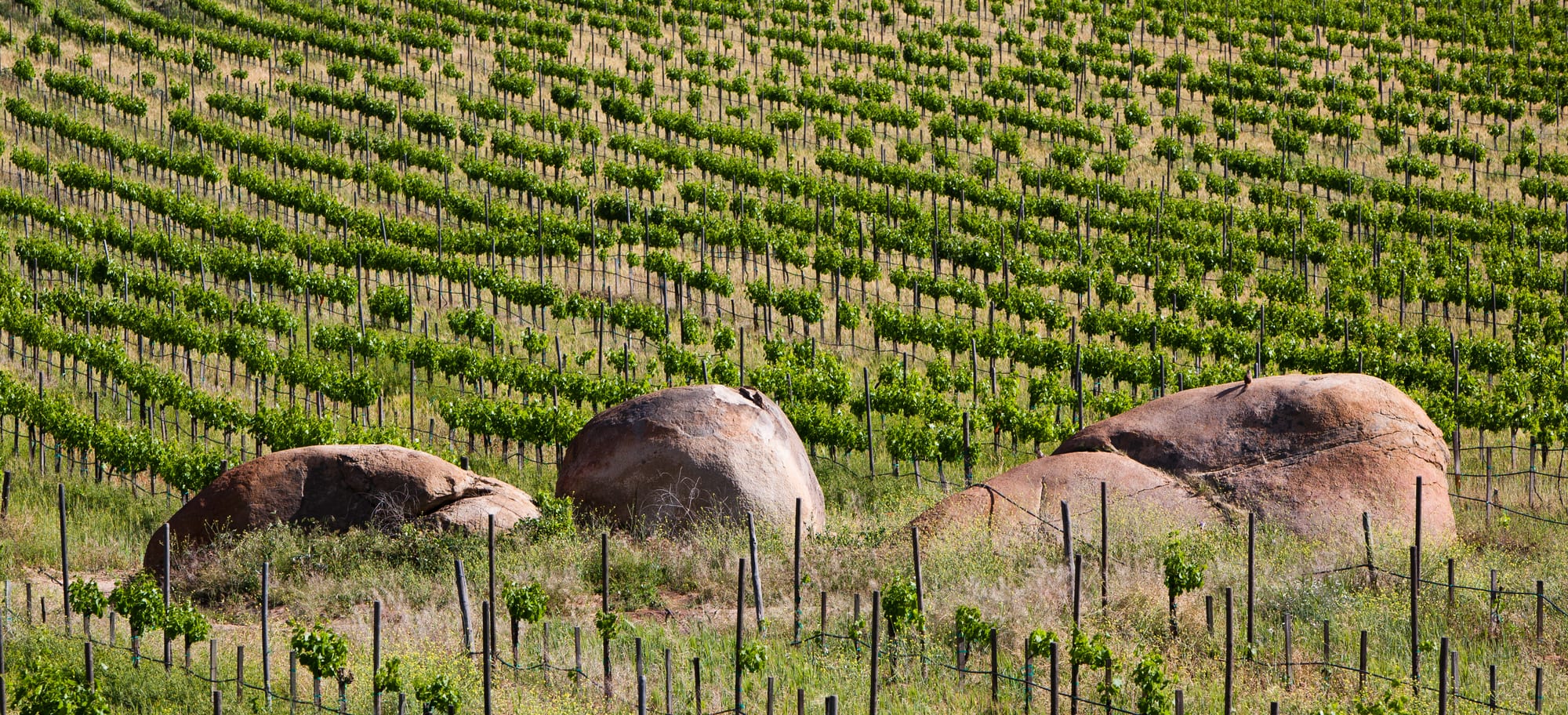
Rows of green grapevines on a sunny slope, with three large rounded granite boulders among the vines

Mexico

Baja California

Vineyards and granite boulders in the Valle de Guadalupe, Mexico's main wine valley, inland from Ensenada in Baja California. (Tomascastelazo / Wikimedia Commons · CC BY-SA 3.0)

The long, narrow peninsula of Mexico's far northwest, divided into the states of Baja California and Baja California Sur — a land of desert, mountain ranges and two coasts, running from the border city of Tijuana and the Ensenada wine valleys down to the whale lagoons, La Paz and the resorts of Los Cabos.

Explore Baja California

History

The peninsula's first peoples were hunters and gatherers — Cochimí, Guaycura and Pericú in the south and centre, Kumiai, Cucapá, Pai Pai and Kiliwa in the north — who left thousands of painted figures of people, deer and whales in the rock shelters of the Sierra de San Francisco. Spanish expeditions reached the coast from the 1530s, and for a time Europeans believed California to be an island, but the dry land defeated early settlement.

Lasting colonisation came through the Jesuits, who founded the mission of Loreto in 1697 and built a chain of missions down and up the peninsula. European diseases devastated the Indigenous population within a few generations. After the Jesuits were expelled in 1767, Franciscans and then Dominicans took over, and the Dominicans extended the missions north towards the frontier with Alta California, which was lost to the United States in 1848.

The region stayed thinly peopled into the 20th century. Tijuana grew during US Prohibition as a destination for Californians seeking drink, gambling and racing, Mexicali grew on cotton irrigated from the Colorado River, and Russian Molokan families settled the Guadalupe valley in the early 1900s. Baja California became a state in 1952 and Baja California Sur in 1974. Since then maquiladora factories have made Tijuana one of Mexico's largest cities, the paved Transpeninsular Highway opened in 1973, and Los Cabos has grown from fishing villages into one of the country's main resort areas.

Culture & Customs

Baja is young, mobile and closely tied to California. Many people in Tijuana and Mexicali have family on both sides of the border, and daily crossings for work, school and shopping shape life in the north; English and US dollars are common. The population is largely made up of migrants from elsewhere in Mexico, so regional identity is newer here than in the colonial heartland, and Tijuana in particular has a reputation for experiment in food, music and art, from its craft-beer scene to the Nortec electronic music collective.

Older layers survive. The Kumiai, Pai Pai, Kiliwa and Cucapá keep their languages and crafts in small communities in the north, and tens of thousands of migrants from Oaxaca have settled in the state. Mexicali's La Chinesca is Mexico's largest Chinese enclave, a community that grew with the cotton boom. Ensenada's Russian heritage lives on in small family museums in the Guadalupe valley.

In the south the culture is quieter, built around ranching, fishing and the old mission towns, and people from Baja California Sur are called sudcalifornianos. The calendar includes the Ensenada carnival, one of the country's largest, and the wine harvest festivities of Valle de Guadalupe in August.

Daily Life

About four million people live in Baja California and under a million in Baja California Sur. Tijuana, with around two million in its municipality, is the largest city, followed by the state capital Mexicali; Ensenada and, in the south, the capital La Paz and Los Cabos each have a few hundred thousand.

The northern economy runs on factories producing medical devices, electronics and cars for the US market, plus farming in the Mexicali and San Quintín valleys and wine around Ensenada. Tijuana's border crossing at San Ysidro is among the busiest land crossings in the world, and queues are part of many people's week. The south lives mainly from tourism, fishing and government work, with Los Cabos drawing workers from across Mexico.

Current issues include water: the peninsula is desert, and cities depend on the Colorado River, wells and desalination. Housing costs in Los Cabos and around the vineyards are rising, and migrants waiting to cross into the United States are a constant presence in Tijuana's shelters.

Food

Baja's cooking comes from the sea and the border. The fish taco — battered white fish in a corn tortilla with cabbage, crema and salsa — originated in Baja California, and shrimp tacos, tostadas of fresh ceviche and cocteles de mariscos, seafood cocktails served in a glass, are sold from stands along the coast. La Paz is known for clams, pickled, breaded and fried, or stuffed.

Tijuana gave the world the Caesar salad, created at Caesar Cardini's restaurant in the 1920s, and today it is known for Baja-Med cooking, which mixes Mexican ingredients with Mediterranean and Asian techniques. Mexicali's Chinese-Mexican restaurants are a local institution, and across the north flour tortillas and grilled beef show the influence of neighbouring Sonora.

Valle de Guadalupe produces most of Mexico's wine, with reds from Cabernet Sauvignon, Merlot and Tempranillo grapes; Bodegas Santo Tomás, south of Ensenada, founded in 1888, is the country's oldest winery in continuous operation. Craft beer is brewed across Tijuana and Ensenada, and in the south the herb damiana flavours food and a traditional liqueur.

Attractions & Natural Wonders

In the north, Tijuana offers the Avenida Revolución, the Centro Cultural Tijuana and its markets, and the beach at Playas de Tijuana. Ensenada, about 100 km south, is a port with a fish market and, nearby, the La Bufadora blowhole; inland lies the Valle de Guadalupe wine route. The Sierra de San Pedro Mártir National Park, with the peninsula's highest peak and an astronomical observatory, rises further south.

The centre is a desert of cardón cacti, the world's largest cactus species. At Guerrero Negro, on the state line, grey whales arrive each winter to breed in the Ojo de Liebre lagoon, and San Ignacio lagoon further south, a breeding ground for grey whales, is part of the El Vizcaíno Whale Sanctuary, a UNESCO World Heritage Site. The rock paintings of the Sierra de San Francisco are also UNESCO-listed, and the mission towns of San Ignacio, Mulegé and Loreto have old stone churches. Bahía Concepción has sheltered beaches along the Sea of Cortez.

La Paz sits on a wide bay, with the islands of Espíritu Santo, home to sea lions, a short boat ride away and whale sharks offshore in season; the islands of the Gulf of California are protected as a UNESCO World Heritage Site. Todos Santos is an artists' town on the Pacific side. Los Cabos ends the peninsula: Cabo San Lucas with its marina and El Arco, San José del Cabo's old centre, and the coral reef of Cabo Pulmo National Park on the east cape.

Cities in Baja California

Planning basics

Budget

The peninsula is one of Mexico's more expensive regions. Los Cabos is priced for US visitors, with resort rates and dollar menus, and Valle de Guadalupe's wineries and restaurants are costly too. Tijuana, Ensenada, La Paz and the small towns of the Sur are far cheaper, and roadside taquerías keep costs down anywhere. Long distances make fuel or bus fares a real part of the budget.

Daily Budget Midrange
USD 110–250 (mid-range hotels, a hire car, boat trips, winery tastings; far more in Los Cabos)
Daily Budget Shoestring
USD 40–70 (hostels or simple hotels, taquerías and fish-taco stands, long-distance buses)

Pay in pesos rather than dollars in Los Cabos to avoid poor exchange rates, and base whale and wine trips in Ensenada, La Paz or Loreto rather than the resorts.

Safety

The two states differ. Baja California Sur, including Los Cabos, La Paz and Loreto, is among the safer parts of Mexico, with petty theft and sea and heat hazards the main concerns. Baja California has high levels of organised-crime violence, especially in Tijuana, where homicide rates are among the highest in the country; most of the violence involves organised crime, but visitors can be caught up in it.

In Tijuana keep to busy central areas by day, use app-based taxis, and avoid driving at night between towns anywhere on the peninsula. Check current official travel advice before travelling.

Climate

Most of the peninsula is desert, hot and very dry, but the northwest corner around Tijuana and Ensenada has a Mediterranean climate like southern California's, with mild wet winters and foggy early summers. The Gulf coast and Los Cabos are hot and humid in late summer, and the south is exposed to Pacific hurricanes, mostly in September and October.

Summer
mild and often grey near Tijuana and Ensenada, 20–28°C; very hot inland and on the Gulf coast, often above 40°C around Mexicali
Winter
mild and sunny in the south, 15–27°C; cool and occasionally wet in the northwest, with frost in the mountains

Transportation

International and domestic flights serve Tijuana, Los Cabos, La Paz and Loreto, and a cross-border bridge links San Diego directly to Tijuana airport. Federal Highway 1, the Transpeninsular, runs some 1,700 km from Tijuana to Cabo San Lucas, with long empty stretches between towns; buses cover it, but most visitors drive or fly between the two ends. Car ferries link La Paz with Mazatlán and Topolobampo on the mainland.

Drive by day, fill up at every chance on the central stretch, and carry Mexican car insurance if bringing a vehicle from the US.

Best Time to Visit

November to May suits most of the peninsula: the grey whales are in the lagoons from about January to March, whale sharks gather near La Paz in the cooler months, and Los Cabos is dry and warm. August and September bring the grape harvest and wine festivals in Valle de Guadalupe, but also heat and hurricane risk further south.