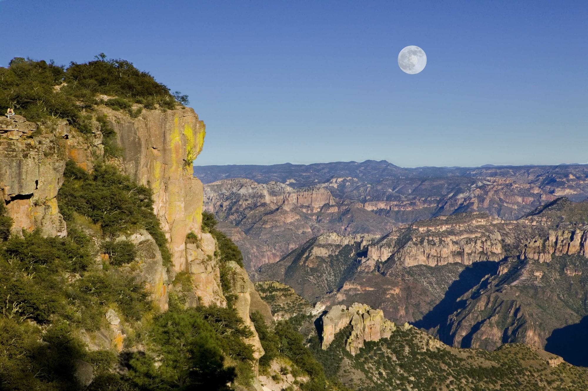
Layered canyon walls and forested ridges stretching to the horizon beneath a full moon in a clear blue sky

Mexico

Sonora, Chihuahua & the Northwest

The Copper Canyon from Divisadero, in the Sierra Tarahumara of Chihuahua. (Comisión Mexicana de Filmaciones / Wikimedia Commons · CC BY-SA 2.0)

Mexico's big northwestern states — Sonora, Chihuahua, Sinaloa and Durango — reaching from the US border and the Sonoran desert across the Sierra Madre Occidental and its Copper Canyon to the Pacific coast at Mazatlán; a land of ranching, mining, irrigated farms, Rarámuri villages and the heartland of Pancho Villa's revolution.

Explore Sonora, Chihuahua & the Northwest

History

People farmed and traded across the northwest long before the Spanish came. Paquimé, near Casas Grandes in Chihuahua, flourished roughly between the 13th and 15th centuries as a trading town of adobe apartment blocks, macaw pens and ball courts, linking Mesoamerica with the Pueblo world to the north. Later the Rarámuri, Yaqui, Mayo, Seri, O'odham and many smaller peoples held the mountains, river valleys and deserts.

Spanish settlement followed silver. Durango was founded in 1563 as capital of the province of Nueva Vizcaya, and mines at Parral, Santa Bárbara and Álamos drew settlers up the Camino Real de Tierra Adentro, the royal road north to New Mexico. Jesuit missionaries, among them Eusebio Kino in Sonora, founded missions from the late 1600s, while Yaqui risings and Apache raids kept the frontier unstable into the late 19th century. After independence the war with the United States and the Gadsden Purchase of 1853 moved the border south to its present line.

The Revolution was largely won in the north. Pancho Villa, born in Durango, led his División del Norte from Chihuahua, and Sonorans — Álvaro Obregón and Plutarco Elías Calles — went on to rule the country in the 1920s. The 20th century brought dams and irrigation that turned the Sinaloa and Sonora valleys into major farmland, border factories to Ciudad Juárez and Nogales, the Chihuahua al Pacífico railway through the Copper Canyon in 1961, and, from the 1970s, the rise of drug trafficking networks whose violence has marked the region since.

Culture & Customs

Norteño identity is strong here: cowboy hats and boots, ranch culture, directness and a reputation for plain speaking and hospitality. Music is the clearest marker. Sinaloa is the home of banda, brass bands with tuba and clarinets, while accordion-led norteño music is popular across the region, and modern corridos, some celebrating traffickers and banned from airplay, have found a huge audience in Mexico and the United States.

Indigenous cultures remain visible. The Rarámuri of the Sierra Tarahumara, famous for long-distance running, keep their own language, dress and Holy Week ceremonies; the Yaqui of southern Sonora perform the deer dance, and the Seri, or Comcaac, carve ironwood figures on the desert coast. Mennonite farmers, who arrived from Canada in the 1920s, run large farms around Cuauhtémoc in Chihuahua and still speak Plautdietsch, a Low German dialect.

Carnival in Mazatlán, held since the 19th century, is one of the largest in Mexico, and Durango's film heritage, from Hollywood westerns shot in its deserts, is celebrated in its museums and old sets. Baseball rivals football in Sonora and Sinaloa, where teams play through the winter league.

Daily Life

Around 12 million people live in the four states. Ciudad Juárez, with about 1.5 million, is the largest city; Chihuahua, Hermosillo and Culiacán each have close to a million, and Durango, Mazatlán, Ciudad Obregón and Los Mochis follow. The rest is sparsely settled, especially the deserts and the sierra.

The economy is varied. Border factories in Juárez and Nogales make electronics and car parts for US markets, Hermosillo has a large Ford plant, and mining for gold, silver and copper continues across Sonora, Chihuahua and Durango. The Sinaloa and Sonora valleys grow tomatoes, wheat and vegetables for export, and Mazatlán lives on its port, fishing fleet and tourism.

Life follows the heat: early starts, air conditioning, and evenings on the malecón in Mazatlán or in the plazas of the capitals. Water shortages are a constant issue in the desert cities, and violence linked to organised crime affects daily routines in parts of the region.

Food

The northwest is beef and wheat country. Sonoran carne asada, grilled over mesquite, is eaten with large, thin flour tortillas and salsas, and machaca, dried shredded beef, is scrambled with eggs for breakfast. Hermosillo is known for its hot dogs wrapped in bacon and piled with beans and salsa, and for coyotas, thin pastries filled with piloncillo, a dark unrefined sugar.

Chihuahua's Mennonite communities make a mild melting cheese, sold as queso menonita or queso Chihuahua, and the state is known for dishes in red chile colorado sauce and for burritos, often linked to Ciudad Juárez. Durango's caldillo is a beef and chile stew.

The Sinaloa coast is a seafood kitchen. Aguachile, raw shrimp cured in lime and chilli with cucumber and red onion, comes from here, along with chilorio, pork cooked in a chilli sauce and shredded, and shrimp from Mazatlán's fleet. To drink there is bacanora, an agave spirit from Sonora, sotol, distilled from the desert spoon plant in Chihuahua and Durango, and Pacífico beer, brewed in Mazatlán since 1900.

Attractions & Natural Wonders

The Copper Canyon, a network of gorges deeper in places than the Grand Canyon, is the region's centrepiece. The El Chepe railway crosses it between Chihuahua and Los Mochis, and the main stop at Divisadero has rim-top views and an adventure park with cable car; Creel is the base for Rarámuri villages, Lake Arareko and valleys of rock formations, and Basaseachi Falls drops more than 200 metres to the north. The old mining town of Batopilas lies at the bottom of a canyon.

Chihuahua itself has a cathedral, murals of the state's history in the government palace, and Pancho Villa's house, now a museum of the Revolution. Further north, Paquimé at Casas Grandes is a UNESCO World Heritage Site. Durango has a colonial centre on the Camino Real de Tierra Adentro, film sets in the desert outside the city, and the Mapimí biosphere reserve.

Sonora is the Sonoran desert: saguaro and organ-pipe cacti, the craters and dunes of El Pinacate y Gran Desierto de Altar, and the coast at Puerto Peñasco. Further south, San Carlos near Guaymas has beaches and scuba diving, and Álamos is a well-preserved colonial silver town. On the Pacific, Mazatlán offers its historic centre with the Ángela Peralta theatre, the malecón, the El Faro lighthouse and beaches north of town.

Cities in Sonora, Chihuahua & the Northwest

Planning basics

Budget

The northwest is generally cheaper than the resort zones and similar to central Mexico. Mazatlán and San Carlos have a range of beach hotels at moderate prices, and city hotels in Chihuahua, Hermosillo and Durango are good value. The big costs are distance and the Copper Canyon: the train's first-class carriages and the canyon-rim lodges are priced for visitors.

Daily Budget Midrange
USD 80–180 (mid-range hotels, restaurants, first-class buses or flights, canyon lodges and tours)
Daily Budget Shoestring
USD 30–50 (budget hotels, taquerías and markets, second-class buses and El Chepe's economy class)

Break the Copper Canyon journey at Creel or Divisadero rather than riding end to end in a day, and book lodges ahead in the autumn and holiday weeks.

Safety

This is one of the parts of Mexico most affected by organised-crime violence, and conditions vary by state and district. Several of these states carry strict foreign government travel advisories. Since late 2024 a violent split within Sinaloa's main criminal organisation has brought heavy fighting to Culiacán and nearby areas; Ciudad Juárez, the border towns and remote parts of the Sierra Tarahumara also see serious violence. Mazatlán, central Chihuahua city and the main Copper Canyon stops receive visitors, but the situation can change quickly.

Check the state-by-state advisory for each place on the route, avoid remote roads and night travel, stay on the main tourist circuit in the canyon, and use registered taxis or apps. Check current official travel advice before travelling.

Climate

Deserts and mountains set the pattern. The Sonoran lowlands, Hermosillo and the Chihuahuan plains are among the hottest places in Mexico in summer, while the high Sierra Madre is cool, with frost and occasional snow in winter. The canyon floors stay warm all year. The Sinaloa coast is hot and humid in summer, with a rainy season from July to September and a risk of Pacific hurricanes.

Summer
very hot in the deserts, often above 40°C around Hermosillo; mild in the sierra, 20–28°C, with afternoon storms; humid, 30–35°C, in Mazatlán
Winter
mild and sunny on the coast, 18–26°C; cold nights and frost in the sierra and in Chihuahua and Durango, with occasional snow

Transportation

Distances are large, and most travel is by first-class bus or by air to Chihuahua, Hermosillo, Culiacán, Mazatlán, Durango or Los Mochis. El Chepe is the region's passenger railway, running between Los Mochis and Chihuahua through the Copper Canyon. A toll highway links Mazatlán and Durango across the Sierra Madre by a long series of bridges and tunnels, and ferries cross the Sea of Cortez to Baja California.

Travel between cities by day on toll roads, and treat the canyon roads beyond Creel with caution, taking local advice before going deeper into the sierra.

Best Time to Visit

October to April suits the deserts and the coast, and Mazatlán's carnival falls in February or March. For the Copper Canyon, October and November bring clear skies after the rains and full waterfalls, and March and April are also good; winter nights on the rim are cold. Mid-summer is too hot for the lowlands but green in the sierra.