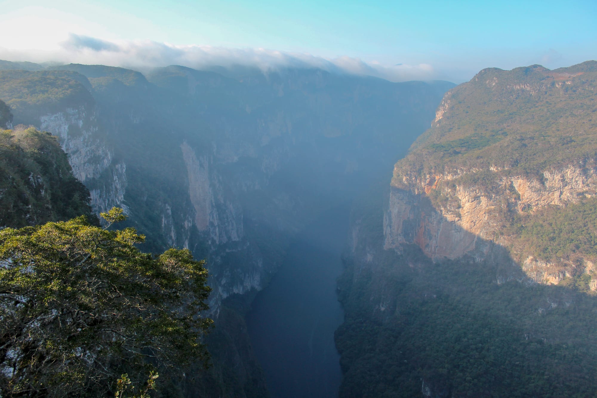
A deep gorge with sheer forested cliffs on both sides and a river far below in morning haze

Mexico

Chiapas

The Sumidero Canyon in Chiapas, seen from the last of the viewpoints along its rim. (AnbyG / Wikimedia Commons · CC BY-SA 4.0)

Mexico's southernmost state, on the Guatemalan border, rising from the Pacific plain of the Soconusco to cool Maya highlands and falling again to the rainforest of the Lacandon jungle — home of the Classic Maya city of Palenque, the colonial town of San Cristóbal de las Casas and the 1994 Zapatista uprising.

Explore Chiapas

History

Chiapas lay on the western edge of the Maya world. Izapa, near Tapachula, was an early ceremonial centre, and in the Classic period Palenque rose in the northern foothills; under Pakal, who ruled from 615 to 683, and his sons it built the Temple of the Inscriptions and the Palace, and Pakal's jade-masked tomb was found inside the temple in 1952. Along the Usumacinta, Yaxchilán and Bonampak flourished, and Toniná near Ocosingo was among the last Maya cities to raise dated monuments. The central valleys were home to the Zoque and the Chiapa people, who gave the state its name.

The Spanish subdued the region in the 1520s, founding Ciudad Real, today's San Cristóbal, in 1528. The Dominican friar Bartolomé de las Casas, who became bishop of Chiapas in the 1540s, argued in Spain for the rights of Indigenous people, and the town now carries his name. For the colonial era Chiapas was governed from Guatemala, and it chose to join Mexico in 1824; the Soconusco, disputed with Guatemala, was settled by treaty in 1882. In the late 19th century German and other immigrants set up coffee plantations in the Soconusco worked by highland Maya labourers, and Tuxtla Gutiérrez replaced San Cristóbal as capital in 1892.

On 1 January 1994, the day the North American Free Trade Agreement took effect, the Zapatista Army of National Liberation (EZLN), a mostly Maya rebel movement, briefly seized San Cristóbal and other towns, demanding land, autonomy and Indigenous rights. Fighting lasted about twelve days before a ceasefire; the San Andrés Accords of 1996 were only partly carried out, and in 1997 paramilitaries killed 45 Tzotzil villagers at Acteal. Zapatista communities have since run their own autonomous schools and clinics in parts of the highlands and jungle.

Culture & Customs

Around a quarter of the people of Chiapas speak an Indigenous language, above all Tzeltal and Tzotzil in the highlands, along with Ch'ol, Tojolabal, Zoque and the language of the small Lacandon community in the jungle. Each highland village has its own dress: the people of Zinacantán, for example, wear pink and purple clothing embroidered with flowers. Weaving on the backstrap loom remains women's work in many villages.

Religion mixes Catholic saints with Maya belief. In Chamula's church, which has no pews, worshippers kneel on pine needles among candles, and healers pray over eggs, poultry and bottles of pox, a local spirit, or of fizzy drinks. Villages elect officials to religious cargos, yearly posts funding the saints' fiestas. The Fiesta Grande of Chiapa de Corzo each January, with its parachicos dancers in wooden masks, is on UNESCO's intangible heritage list.

Chiapas regards the marimba as its own instrument, and marimba bands play in Tuxtla's parks in the evening. Amber from the mines around Simojovel, lacquerware from Chiapa de Corzo and highland textiles are the main crafts. San Cristóbal itself has become a cosmopolitan town of cafés, activists and long-stay foreigners.

Daily Life

Chiapas has about 5.5 million people and, by most measures, the highest poverty rate in Mexico. Tuxtla Gutiérrez, the capital, has around 600,000 people, Tapachula about 220,000 and San Cristóbal around 200,000; most of the rest live in villages and small towns.

Farming is the base of the economy: Chiapas is Mexico's leading coffee producer, and it grows bananas, maize, cacao and palm oil and raises cattle. Its dams on the Grijalva, among them Chicoasén and Malpaso, supply a large share of the country's hydroelectric power. Tourism centres on San Cristóbal and Palenque, and many families rely on remittances from migrants working in the north and the United States.

Tapachula, near the Guatemalan border, is the main entry point for migrants heading north, and thousands at a time wait there for papers. Village life follows market days and the church calendar, and land disputes, road blockades by protesting communities, displacement caused by violence in border and highland municipalities, and deep poverty are the region's current concerns.

Food

Chiapas is known for its tamales, of which there are dozens: tamales de chipilín, flavoured with a local green herb; tamales de bola, filled with pork in a chilli sauce; and banana-leaf tamales with mole. Cochito horneado is pork baked in a spiced adobo of chillies and vinegar, and Chiapa de Corzo makes pepita con tasajo, dried beef in a pumpkin-seed sauce. San Cristóbal's sopa de pan is a bread soup made with chicken broth, and the town is also known for its sausages and cured hams.

Ocosingo produces queso de bola, a round cheese sold across Mexico. The drinks are distinctive: pozol, a cold drink of ground maize, often with cacao, is drunk in the lowlands through the day, and tascalate is a sweet drink of ground maize, cacao and achiote. Pox, a spirit distilled from maize and sugar cane, is used in highland ritual as well as drunk.

Coffee from the highlands and the Soconusco is served across the state, and San Cristóbal has many cafés roasting local beans; chocolate is made in the lowlands from local cacao.

Attractions & Natural Wonders

San Cristóbal de las Casas is the base for the highlands: the cathedral, the carved baroque façade of Santo Domingo with its textile market, the hilltop churches of Guadalupe and San Cristóbal, and Na Bolom, the house-museum of the archaeologist Frans Blom and the photographer Gertrude Duby-Blom. Chamula and Zinacantán lie a short ride away.

Below the highlands, the Sumidero Canyon National Park protects a gorge whose cliffs rise about a kilometre above the Grijalva; boats run through it from near Chiapa de Corzo, whose square has a 16th-century fountain, La Pila, and viewpoints line the rim road from Tuxtla. To the south-east, near Comitán, the Lagunas de Montebello National Park has lakes of varying colours, and El Chiflón's waterfalls lie close by.

In the north, Palenque, a UNESCO World Heritage Site, spreads through the forest with the Temple of the Inscriptions, the Palace and its tower, and the Temples of the Cross group; the Misol-Ha waterfall and the cascades of Agua Azul lie on the road south, with Toniná near Ocosingo. The Lacandon jungle to the east holds the Montes Azules Biosphere Reserve, the Lacandon community of Lacanjá Chansayab, the Bonampak murals and, reached by boat on the Usumacinta, the ruins of Yaxchilán. In the far south, the Soconusco has the ruins of Izapa and the coffee farms on the slopes of the Tacaná volcano.

Cities in Chiapas

Planning basics

Budget

Chiapas is one of the cheapest states in Mexico. San Cristóbal has plenty of inexpensive hostels and guesthouses, and meals in markets and comedores cost little, though the town's cafés and boutique hotels charge more. Organised tours from San Cristóbal and Palenque are the usual way to reach the canyon, the waterfalls and the jungle ruins, and they are good value; lodges in the Lacandon jungle cost more.

Daily Budget Midrange
USD 75–160 (boutique hotel, restaurants, first-class buses and organised day tours)
Daily Budget Shoestring
USD 30–50 (hostel, market food, colectivos and second-class buses)

Carry cash for villages, entry fees and community charges, which are often collected by local groups at the roadside.

Safety

San Cristóbal, Palenque and the main tourist routes are visited without trouble by most travellers, but Chiapas has serious problems away from them. Since around 2021 rival organised-crime groups have fought for territory near the Guatemalan border and in parts of the highlands, forcing residents from their homes, and several governments advise reconsidering travel to the state. Road blockades, land disputes and robbery on rural roads are common. Zapatista communities are generally peaceful but should be visited only with permission.

Stick to main routes and daytime travel, avoid the border areas, and ask before photographing people, especially in Chamula's church, where photography inside is banned. Check current official travel advice before travelling.

Climate

Altitude divides the state. San Cristóbal, at about 2,200 metres, is cool all year and can see frost on winter nights, while Tuxtla Gutiérrez and the Sumidero Canyon lie lower and are hot. Palenque and the Lacandon jungle are hot and humid, and the Soconusco coast around Tapachula is one of the wettest parts of Mexico. The rainy season runs from about May to October.

Summer
hot and wet in the lowlands, 30–35°C; mild in San Cristóbal, around 20–23°C, with daily rain
Winter
dry; 20–30°C in the lowlands, cold nights near 0°C in the highlands

Transportation

Tuxtla Gutiérrez's airport has the most flights, and San Cristóbal is about an hour away by highway. Palenque and Tapachula have smaller airports, and Palenque is also the western terminus of the Tren Maya. The road between San Cristóbal and Palenque via Ocosingo, past Agua Azul, is slow and winding, and many travellers use tourist shuttles or go via Villahermosa. Colectivo vans run to the highland villages, and boats reach Yaxchilán from Frontera Corozal on the Usumacinta.

Travel by day and check locally before taking the Ocosingo road, where blockades and roadside charges are common.

Best Time to Visit

November to April is dry, and March and April are the best months for the waterfalls' turquoise colour before the rains muddy the rivers. Chiapa de Corzo's Fiesta Grande, with its masked parachicos dancers, runs through much of January, and Easter week is celebrated with processions in San Cristóbal and the highland villages. Bring warm clothes for San Cristóbal in December and January.